Driving the Enchanted Circle and Highway of Legends Scenic and Historic Byways -- Day 9, 13 August 2010
Day Nine - Driving The Enchanted Circle and Highway of Legends Scenic and Historic Byways, 13 August 2010: We left Taos early this morning with our host Dave Martin to drive part of the Enchanted Circle Loop, US HWY 64 through the Carson National Forest to Angel Fire NM. One of the first scenic stops we made was near Eagle Nest Lake NM, not far from Angel Fire.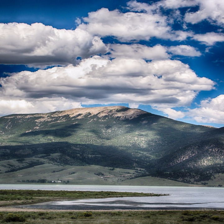 We heard a "bark" and just beyond the edge of the road was a prairie dog.
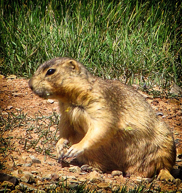 The peaks and clouds near Eagle's Nest were stunning.
 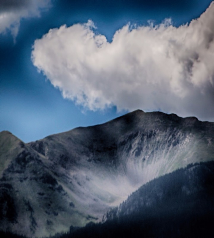 The Enchanted Circle drive continued north on NM HWY 38, but we continued east on US HWY 64. We soon got to spectacular Cimarron Canyon, with hundreds of tall rock spires and a beautiful little river running through the bottom.
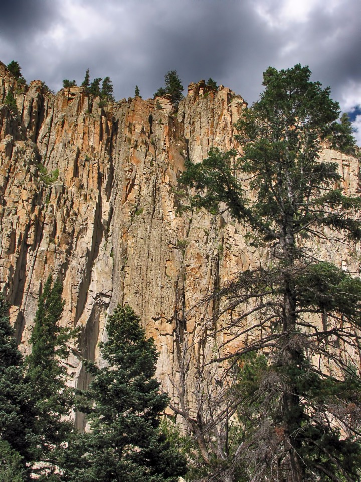
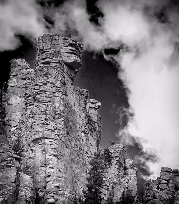
 The Cimarron River wound its way through a series of rocky tumbles on its way downstream.
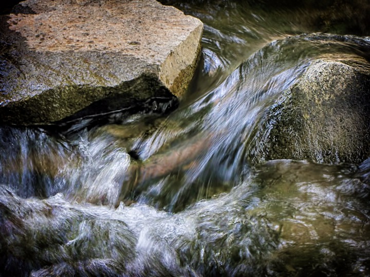 The river bottom was wet enough to support oaks and a number of other trees that kept framing the canyon sidewalls like wooden picture frames.
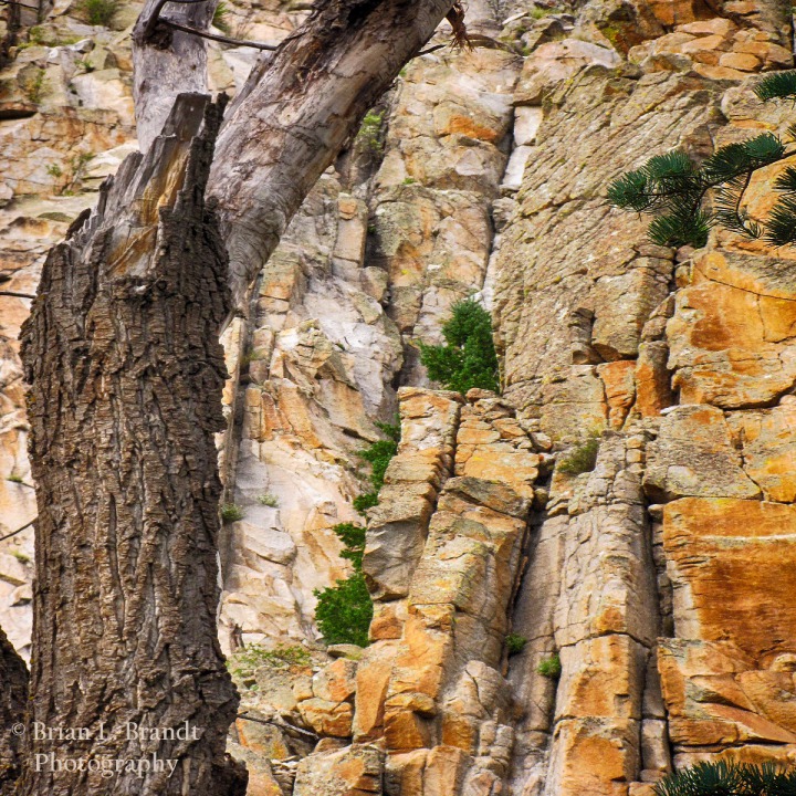 Wildflowers lined the moist riparian areas.
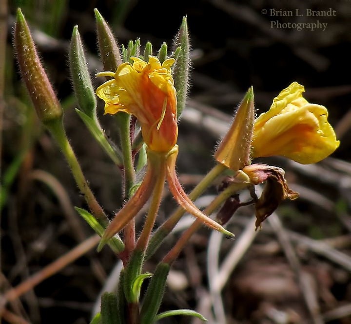 On the canyon walls, you could almost imagine stone figures having geologic conversations through the gaps between them.
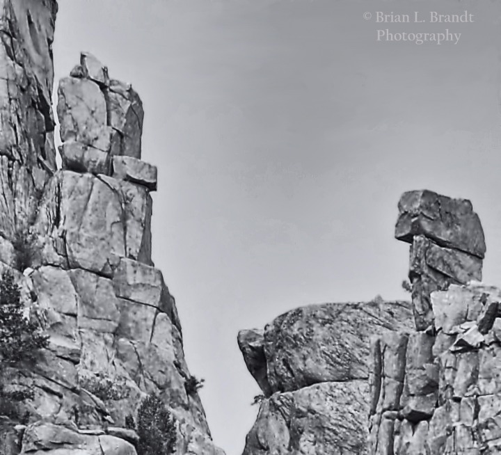 Along the river, cutleaf coneflowers had taken a strong foothold.
 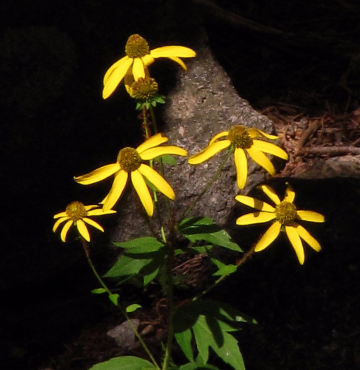 The Cimarron River runs through evidence of flooding -- debris scattered along the shore and stuck on mid-stream rocks to remind people that this is volatile flash flood country and to pay attention to big thunderheads if you are along the streams.
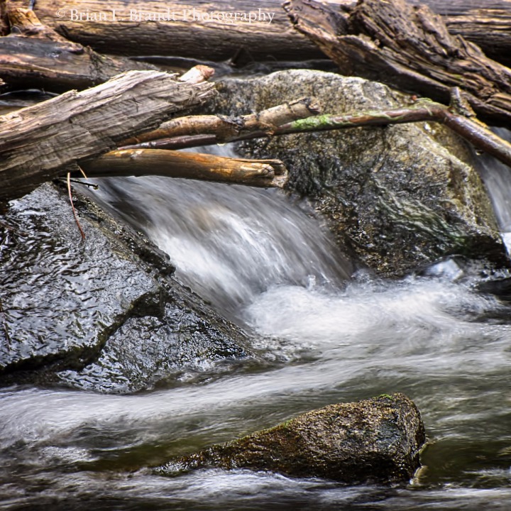 As you leave the narrowest part of Cimarron Canyon proper and start out onto the plains, one side (the north side) of the road still has a canyon wall with some amazing geological formations along it.
 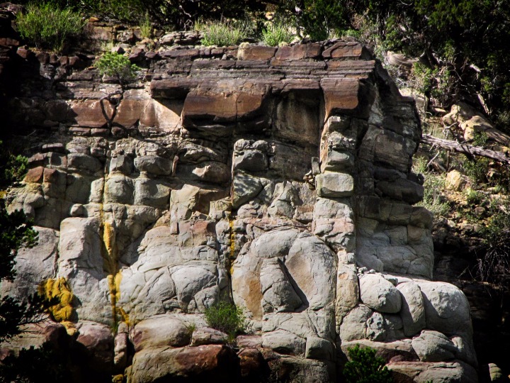 A stone man sentinel leans out into the valley floor amid gathering cumulus clouds -- the kind that are classic New Mexico cloud formations and which periodically douse the landscape with unexpected deluges of rain.
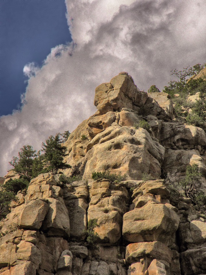 The Palisades in Cimarron Canyon are cut and sculpted by wind and rain into wave shapes and overhangs.
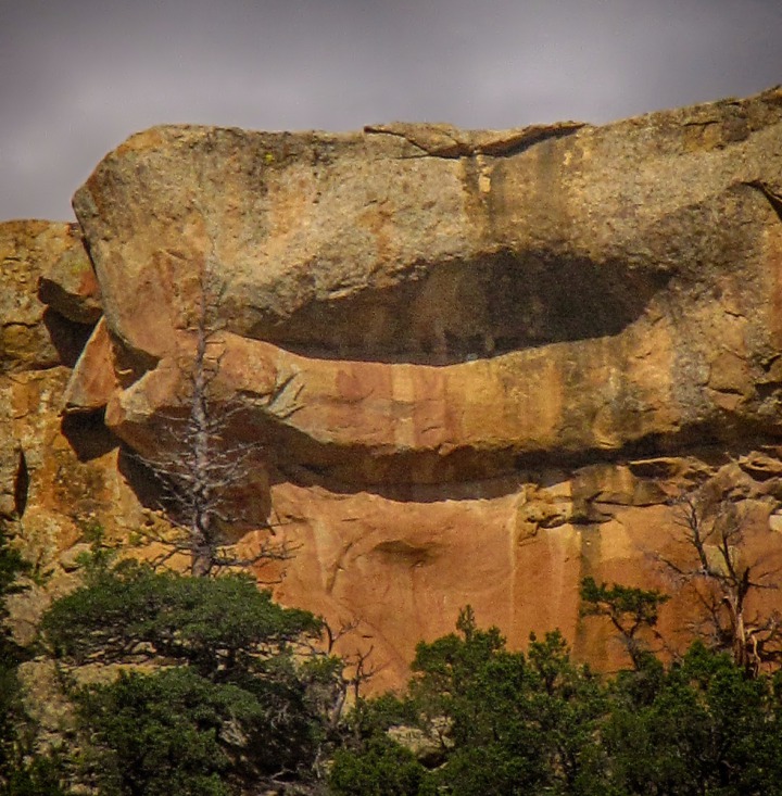 Mesa Beyond Cimarron NM -- Just beyond the small town of Cimarron, Midnight Mesa, a classic New Mexico mesa, protrudes out onto the ever-flattening prairie. The name is presumably
because the only time anything happened there, it took place after midnight (like
gambling or what-not). The right side which faces Cimarron is called Slate Hill. Thanks so much to Candee Rinde, Executive Secretary, Cimarron Chamber of Commerce for her kind assistance in updating some of the geology and geography information, and to local expert, Gene Lamm for identifying Midnight Mesa.
Mesa Beyond Cimarron NM -- Just beyond the small town of Cimarron, Midnight Mesa, a classic New Mexico mesa, protrudes out onto the ever-flattening prairie. The name is presumably
because the only time anything happened there, it took place after midnight (like
gambling or what-not). The right side which faces Cimarron is called Slate Hill. Thanks so much to Candee Rinde, Executive Secretary, Cimarron Chamber of Commerce for her kind assistance in updating some of the geology and geography information, and to local expert, Gene Lamm for identifying Midnight Mesa.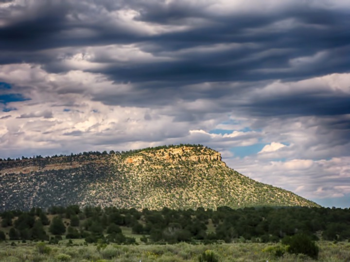 The view to the southeast is lovely in the right light. Drive over that way about 120 miles and you'll be in Dalhart, Texas.
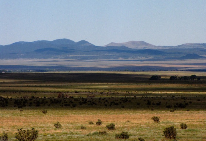 As we drove along in the direction of Raton NM, we saw a beautiful buck antelope (pronghorn) standing along the fence line, more or less just gazing off in the general direction of Texas.
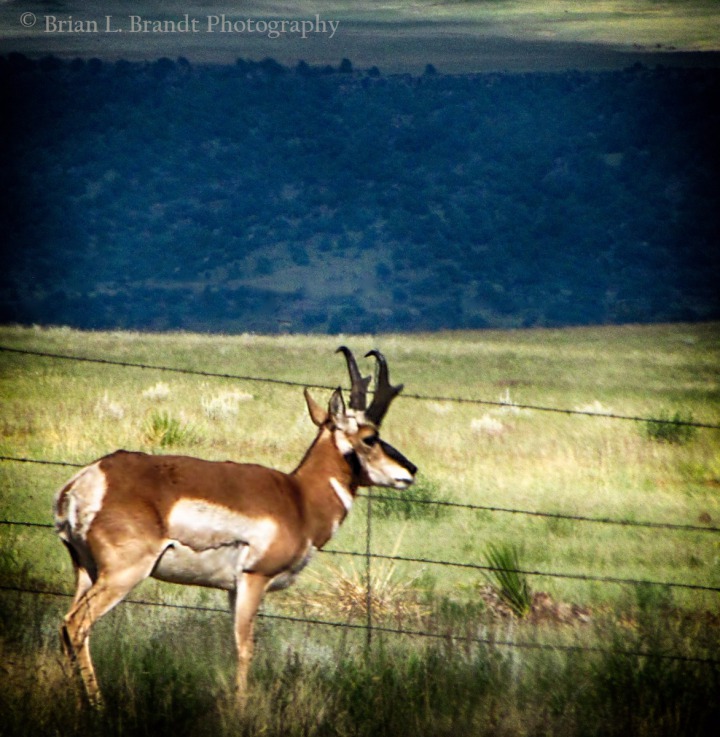 He barely moved when we drove past.

Touch-Me-Not Mountain Beyond Eagle Nest Lake NM

Prairie Dog Near Eagle Nest Lake NM

Cloud and Peak Near Eagle Nest Lake NM

One of Hundreds of Cimarron Canyon Monoliths

The Palisades in Cimarron Canyon CO

Cimarron River Side Flow Riffle

Cimarron Canyon Oak and Yellow Cliffs
 &)
Cimarron Canyon river-side Yellow Evening Primrose (Oenothera flava)

Cimarron Canyon Cross-Gap Monolith Chatter
 &)
Creek-side Cutleaf Coneflower (Rudbeckia laciniata)

Cimmaron River Runs Through Remnants of Flood Debris

Convoluted Side Wall Formation Just Beyond the Canyon

Stone Man Sentinel

Side Wall Overhang

Midnight Mesa Near Cimarron NM

Looking in the Direction of Dalhart TX from Cimarron NM
 Contemplates the Plains&)
Pronghorn (Antilocapra americana) Contemplates the Plains
Leaving Raton NM -- As we started up Raton Pass, we got views of another jagged formation - Fishers Peak, the iconic mountain that erupts 9,633 feet off Raton Mesa.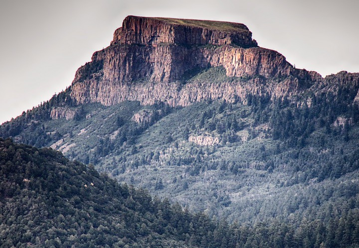 On the west side of Raton pass, we reached Trinidad CO, which has some lovely old architecture. As the sun started to drop, it blasted some of the old brick storefronts while Fishers Peak in the background lapsed into a cloud shadow.
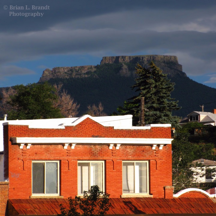 The only public access to this peak is from the adjacent Lake Dorothy State Wildlife Area/James M. John State Wildlife Area -- both wildlife viewing areas.

Back Side of Fishers Peak from Raton Pass

Low Sun Blasts Red Brick in Trinidad CO, with Fishers Peak as a Backdrop
After Trinidad CO -- Driving I-25 past Trinidad CO, we picked up a few unfortunate bug hitchhikers on the windshield, although they did add a certain "refractive" quality to the sun that was headed for the western horizon. We were now "hitting the gas" a little to try to get to the Spanish Peaks in Colorado to catch the sundown from up there.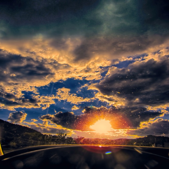 Trinidad CO to La Veta CO on CO HWY 12, Highway of Legends -- We were starting to see a few deer along the road, so we slowed down to "deer speed" and rounded a corner just in time to see this very nice buck (antlers in velvet) just before he jumped the fence and ambled out into the nearby pasture.
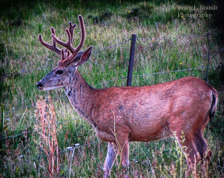 Not long after we saw the buck, we saw a turnoff to San Isabel National Forest Road 364 leading east up to where we could get a viewpoint of the Spanish Peaks in the Spanish Peaks Wilderness area of about 20,000 acres.. We turned off the pavement and headed uphill.
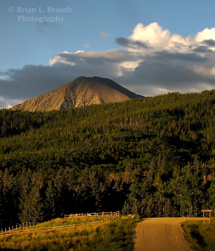 We got to a high viewpoint on the forest road just as the low sun bathed West Spanish Peak (13,623 feet high) in a rosy alpenglow.
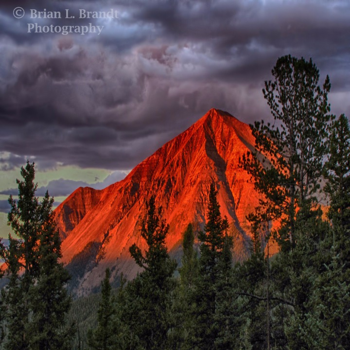 Louise, Dave, and I went for a short sundown stroll back along the forest road, soaking up the silence and the wonderful evening glow in the sky and on the peaks.

Sun Drops on a Bug Splattered Windshield
 Buck Getting Ready to Jump a Roadside Fence&)
Mule Deer (Odocoileus hemionus) Buck Getting Ready to Jump a Roadside Fence

San Isabel National Forest Road 364 Toward Spanish Peaks CO

Alpenglow on West Spanish Peak CO
Then we headed back to CO HWY 12 and US HWY 160 to Fort Garland CO. Then CO HWY 159/ NM HWY 522 took us to Taos. The moment was too special to hurry.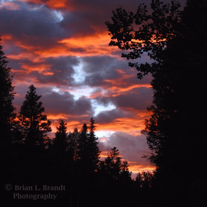 Text by Brian and Louise with Photos by Brian. Text and Photos Copyright by Goinmobyle, LLC. 2010.

Spanish Peak Sundown