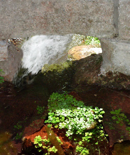
Cascade Spring, by Louise: 24 March 2008: About twenty miles south of Hot Springs on SD HWY 71, Cascade Spring flows out of the limestone, forming Cascade Creek. Cascade Spring is the largest spring in the Black Hills and one of only two warm springs. The warm water (68 degrees year-round) creates riparian habitat unique to cold and snowy South Dakota.
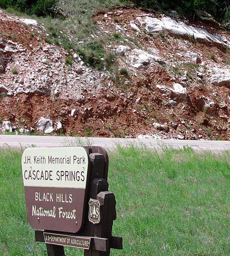
The area supports four plants found nowhere else in South Dakota or the surrounding Great Plains: tulip gentian (Eustoma grandiflorum), beaked spike-rush (Eleocharis rostellata), southern maidenhair fern (Adiantum capillus-veneris), and stream orchid (Epipactis gigantea). Our first stop was at the J.H. Keith Memorial Park, a Black Hills National Forest site with easy walking paths to the spring and facilities for a nice picnic. There is a spring cistern there as well.
 The next stop, across from the historic sandstone bank building from the old town of Cascade, was The Nature Conservancy's Whitney Preserve.
 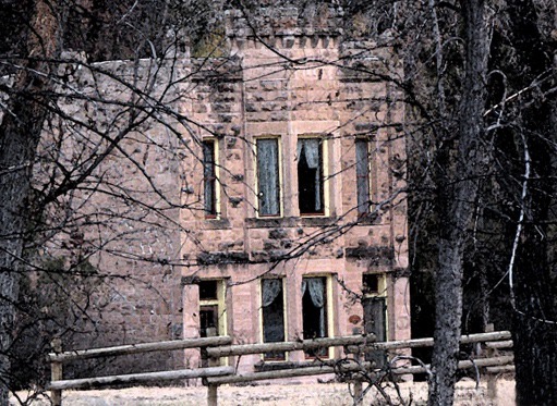 The Preserve is named for Nathaniel and Mary Whitney, South Dakota conservation pioneers. Nathaniel Whitney wrote many studies of South Dakota birds.

Red Rocks and Gypsum at J.H. Keith Memorial Park on Cascade Creek SD

Cascade Spring Emerges from Cistern

Old Town Bank in Cascade SD
Cool Spring, also warm, bubbles out of the rocks on the Preserve and flows through a series of small pools and marshes to Cascade Creek.
 Other springs emerge from the base of the long ridge that forms one side of the preserve.
 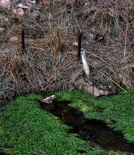 The Nature Conservancy volunteers have constructed a nature walk along the course of the spring, and tulip gentian is especially abundant along the walk. The relatively warm water also creates marvelous habitat for birds. Visitors are welcome on the trail during daylight hours.
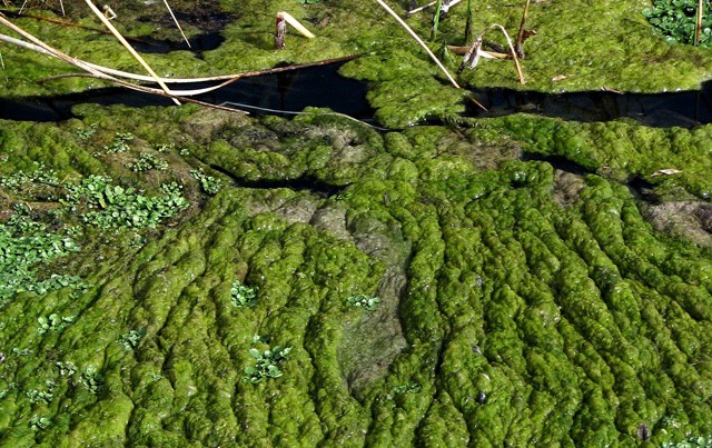
 In July 2007, the Alabaugh Canyon forest fire burned the north edge of the Preserve including the trail area. The lightning-caused fire burned eleven square miles, destroyed twenty-seven homes, and killed a homeowner,

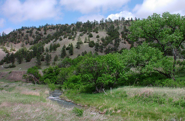
Cascade Creek Valley

Cool Spring Emerges

Warm Water Gives Rise to Algae Flows

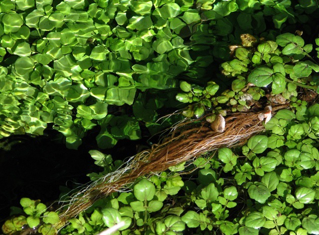
Warm Water Creates a Wealth of In-Stream Vegetation
Now in the spring of 2008, we were watching the beginnings of recovery. Much of the non-native vegetation such as Russian olive trees and brome grass had burned, opening a window for the natives to return. Non-native vegetation isn't as well adapted to fire as natives and does not come back as quickly. We saw mostly mud and ash this day; the ash revitalizes the soil -- it's all good if not very pretty! 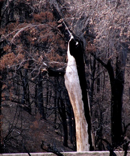 The Preserve also includes sagebrush, grassland, and pine forest habitats, making it home to deer, elk, mountain lions, turkey, and bobcat.
 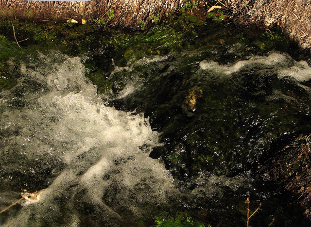 Our last stop was Cascade Falls picnic ground, another Black Hills National Forest Service site just south of the Preserve. Here the creek flows over slick rock in a series of falls and deep pools. This is a favorite swimming spot in summer. In the spring flocks of mountain bluebirds dance through the air, singing their soft songs as they feast on insects in the grass. Scarlet tanagers flash in the cottonwood trees along the creek.
 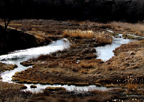 Some years, the Black Hills Volkssport Association sponsors walks into the Preserve backcountry. These walks provide a perfect way to see the rugged canyons, sagebrush uplands, and other habitats on the Preserve. At one point, you can see three states -- South Dakota, Nebraska, and Wyoming.
 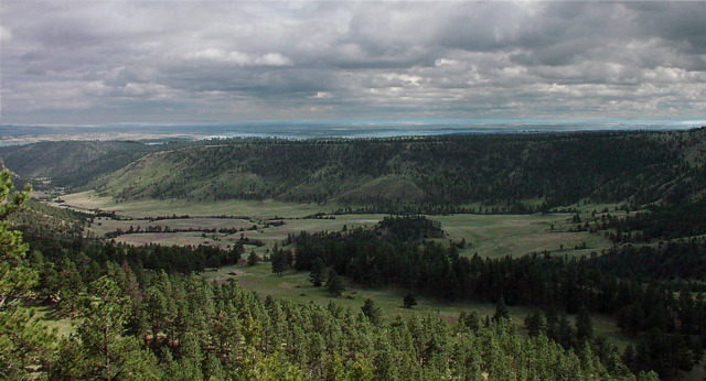 Just past the Falls, the highway crosses the Cheyenne River. Put your canoe in the river here and paddle to Angustora Reservoir, birdwatching as you go. The best take-out point is at the end of Shep's Canyon Road. Most years, plan on doing this trip in late spring when the river has plenty of water.
 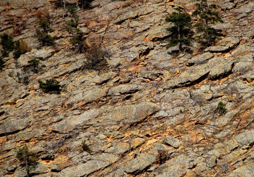 Louise with pictures by Brian, Cathy Malotky, and Abbie Engelstad Text and Photos copyright Goin Mobyle LLC, 2008

Burned "Bittern" Following the 2008 Fire

Cascade Creek Splashes and Dives In Open Stretches

Wet Meets Dry Just Outside the Whitney Preserve SD

Three-State View Looking South

Golden Rock Hillside Across SD HWY 71 from the Preserve