Today I took Brian to Bear Butte for the first time. It was a mostly sunny day with temperatures in the 50s. "Banana Belt" weather!
This igneous intrusion is almost 4,500 feet high, looming 1,200 feet above the surrounding prairie. According to Roadside Geology of the Black Hills, Bear Butte "is the mostly easterly of a line of Tertiary igneous intrusions that stretch for 50 miles across the northern Black Hills to Devils Tower and the Missouri Buttes in Crook County, Wyoming." These formed when molten magma from the earth's core rose through the sedimentary strata.
Bear Butte is sacred to many Indian tribes who come here to hold religious ceremonies. Prayer bundles of many-colored cloth and tobacco are tied to trees as part of these observations. The Lakota call the mountain Mato Paha (Bear Mountains), and the Cheyenne name it Noahvose. The mountain is a South Dakota State Park, and visitors are asked to be respectful in this sacred place.
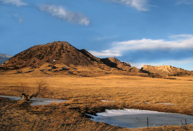

Bear Butte in Winter
I started climbing the summit trail, a 3.6 mile round trip hike that gains 1,026 in elevation. In 1996, a fire burned most of the trees off the steep slopes, revealing the bear-like shape of the butte and opening up tremendous views in all directions -- South Dakota and Wyoming are visible from the platform on top. And the wild flowers are amazing in the spring and summer. However, this day the trail was muddy and slippery and snow-covered. Gumbo is the sticky mud created when Pierre clay gets wet, and it abounds on the South Dakota prairie. Even cattle and deer can't move easily across it; the mud packs on their feet like big pie plates.
So I couldn't hike up Bear Butte this day. Instead, I headed south on the South Dakota Centennial Trail. This 111-mile wonder of cooperation runs from Bear Butte State Park south to Wind Cave National Park across Bear Butte National Wildlife Refuge, Ft Meade Recreation Area, private land, the Black Hills National Forest, the Black Elk Wilderness Area, Mt Rushmore National Monument, Custer State Park, and Wind Cave National Park.
I hiked through yucca, prairie grass, and green ash trees. The gullies had some snow, and the branches of the ash were as red as mountain mahogany. Deer and bison watched as I strode by; the Black Hills outlined the western sky. Bear Butte Lake, now covered with ice, reflected the sunset.
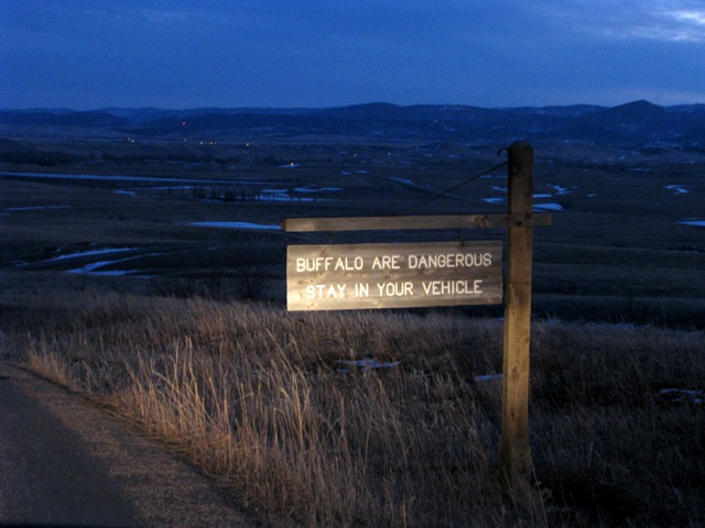

Bison Warning
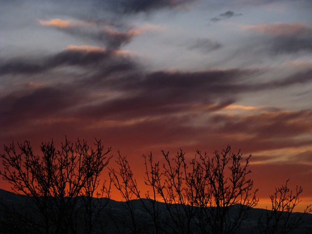
But I was in a hurry. Brian thought I was on the summit trail, and we had planned to meet at the car at the visitor's center at 5:45. The trail crossed the park entrance road, and I decided to hike back to the center that way -- a total of three miles in forty-five minutes! And it was cold and getting dark fast. But I made it; Brian's picture taking had lasted longer, too. The sunset was magnificent that night!
 We ended this day with a lovely steak dinner at the Elk Creek Steak House on I-90.

Bear Butte Sunset
Bear Butte is only a few miles from Sturgis, SD, and the annual motorcycle rally. Most of the land immediately around the mountain is private, and a proliferation of bars and biker shops threatens the sacred nature and the natural beauty of the mountain.
Louise with photos by Brian
text and photos copyright GoinMobyle, LLC 2009