Our Long May Loop: (over 2000 miles round trip) We started this trip in Lakeside MT after a visit with friends and a visit in Bozeman with Brian's brother.
Lakeside MT: The weather was most foul, so we didn't stop much to take photos or to stretch out our cat Leesha between Rapid City and Kalispell.
We spent a wonderful couple of days in Lakeside with our good friends Randy and Sue. If you don't know them, too bad, because they are the consummate hosts.
On to Lake Conconully WA: Now we’re off on my (Louise) first ever trip to Washington State, and or to northwestern Montana for that matter. We're headed for Lake Conconully. It is only on our radar because Brian's good friend and business partner Gary has been going there since he was a tyke, and still goes there frequently. So we're heading over there to spend some time with him, his wife, and their little dog pack of two Shelties.
I’m sometimes amazed at how little I know about my birth state. But when we visit people in other places, they say the same thing about theirs, so I guess a whole state is just a lot to cover.
Forest Fire Fighting Stories: We head west on US HWY 2 – the High Line – from Kalispell to Libby. Brian tells me stories about fire fighting in Libby in the '70s. The fire covered nearly 100,000 acres and exposed the nests of millions of yellow jackets, and swarms of yellow jacket hornets were so thick they would literally coat their food in fire camp and sent hundreds of firefighters to the fire camp infirmary with stings. One got tangled up in Brian's salad, stung him a half dozen times on the way down his throat, and sent him into town to the hospital. Brian had the very first co-ed fire crew in the U.S. on that fire, precipitating lots of funny stories. He says they kicked ass.
Fisher River MT: Before Libby, the highway starts to follow the Fisher River.
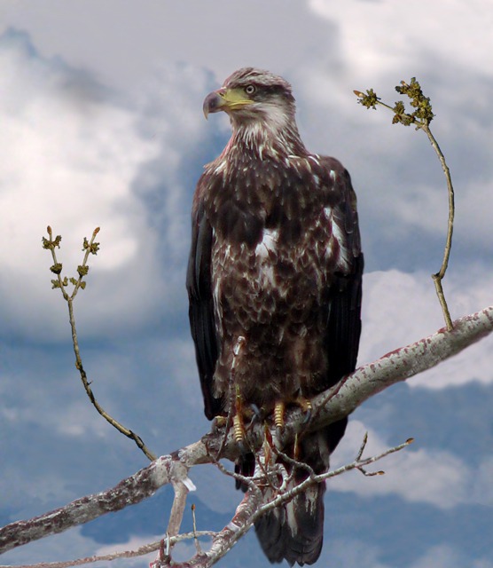
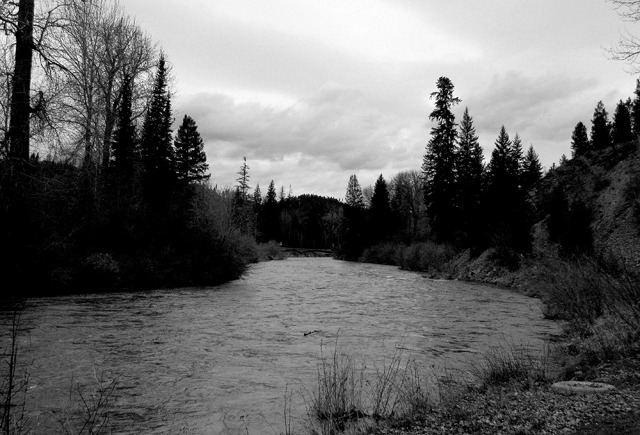 The winter and spring had been wet ones and the river is booming – flowing high and flooding the brushy banks. We pull off to take pictures of eagles – a golden eagle is perched in a cottonwood tree just above the pull out.
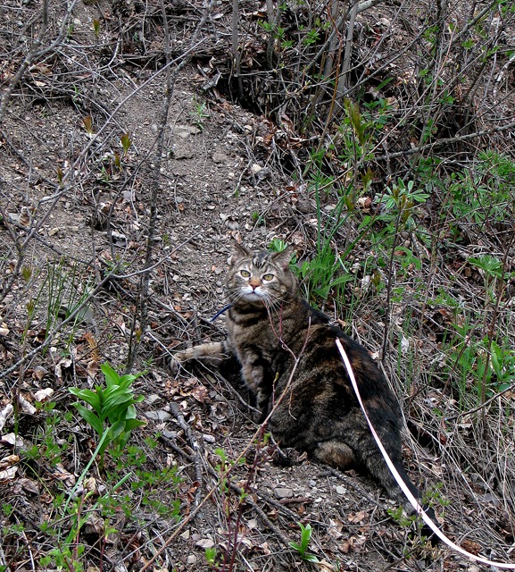
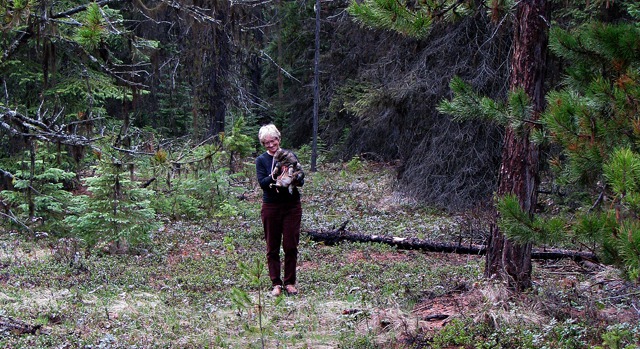
 Leesha welcomes the opportunity to explore and heads straight for the nearest steep hill. Up she goes! She doesn’t notice the eagle, and the eagle doesn't pay us any attention.
 It’s all very exciting.
&)
Grey Day on the Fisher River MT (black and white)
 in Tree Overlooking the Fisher River MT&)
Immature Bald Eagle (Haliaeetus leucocephalus) in Tree Overlooking the Fisher River MT

Furry Purry on her Leash on an Uphill Run by the Fisher River

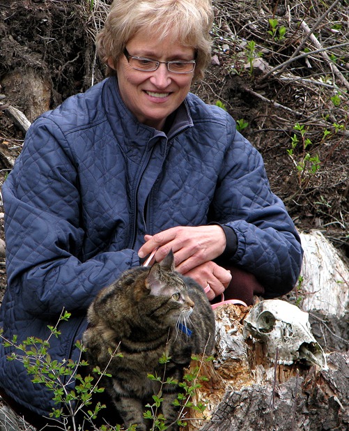
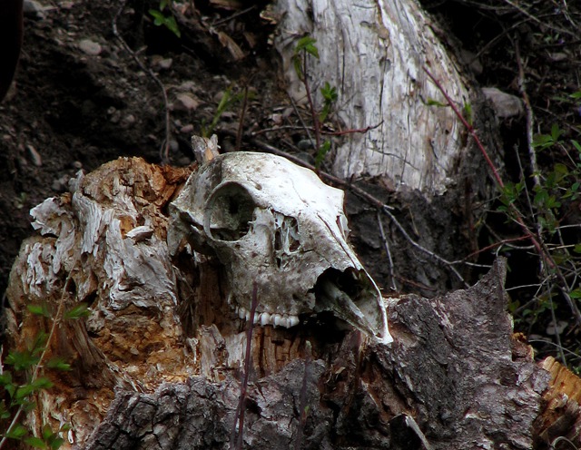
A Shakespearean Moment with Deer Skull On the Hill

Deer Skull Along the Fisher River MT
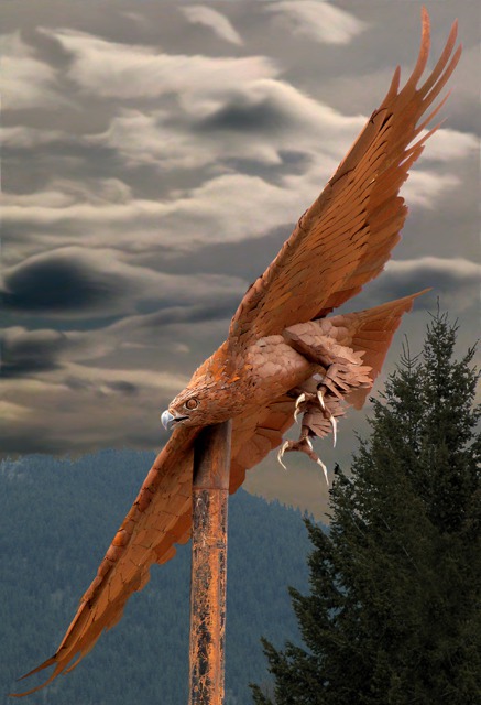
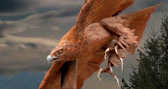
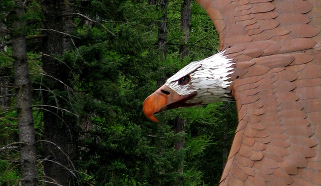
Libby MT: All around Libby are huge metal "Libby Eagles" but the sports teams here are the Libby Loggers -- a sort of past-tense name, since a lot of the logging around there "played out" in the 80's. But they still have "Logger Days" in July.
Libby is recasting itself as The City Of Eagles -- trying to resurrect after a famous run as an asbestos-laden Super-fund site -- a legacy of a W.R. Grace & Co. mine nearby. Local artist Todd Berget and long time friend Darien Greason are school teachers and co-creators of the Libby eagles. Darien, originally from Libby, is a high school friend of Todd's who comes back to Libby during summer break to work on the Libby Eagles. They combined Todd's artistic ability with their combined welding skills to build metal eagle sculptures that reach 40 feet wing-tip-to-wing-tip and weight up to a ton.
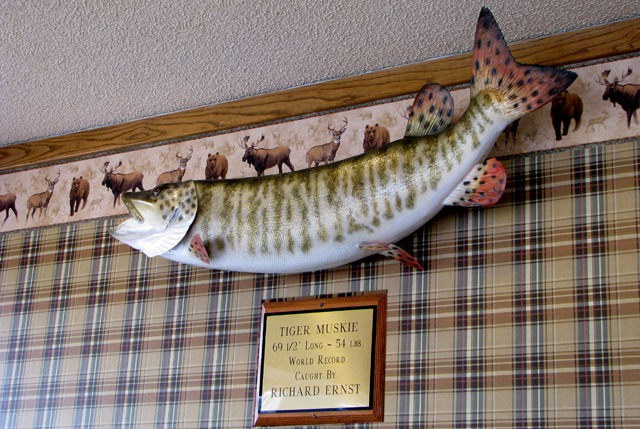
 In Libby, we drove around until we found the cafe -- the Antlers -- with the most cars in front of it and went in. The walls were covered with trophy fish, including the world-record Tiger Muskie, caught by the owner, Richard Ernst. The walls abounded with huge fish he'd landed over the years, and the food was excellent.
 In Libby you can also get huckleberry everything -- from pancakes to candy. They thrive in the abundant rain and cool climate.

One Ton, Forty-Foot Wing Span Eagle on a Stick in Libby MT

Eagle on a Stick Close Up in Libby MT

Iron Eagle Sweeps Through the Forest in Libby MT

Record Tiger Muskie at Antlers Cafe In Libby MT
Idaho: It’s a cloudy grey day with occasional rain. The forests are deep with underbrush, fallen trees, ferns – forests of rain.
Then into Idaho and Bonner’s Ferry. The river turns north at that point, and we head south to Sandpoint through the Purcell Trench. At a rest stop along the way, Leesha heads into the woods, undeterred by the rain. The undergrowth provides lots of cover for kitties.
 Glacial Ice Carved the Landscape: The Percell Trench was formed by huge flows of glacial ice about 15,000 years ago. The ice flowed out of British Columbia into the Flathead and Swan valleys in Montana, the Purcell in Idaho, and the Okanogan in Washington. The mass of ice dammed the Clarks Fork River, forming Glacial Lake Missoula in Montana.

Coming Back from a Soggy Walk in Kaniksu National Forest ID
Catastrophic Prehistoric Floods: Glacial Lake Missoula had no outlet and filled with water over the years until the ice dam floated. That resulted in monstrous floods as the lake drained across eastern Washington, down the Columbia River to the Pacific Ocean. This cycle was repeated several dozen times with the last flood occurring about 13,000 years ago. We’ll see this geology gouged into the landscape throughout our Washington trip. Glacial Lake Missoula and Its Humongous Floods by David Alt tells the story in language for the citizen scientist.
At Sandpoint ID we encounter enormous Pend Oreille lake-- 43 miles long and 1150 feet deep at its deepest point. US HWY 2 takes us west along the huge Pend Oreille river through the Kaniksu National Forest – quite a sight for current South Dakota residents like us who have forgotten the wet Western Montana springs and are more accustomed to the arid lands east of the Rocky Mountains and west of the 100th meridian.
The Pend d'Oreilles Indians: The Pend d'Oreilles Indians, also known as the Kalispel, named their territory Kaniksu. Pend Oreille is French and means "hangs from ears," which refers to the large shell earrings that these people wore.
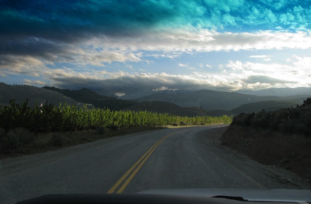
Washington: At Newport we head north on WA HWY 20, still following the river. Then at Tiger WA, the highway turns west to Kettle Falls where we cross the Columbia River – the rivers just keep getting bigger! Through the Colville National Forest and the Okanogan National Forest to Tonasket.
Entering the Okanogan Country: Now we’re in the scablands in the Okanogan Valley; Alt describes these as “scabby outcrops of black basalt, broad expanses of raw gravel, and dry stream channels (coulees).” This is part of the
Ice Age Floods National Geologic Trail, being developed by the National Park Service.
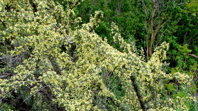
This is familiar country – dry with sagebrush and scrubby trees, and arrowleaf balsamroot. And sunshine! Gone are the grey clouds and mist, replaced by blue sky and full sun.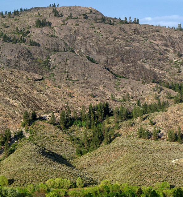 At Tonasket, WA HWY 20 turns south and joins US HWY 97 along the Okanogan River. At Okanogan we turn west on Conconully Road past dry hillsides covered with golden balsamroot flowers. The vegetation is dramatically different than just 100 miles before when we were in sodden spruce and fir forests with heavy underbrush.
 And we’re here – Conconully State Park Conconully is a Salish Indian word that means “money hole,” referring to the abundant beaver in the creek whose pelts were sold at Fort Okanogan.
 Louise and Brian, with photos by Brian
Text and photos copyright Goin Mobyle LLC, 2009
Louise and Brian, with photos by Brian
Text and photos copyright Goin Mobyle LLC, 2009
This is familiar country – dry with sagebrush and scrubby trees, and arrowleaf balsamroot. And sunshine! Gone are the grey clouds and mist, replaced by blue sky and full sun.

Okanogan Scab Land Sidehill

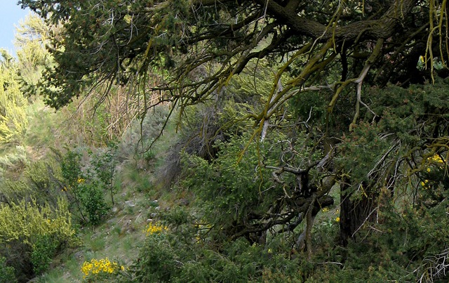
A Fir and Sage Interface Zone in a Side Canyon of the Okanagon Region
 on the Turnoff to Conconully WA&)
Antelope Bitterbrush (Purshia tridentate) on the Turnoff to Conconully WA
 on the Turnoff to Conconully WA&)
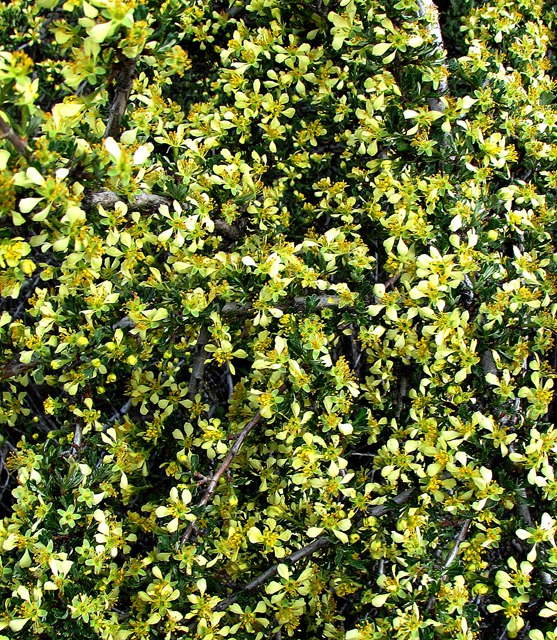
Closeup of Antelope Bitterbrush (Purshia tridentate) on the Turnoff to Conconully WA

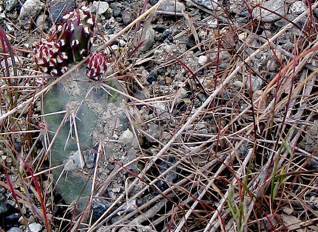
A Prickly Pear Cactus Amid Pine Needles

Over the Hill and Into the "Money Hole"