Geologic Discovery, by Louise: 4 August 2009: Today we headed east from Cody WY on US HWY 14 through the Bighorn Basin. Just past Greybull WY, we whizzed by a sign pointing north to Devil’s Kitchen. We turned around and back we went – we certainly weren’t going to drive on without seeing that!
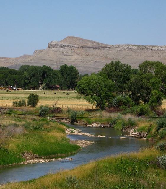
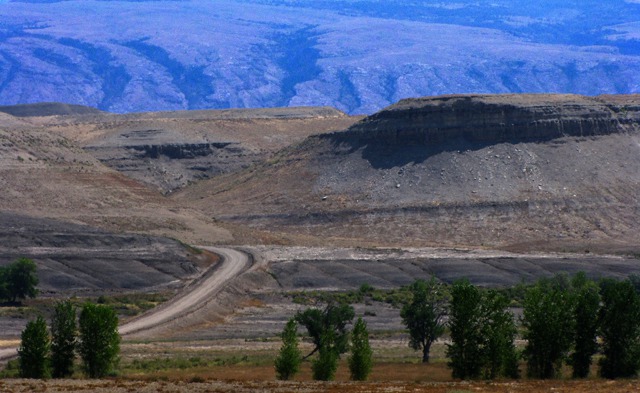
Davis Road headed north, crossing Shell Creek. Then we turned left or west on County Line Road 33 parallel to Shell Creek – magnificent views of the Beartooth/Absaroka Mountains we crossed yesterday. A small sign directed us left to the formations.
A word of advice -- don't attempt the short spur road from County Line Road 33 to Devil's Kitchen if there's even so much as a drop of rain. The axle-deep ruts tell you what will happen if you try!
We shared the main road with huge gravel trucks, hauling bentonite and other minerals from the area’s mines. Most of the land is owned and managed by the US Bureau of Land Management.
A Little Light Reading for the Geology Buff -- (if you aren't a buff, you can skip to the pictures, but this was very interesting to us.) Wyoming’s geology of inland seas, tremendous mountain building (a period called the Laramide Orogeny), and the wonders of Yellowstone is the most complex and beautiful in the US. John McPhee, Pulitzer Prize-winning author, wrote the best description for us everyday folks in his book Rising From the Plains.
The following is adapted from Morrison, Cloverly, and Sykes mountain formations, northern Bighorn basin, Wyoming and Montana, by Ralph Moberly, Jr. In Geological Society of America Bulletin, August 1960, v. 71, No. 8, pp. 1137-1176.
The Devil's Kitchen exposure is part of the Cloverly formation, a sedimentary sequence (deposit) about 125 to 11 million years old. Sedimentary rocks form in part when particles (dirt, animal remains, shells, etc.) are deposited by water. The Cloverly formation has three member deposits that are called Little Sheep, Himes, and Pryor.
The Little Sheep mudstone member and most of the Himes member were formed authigenically (in place during or after deposition) in seasonal lakes and swamps from the weathering of nearby volcanic debris, with their different lithologies (characteristics) due to different drainage conditions and parent ash.
The Pryor conglomerate member and deposits of similar sandstone conglomerates in the Little Sheep member came from reworked sedimentary rocks west of basin. Channel-filling clean quartz sandstones of the Himes member were derived from an eastern sedimentary, and perhaps metamorphic, terrain.
The lowest layer at Devil's Kitchen -- the Little Sheep mudstone member -- consists chiefly of bentonitic (montmorillonitic) mudstones in variegated shades of neutral gray, purple, olive, and dusky to pale red. Other typical lithologies include bentonites, cherts, coaly beds, calcareous nodules, and chert-pebble conglomeratic sandstones.
The Pryor conglomerate member in the northernmost Bighorn Basin is characterized by black-chert pebbles. The upper member of the Cloverly formation is the Himes member and comprises three principal lithologies. Commonly at its base is olive-gray and reddish-brown clay-matrixed salt-and-pepper sandstone. Most of the member is variegated reddish- and yellowish-brown and gray kaolinitic claystone and mudstone, containing veinlets and hardpans of iron oxides. Clean quartz sandstones which filled fluvial channels are laced through the claystones.
The Cloverly formation contains the fossilized remains of Deinonychus, which was a velociraptor, along with the remains of other Early Cretaceous-Period lizards.
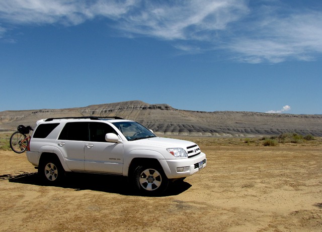
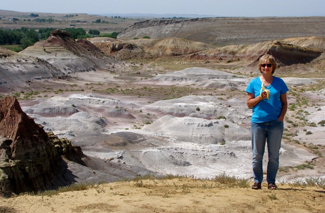
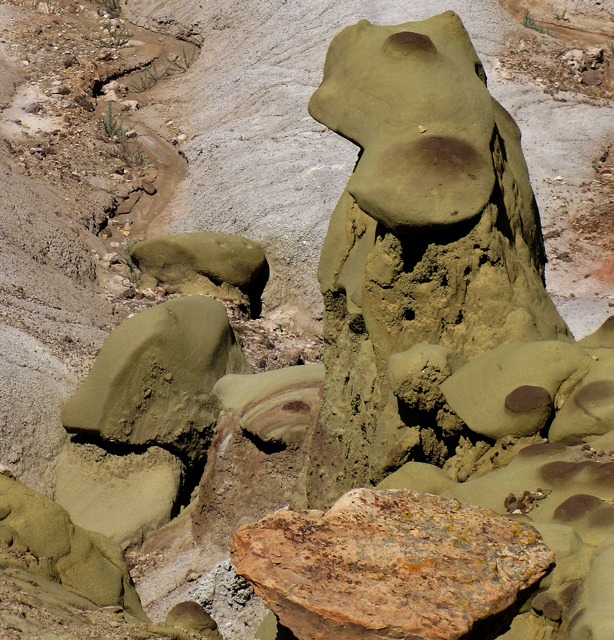
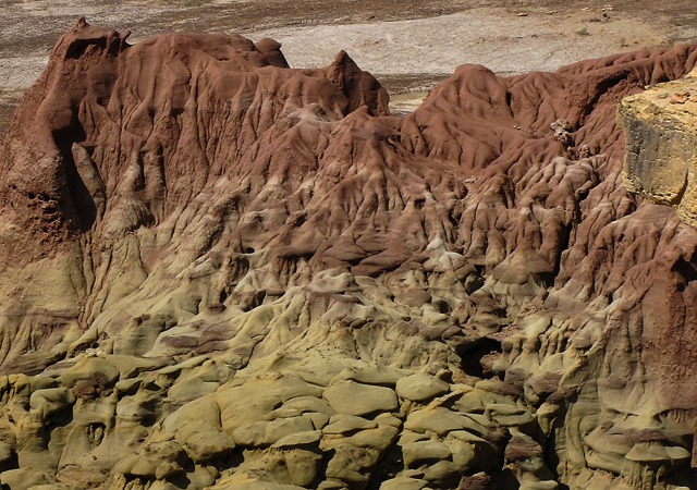
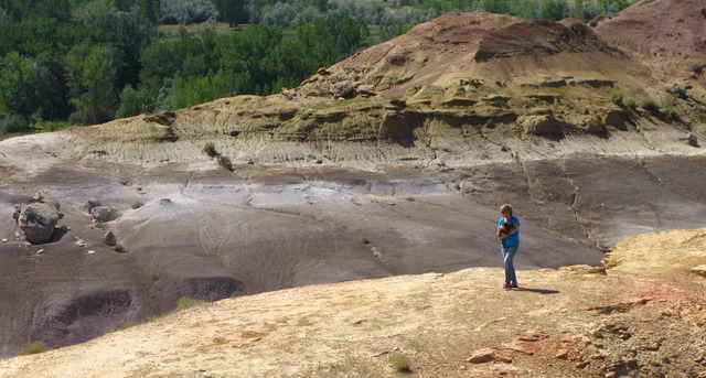
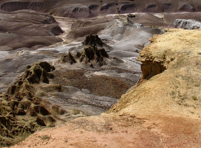
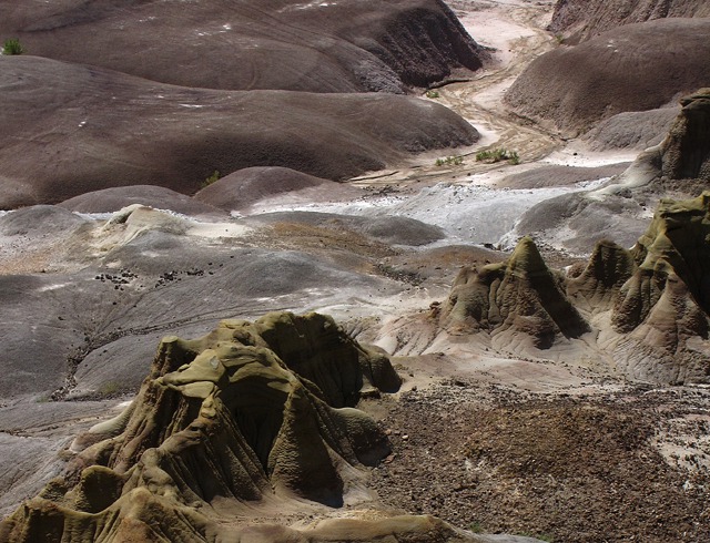
So we found Devil’s Kitchen – we parked on the eastern rim and looked down into an amazing world of eroded spires, cliffs, rock toadstools, and hillocks of colorful rock.
The mudstone mushroom shapes were olive and brown. The cliffs were orange and purple. White hillocks punctuated the valley floor.
Brian commenced with his camera – pictures everywhere we looked!
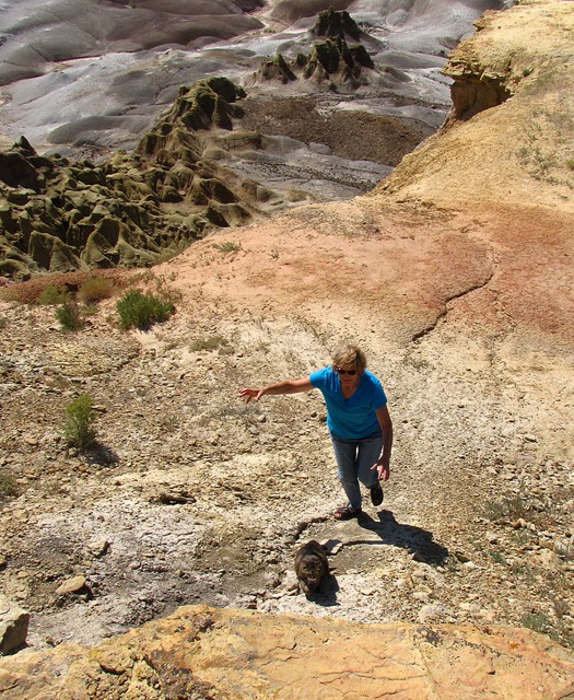
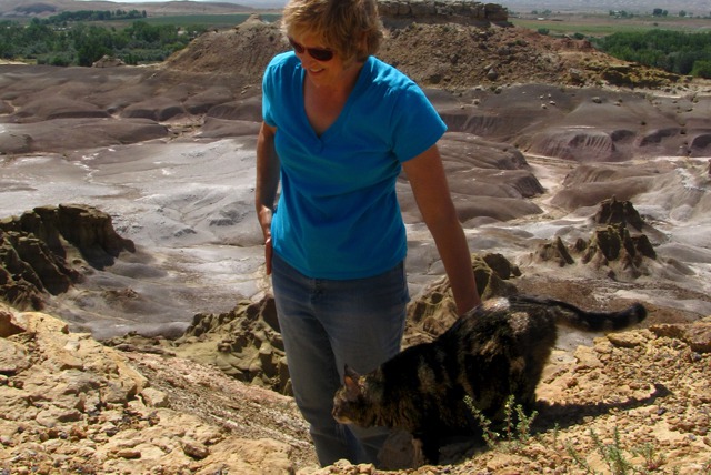
Leesha, however, did not like the area. She wouldn’t get out of the rig on her own, so I carried her over to the edge, and we went for a little combination cat carry and cat hike. She wasn't at all impressed with the geology -- or the considerable heat.
She periodically loudly meowed her displeasure, and when left to her own devices, she promptly headed back to the rig.
On one side trip she tried to hide in a shallow cave on the rim between rock layers. But I wouldn’t let her – there might be snakes. Was it the heat making the ground too hot for her feet? Did she feel too exposed on the open ground with no trees or grass in sight? Hard to know the mind of a cat, but back to the car she went and stayed!
There was so much to see when you looked at the formations as microcosms that we could have spent the entire day there. Well worth the drive over the gravel to see.
For you amateur geologists, here are more suggested sources of information. To obtain the materials, just take a trip to your local library for a chat with the reference librarian.
1. Cifelli, Richard L., and John R. Wible and Farish A. Jenkins, Jr. Triconodont Mammals from the Cloverly Formation (Lower Cretaceous), Montana and Wyoming. In Journal of Vertebrate Paleontology, Apr. 10, 1998, v. 18, No. 1, pp. 237-241. http://www.jstor.org/stable/4523887
2. Horner, John R. Dinosaurs Under the Big Sky (Cloverly Formation). Mountain Press Publishing Company. pp. 93-100.
3. Burton, D., Greenhalgh, B.W., Britt, B.B., Kowallis, B.J., Elliott, W.S., and Barrick, R. 2006. New radiometric ages from the Cedar Mountain Formation, Utah and the Cloverly Formation, Wyoming: implications for contained dinosaur faunas. IN Geological Society of America Abstracts with Programs, v. 38(7), p. 52.
4. Chen, Z.-Q. and Lubin, S. 1997. A fission track study of the terrigenous sedimentary sequences of the Morrison and Cloverly Formations in northeastern Bighorn Basin, Wyoming. In The Mountain Geologist, 1997, v. 34. pp. 51-62.
5. Cifelli, R.L. Tribosphenic mammal from the North American Early Cretaceous. In Nature, 1999, v. 401, pp. 363-366.
6. Nydam, R.L., and Cifelli, R.L. Lizards from the Lower Cretaceous (Aptian-Albian) Antlers and Cloverly Formations. In Journal of Vertebrate Paleontology, 2002, v. 22, pp. 286-298.
7. Ostrom, J. H. Stratigraphy and paleontology of the Cloverly Formation (Lower Cretaceous) of the Bighorn Basin area, Wyoming and Montana. In Peabody Museum Bulletin, 1970, v. 35, pp. 1-234.
Louise, with Photos by Brian. Text and photos copyright Goin Mobyle LLC 2009


Row and Cliff Manuel wrote:
June 1st at 1:04 PM