Part 1: Down the Gallatin Canyon to Hebgen and Quake Lakes: 14 June 2009: We all piled into the rig for a long day-trip out of Bozeman, MT, to the Red Rock Lakes Wildlife Refuge. Despite some frightful weather, we decided to go through Gallatin Canyon, with a stop by Quake Lake on the way.
One thing we learned growing up in Montana is that the weather in Bozeman isn't necessarily the weather outside Bozeman -- typically, you go twenty miles in any direction and the weather improves.
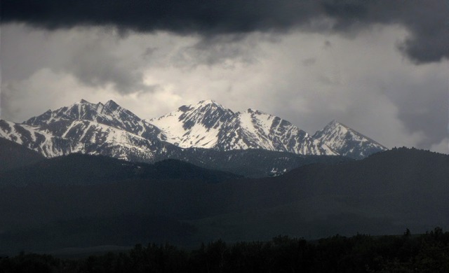
So even though the Spanish Peaks south of town were covered with black clouds, we decided to go anyway on the chance that we'd find better weather as we went.
 We drove through Gallatin Canyon on US HWY191 and into the little "arm" of Yellowstone Park at the West Yellowstone end of the canyon.

Weather Over the Spanish Peaks MT
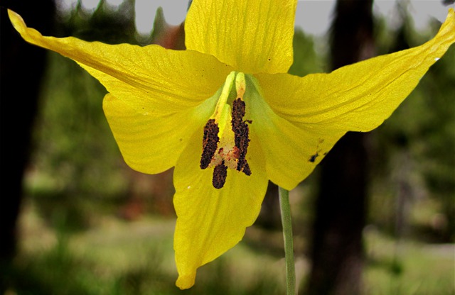
Ephemeral Spring Flowers, by Louise: We started to see the array of wild flowers that bloom for a few weeks or less in the wake of the recent snow melt. Leesha, a.k.a., Furry Purry, was anxious to get out and stretch and sniff at the pullout.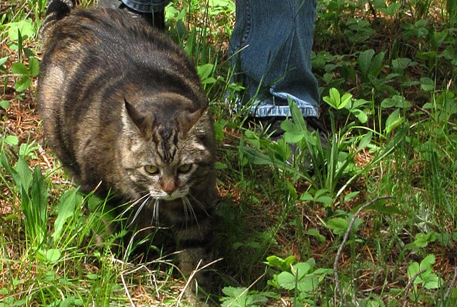 There was a host of glacier lilies springing up; my mother always called them trout lilies. Brian teases me that I can spot a wood lily at two hundred yards in the woods and completely miss the deer nearby! I have found over the years of doing this that I can name the types of grass in the ditch as we drive by -- seems my eye is botanical. Brian sees the animals and birds so it works out well.
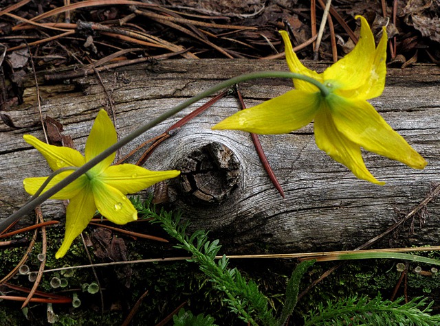
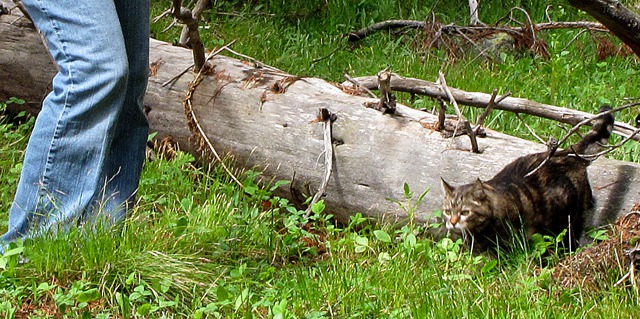
 In the Montana world of the sweeping vistas, it's often easy to overlook the smaller vignettes. There was an amazing little "pine garden" next to the pullout that reminded us of a Japanese garden. There was a plethora of little scenes to see if you narrowed down your focus to cat level.
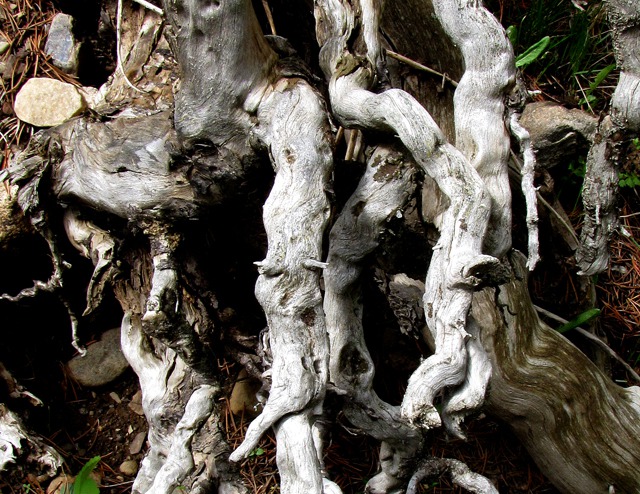
 After we finished stretching ourselves and the Furry Purry, we headed for junction of US HWY 191 and US HWY 287. Soon after our turn onto US HWY 287, which curves around Hebgen Lake past Quake Lake and eventually down the Madison River Valley, we stopped at another small roadside-ditch garden spot where there were several species of flowers in spectacular bloom.
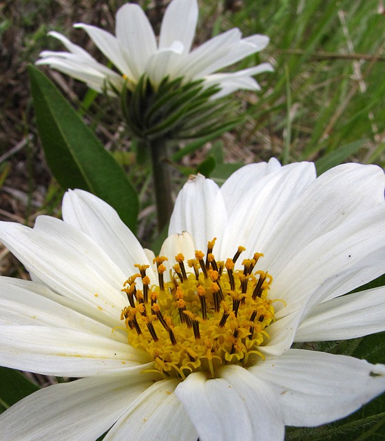
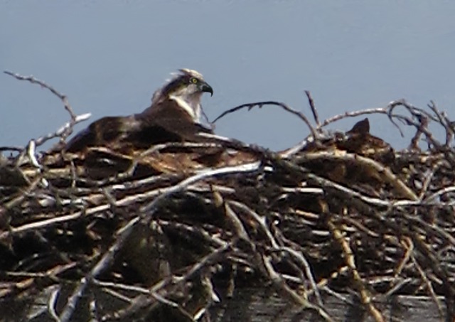
 Then we spotted an osprey nesting platform with an osprey in residence. From our viewing distance, we couldn't tell whether the osprey was an adult or not, but it looked too large and mature to be a chick that early in the summer.
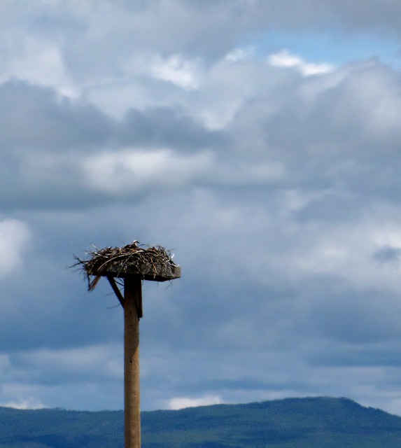
 On the way to Quake Lake along Hebgen Lake, the sun made a few forays into the open, giving us some ray of hope, so to speak, for better weather ahead.
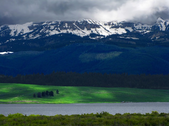
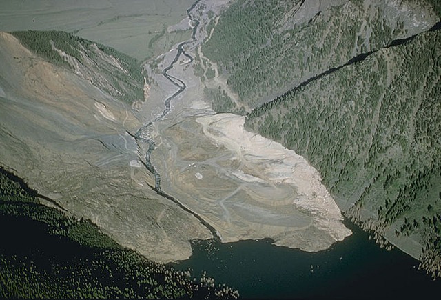
 The Quake That Formed Quake Lake: On 17 August 1959, a 7.5 Richter-scale earthquake centered 27 miles north and west of West Yellowstone MT dropped one side of Hebgen Lake twenty feet in an instant, causing a huge wave to hit the north shore of the lake and sweep downstream and crest over the top of the Hebgen Lake dam and into the Madison river below.
In that same moment, downstream from the dam, a massive landslide was moving downhill at over 100 m.p.h., sending over eighty million tons of rock crashing into the narrow canyon, blocking the Madison River, burying a campground full of people, and forming Earthquake Lake.
The Quake That Formed Quake Lake: On 17 August 1959, a 7.5 Richter-scale earthquake centered 27 miles north and west of West Yellowstone MT dropped one side of Hebgen Lake twenty feet in an instant, causing a huge wave to hit the north shore of the lake and sweep downstream and crest over the top of the Hebgen Lake dam and into the Madison river below.
In that same moment, downstream from the dam, a massive landslide was moving downhill at over 100 m.p.h., sending over eighty million tons of rock crashing into the narrow canyon, blocking the Madison River, burying a campground full of people, and forming Earthquake Lake.

Furry Purry Takes a Stretch Break in Wild Strawberries
 and Ferns&)
Trout Lilies or Glacier Lilies (Erythronium grandiflorum) and Ferns
&)
Cat's Eye View of a Trout Lily (Erythronium grandiflorum)
 &)
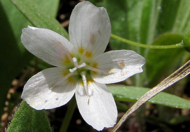
Spring Beauty (Claytonia lanceolata)

Root-Tangle Sculpture

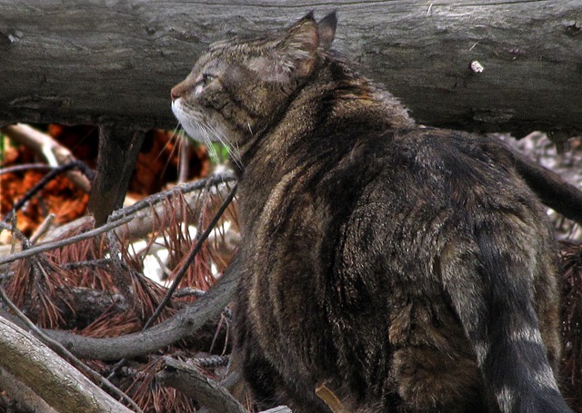
Leesha Takes a Forest Floor Sniff Break

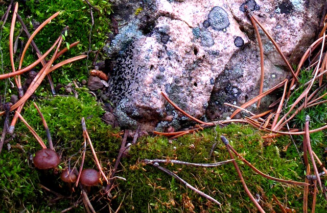
Rock, Moss, Pine Needles, and Mushrooms

Over-the-Log Prowl
&)
Sunflower Mule-ears (Wyethia helianthoides)
&)
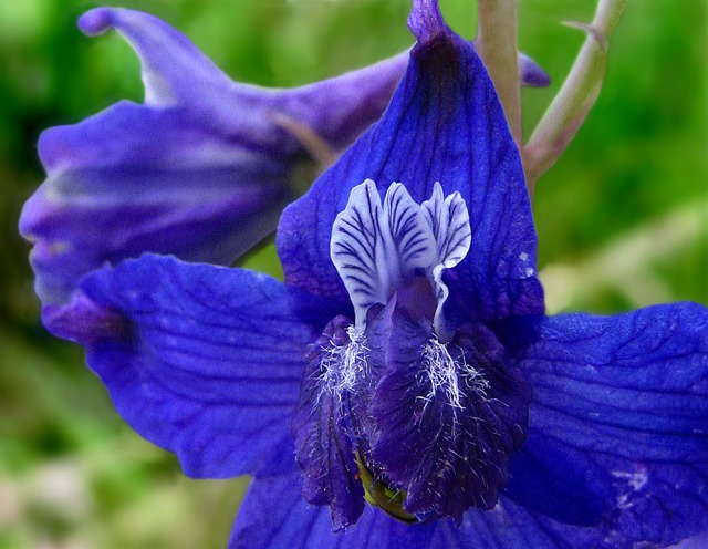
A Perky Larkspur (Delphinium)

Osprey Nesting Platform Overlooking Hebgen Lake
 on the Nest&)
An Osprey (Pandion haliaetus) on the Nest

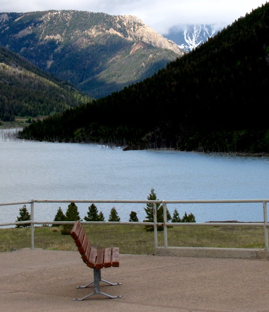
Sun Breaks on the Far Hebgen Shore

Coffin Mountain on the South Side of Hebgen Lake
The river rapidly rose behind the landslide and quickly started cutting a channel through it. Fear of a wash-out or catastrophic flood from the failure of the Hebgen Lake dam prompted evacuations as far as fifty miles downstream in the Madison Valley.
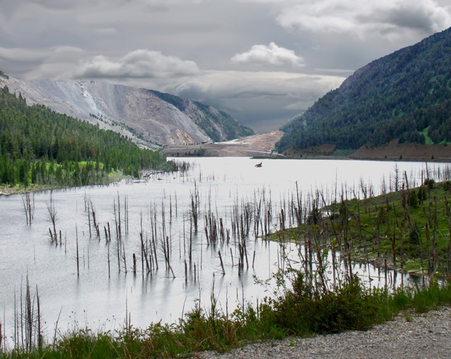
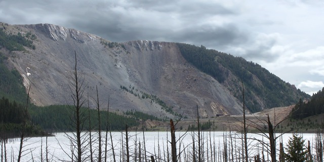
Catastrophic Slide: The landslide happened because the huge dolomite "buttress" on the left-hand side of the photo below broke outward when the earthquake hit, allowing millions of tons of rock stacked up behind that buttress to slide down the left-hand or south side of the canyon and "slosh" up the right-hand side, as you can see in the photo. Rocks that are barely visible on the right-hand side of the photo are the size of houses. In the lower right corner of the photo, you can see what had been US HWY 87, now nearly underwater, disappearing into the base of the slide nearest the lake.
 Louise Remembers: I was twelve years old when the quake hit. I wasn't in Bozeman at the time; my family was in Great Falls, two hundred miles north. But the quake rattled our motel room just as we were going to bed. My great-aunt, one of those fussy old ladies who always worried about being attacked by a depraved man, really did shriek and look under the bed. She was sure there was finally a man there! More sensible heads prevailed, and we realized it had been an earthquake somewhere.

USGS Photo Taken Soon After the Landslide Blocked the Madison River Canyon
My Uncle Bill worked on the Flying D ranch south of Bozeman in the Gallatin Canyon. When we got back to Bozeman the next day, he told us about the shaking and the evacuation orders.
My Great-Aunt Anna (not the fussy one) was in the hospital during the quake -- the old three-story brick Bozeman Deaconess hospital. She told us about watching the street lights moving back and forth across the window of her room on the third floor as the earth rippled and moved. I don't know why that old brick building didn't just crumble!
Twenty-eight people were killed in the quake when the landslide swept through the Forest Service campground at the base of the mountain. We saw some of the survivors of the catastrophe along the Hebgen Lake shore in the hospital -- I'll never forget that thousand-mile stare and the bandages around heads and arms and legs.
Brian Remembers: I was in Bozeman, and the earthquake, which happened around midnight, woke me and the family up. I got up when the radiator cover in our bedroom started to bang loudly. I looked out into the back yard, where the apple tree was swaying back and forth like it was caught in high wind.
But there was no wind, and soon dad appeared in the bedroom door, saying "Get downstairs -- it's an earthquake."
I remember that the sky was a very strange apricot/purple color the evening before the earthquake -- everyone was talking about it -- and all the birds and animals were acting strangely -- our normally ultra-sanguine cat crouched on the floor with its ears back for long periods at a time; birds were just sitting in the trees in dead silence all afternoon. We heard many such stories about animal behavior in the days after the quake.
 Louise hadn't been back to this area until the day we toured the
Visitors' Center
. It brought back lots of memories!
Louise hadn't been back to this area until the day we toured the
Visitors' Center
. It brought back lots of memories!
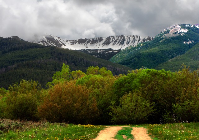
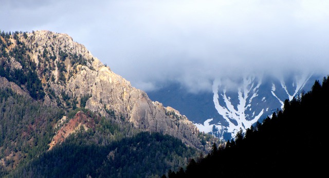 We watched from the observation deck at the Visitors' Center while a sun shaft lit up a ridge up a side canyon off Quake Lake and decided there was hope for getting all the way into the Red Rock Lakes on the next leg of the trip. Sun and wet dirt is better than rain and wet dirt on these kinds of trips, and it was thirty miles of dirt into the Lakes. The second portion of this trip is in the post to your right under the map and is called Red Rock Lakes.

Looking "Downstream" Over Quake Lake Toward Landslide That Blocked Madison River

Quake Lake and The Area Where the Slide Originated

The "Upstream" View from the Quake Lake Visitor's Center Atop the Slide

Sun Hits a Ridge Over Quake Lake
And then Louise found a bit of George W. Bush pseudo-science in the explanatory exhibits. At one point, the Bush Administration had instructed the Park Service, Forest Service and other agencies to list all "credible" theories at interpretive sites. So we were a little open-mouthed when Brian and I read that "scientists just don't know what caused Yellowstone Park."
The exhibit detailed the volcanic theory that we all know and love and accept.
But then the exhibit posited the existence of a huge meteor still buried in the ground under the Park and generating the heat that causes all of the geologic activity in the Park. Say what?!! Gosh, never heard that one before! Thanks for the enlightenment, George.
Louise and Brian, photos by Brian
Text and photos copyright Goin Mobyle,LLC, 2009