Rapid City to Buffalo, WY: We've arrived at the Comfort Inn in Buffalo, WY -- whew! One thing we have to work on in this traveling life is getting ready. Seems like we're always frantically packing and rushing to leave and then leaving about two hours later than we planned. Of course, traveling in the winter in the Midwest and West requires piles of winter survival gear -- sleeping bags, heavy boots, down parkas, hats and gloves, chains for the car, snow shovel, etc.
So here we are at this nice little motel on I-25.
 We turned left on WY HWY 31 to Manderson and then west on US HWY 16/20 to Basin and Greybull along the Big Horn River. Just west of Greybull, we turned north on US HWY 310, a little gem of a highway that runs from Greybull to Laurel, MT, between the Big Horns and the Beartooth mountains.
I've been for an invigorating swim in the small pool -- another thing about travel is finding time to exercise after all that sitting in the car. Now we're settling in for the night.
Morning in Buffalo, WY: November 23, 2009: Not a very good night's sleep -- the beds were harder than rocks! And the heat was hard to adjust between freezing and too hot. But the staff here is great, and we had a lovely breakfast with waffles.
Overheard in the breakfast room -- "We're making a film about all the towns in the US with the name 'Belgrade.' So our next stop is Belgrade MT." He was tall and thin with lots of jewelry, and she had bright red hair dyed to match her fur coat. Exotic appearance for Wyoming! Stay tuned for more of this story below! 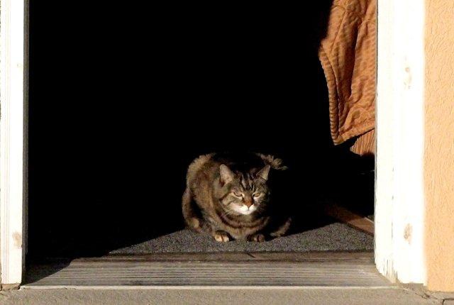
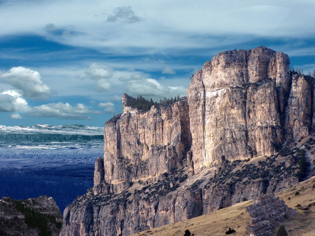
 Buffalo WY to Bozeman MT the Long Way: Of course, we couldn't stay on I-90 as we had planned so we headed out west over the Big Horns on US 16 to Ten Sleep. I love this area and have spent a lot of time here; I love showing it to Brian. So over the top of Powder River Pass and down into Ten Sleep Canyon.
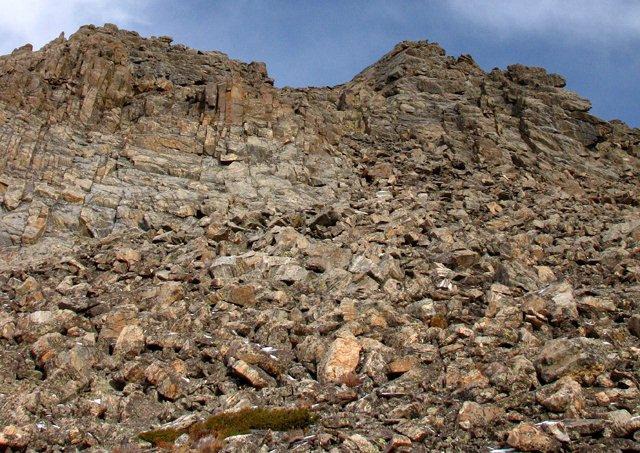
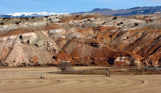
 At Ten Sleep, we turned north on WY HWY 47, Nowood Road, a lovely drive in a small valley along the river of the same name. The red cliffs along the river contrast sharply with the snow-covered high peaks we had just crossed: Cloud Peak, Black Tooth, Penrose, Big Horn, Bomber. I love looking at that range and having a personal story for every peak, remembering every trail.

Leesha at the Comfort Inn While We Load the Car

Willows Along Clear Creek, Buffalo WY

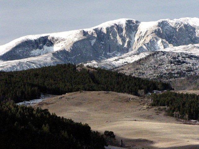
Big Horn Peak From Forest Service View Point on US HWY16

Powder River Pass on US HWY 16, Altitude 9,666 feet

Ten Sleep Canyon Looking West

Nowood River Valley
Lunch in Lovell, WY: In Lovell, we stopped for lunch, first at a convenience store just at the same time the high school next door started lunch hour. So we drove on away from those long lines to the A&W. Leesha had a nice stroll around the grounds -- storage sheds, dumpsters, barrels, fences full of leaves, and alley -- perfect cat sniffing areas!
I remembered the A&W from trips to Colorado when I lived in Bozeman. My grandmother spent time at Colorado State University, and we all went along. No freeway in those days; we cruised US HWY 87.
On we went -- Allen, Brian's brother, was expecting us for supper. Past Cowley, Deaver, and Frannie -- usually now just railroad switching spots.
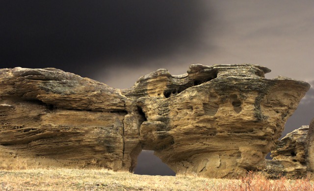
Wandering Montana: We crossed the Montana state line to Warren and Wade and Bridger and Fromberg. Tired of pavement, we found a gravel road from Fromberg to Joliet after a bit of a search through the streets of Fromberg. Our discovery along this little road -- amazing sedimentary rock formations at Elbow Creek!
 We headed south from Joliet on US HWY 212 for a few miles and then turned right onto the narrow pavement of MT HWY 421, a road that winds and climbs and dips through prairie hills and juniper-filled draws. We crossed the Yellowstone River and made our way to Columbus on MT HWY 78. We reluctantly re-joined I-90, trying to get to Bozeman before dark.

Elbow Creek Hoodoos
At exit 400, we pulled off to the north on West Springtime Road for a rest break and marked that road down for future exploration!
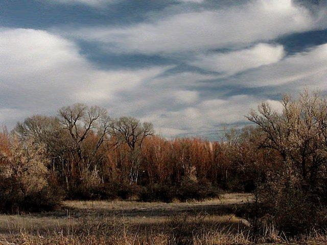
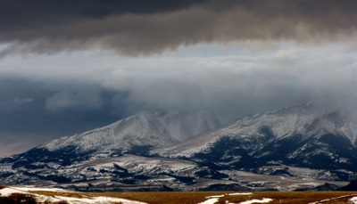
The sky was spectacular, full of scudding clouds in fantastic shapes.
We stopped in the Springdale area to take pictures of the Crazy Mountains against that backdrop. Brian had to hold on to the car in the fierce wind!
 Arrival at Last: Finally, we arrived in Bozeman just after dark -- which is 5:00 in the winter -- and ate an amazing Chinese dinner.

Snow and the Crazy Mountains at Dusk
Bozeman had two feet of snow last week, and most of it is still on the ground -- and the sidewalks and the streets. Not much snow all along our drive until we came over Bozeman Pass. This one of many reasons why we don't live here any more!
November 25, 2009: An article in the Bozeman Daily Chronicle -- two film-makers from Serbia are in Belgrade. They're visiting all towns in the US with that name; the same name as their home town of Belgrade, Serbia. There are Belgrades in Montana, Nebraska, Minnesota, Missouri, and Maine, of all places. Wouldn't that be an amazing trip? So that's the story of the pair at breakfast in Buffalo!
Heading Back to Rapid City SD: November 29, 2009: We drove from Bozeman to Rapid City yesterday -- yes, all in one day! I have to teach yoga today so I needed to be back.
We set out on I-90 with the best of intentions, but that didn't last long. At exit 384 we headed south on Bridger Creek Road. What a gem!! Following the creek, the road wound through grassy hills, cottonwood forests, juniper and brush filled draws.
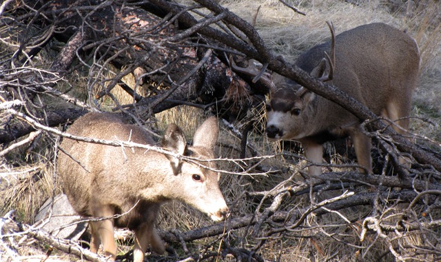
Bridger Creek Road MT: A huge forest fire burned through this area in 2006 so the countryside is open and grassy now. Perfect deer habitat!
And there they were -- does and bucks wandering the hillsides. It's the rut right now, so the bucks were sniffing and pestering the rather coy does. This pair danced round and round through the fallen trees for as long as we watched.
 Off down the road we finally had to go. And met pick-up truck after pick-up full of road hunters from Billings. It was the last day of deer season, and these slackers were peering into the brush at anything that moved. We have a pretty low opinion of folks who don't hunt ethically -- shooting from the road is illegal but very hard to enforce on these remote little roads. All we hope is that the buck survived the day. He probably did since he and his harem were very close to a ranch house. The property is all fenced and marked no hunting, but that didn't seem to have much impact on these hunters.

Deer Dating
We turned left (east) onto Stockade Road and then right (east) onto North Stillwater Road for a lovely drive along the river to Absarokee. At Absarokee we turned north on MT HWY 78 to Columbus and I-90. Lots of great state fishing access points along MT HWY 78 for you trout fishers.
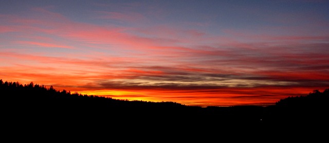
Warrior Trail: We managed to stay on I-90 to Crow Agency MT where we headed east on US HWY 212. This section of US HWY 212 is designated the Warrior Trail. Just outside of Lame Deer we pulled off for a sunset photo.
 Leesha marched out of the car and up a dirt road toward the trees. She loves evening -- "the cat hour." A local Northern Cheyenne rancher stopped to make sure we were all right and told us about another rancher along MT HWY 39 who has petroglyphs on his property. Folks are so nice out in this open country.

Sunset on the Northern Cheyenne Indian Reservation, MT
The rest of the drive was an exhausting 220-mile slog through the dark -- US HWY 212 to Belle Fourche, SD HWY 34 to I-90, and I-90 to SD HWY 79 and home.
Louise with photos by Brian. Text and photos copyright GoinMobyle, LLC 2009