Day Three: We're putting in a Day 3 so people don't think we skipped a day -- but we didn't do much except visit good friends and relatives. All in all, a great day, but not much in the way of photos or travel. We did make a trip to Costco in Bozeman, which left us wishing Rapid City had one. But alas -- we're getting a second Walmart instead. Boo.
Day 4: Yellowstone National Park, by Brian: On Saturday my brother Allen pointed out that it was "free day" in Yellowstone National Park, so we saddled up and rode to West Yellowstone MT to dig into a "spring in the Park experience." On US Hwy 191 through the Gallatin River Canyon, which can be bumper-to-bumper traffic headed for the Yellowstone Club or Big Sky, the traffic was relatively light -- partly due to the fact that we were driving in the pouring-down rain. So that was a mixed blessing -- dark skies and light traffic.
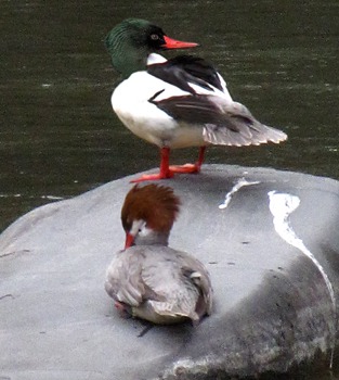
Gallatin River Canyon: Along the Gallatin River, not too far from the Deer Creek bridge, Louise spotted some "suspect" ducks in the river, and we turned around and went back to investigate. They were "suspect" because they weren't something we'd seen a lot of (we no longer turn around for mallards, which are so common and evolutionarily adept that they can nest in a road-side ditch).
The pullout was a hallmark of "The New Montanan." One rig with a trailer took its place in the very middle of the turnout leaving very little room for anyone else. I remember when I was growing up there, it was just understood that you pulled ahead and left room for others to park. Not any longer -- now it's more about hacking out "your share" of Montana at everyone else's expense. Makes me sad to see the loss of wilderness manners.
We squeezed into the room that was left and went over to check out the ducks -- which turned out to be a pair of Common Mergansers (Mergus merganser). I didn't realize it until we checked out the bird book that the male and female of the Merganser tribe look like entirely different species. The male was huge -- and the female had a feather do-wacka-hair-do and a half.
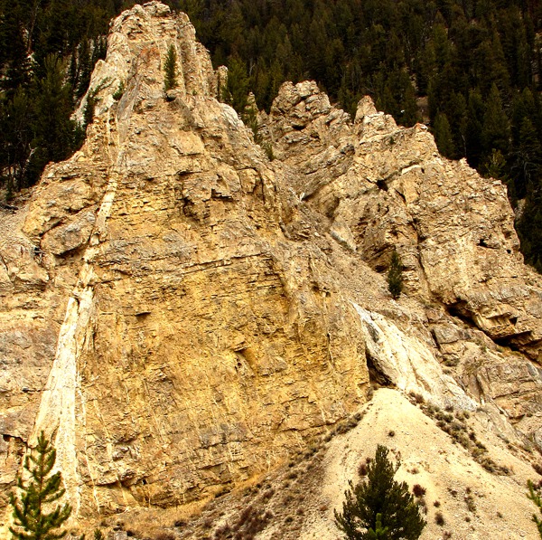
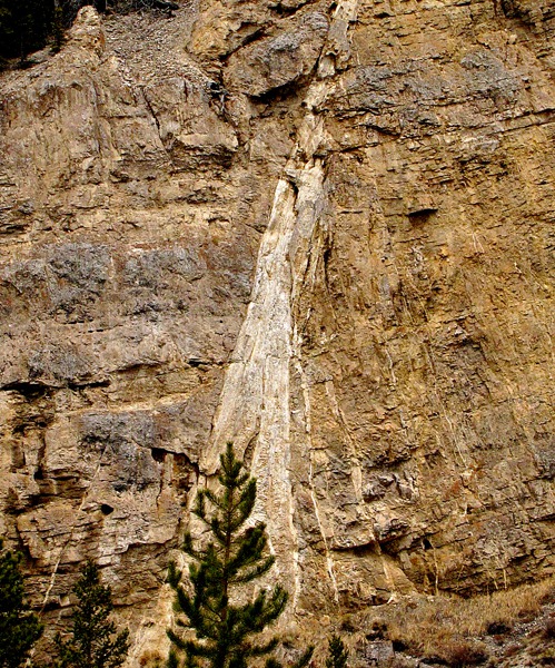
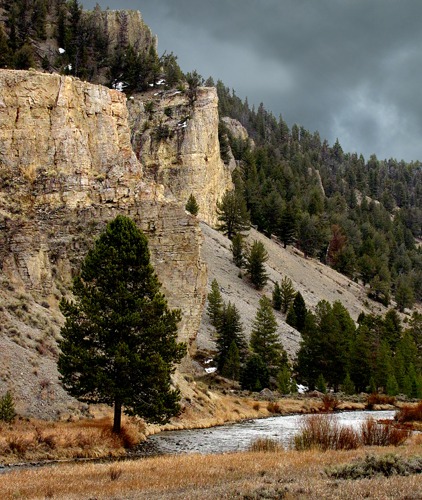
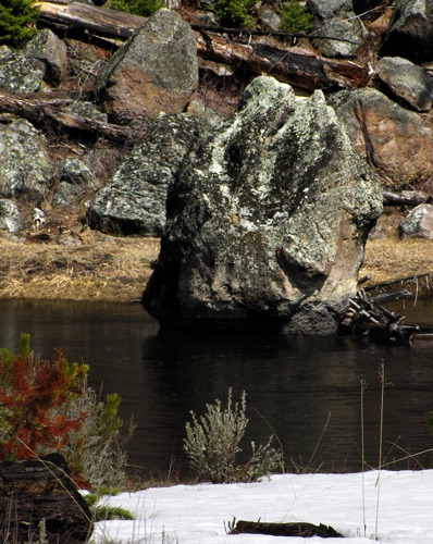
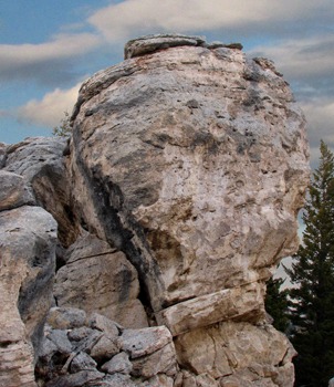
 When I used to drive Gallatin Canyon in my Corvette on my way to work for the Forest Service in West Yellowstone, I didn't get much time to view things like interesting rock formations - they were going past the window at far too-brisk a pace. Now, on a cloudy day with little traffic, we had time to slow down and really look -- and as it turns out, upon more meandering observation, Gallatin River Canyon has amazing limestone spires everywhere. The walls of the canyon are a veritable sculpture garden of formations.
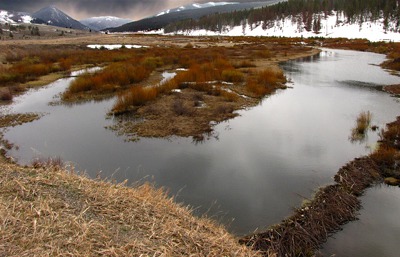
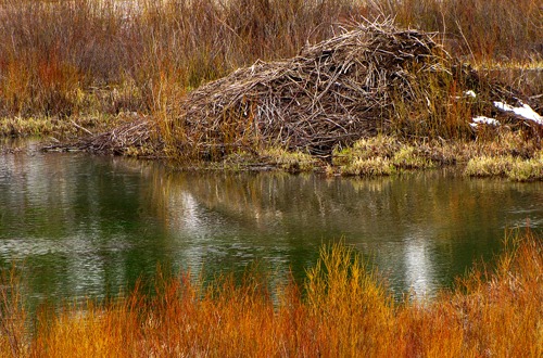
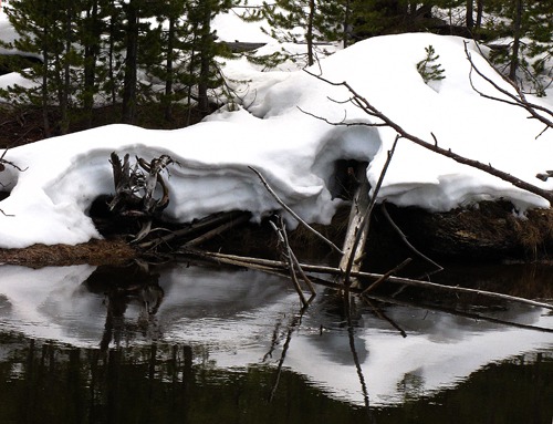
 Entering Yellowstone Park, Still Along the Gallatin River: Further on, just at the Park boundary, beavers had been at work. At one time, this area was rife with moose -- the tall willows made perfect habitat. Over the years, the elk browsed the willows to nubbins as they tried to stay alive in the Yellowstone winters without the benefit of thinning-the-herd predators. There appears to still be a "healthy" browse being put on the willows, but we haven't seen moose in the area for years.
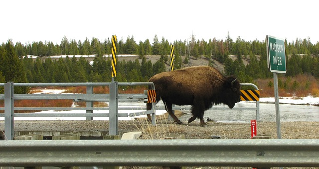
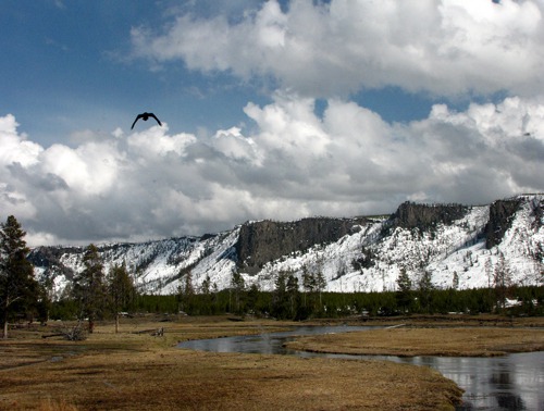
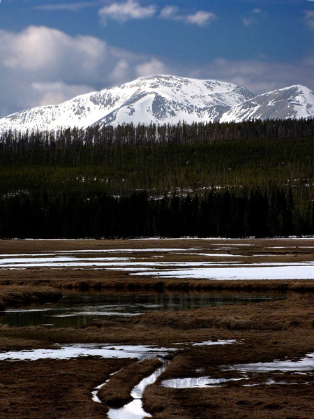
 Madison River Just Outside Yellowstone Park: We drove out onto the West Yellowstone Flats around, and south of, Hebgen Lake, just outside the Park. The rain was now a light drizzle. We soon saw "Wildlife in the Road" signs, and up ahead, spotted a Yellowstone traffic jam.
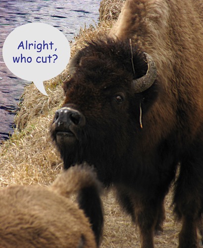
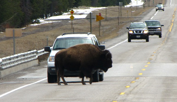 Answering only to itself the old question, "Why did the bison cross the road?" this big bull took his sweet time and eventually got to whatever was better on the other side. Several more grazed along the banks of the Madison River as it crossed under the highway.
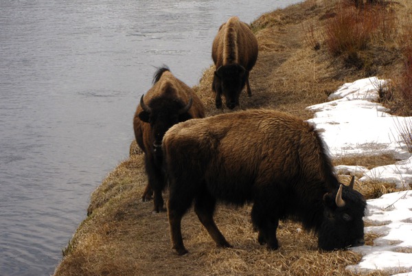 What appears on the surface to be a placid scene of bison grazing and camaraderie turns out to be a series of complex social interactions when you stop the engine and get out, listen, and observe.
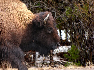
 The bison, with all their bovine introspection , did manage to reach out and navigate a bike path over the Madison River bridge, turning it into a private bison bridge used by most of the small herd that was in residence along the highway.
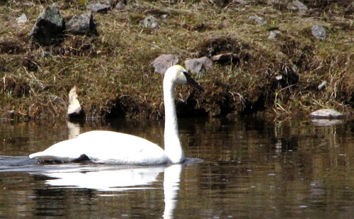
 Back Into the Park Along the Madison River: After the Bison Jam, we drove on to West Yellowstone and through the official West entrance into the Park. Free Day inspired a fair number of visitors, many from neighboring states, but it was still a relatively peaceful day in the Park. Not long after we found the Madison River again, we spotted a trumpeter swan meandering along the shore. It's always a thrill to see them, large, graceful, and back from the brink.
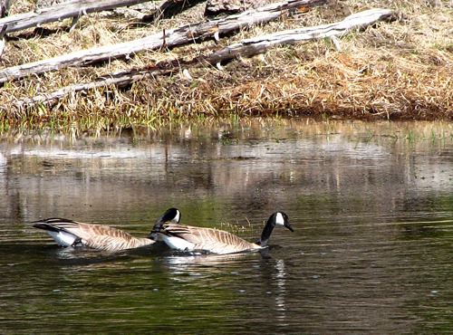
 Not far away, a pair of Canada geese enjoyed the relatively warm water of the Madison River as well.
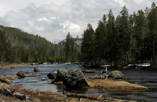
 That stretch of the Madison River from the West Yellowstone entrance on US HWY 191 to Madison Junction (where the Firehole River and Gibbon River join to form the Madison) has always been one of my favorite stretches. It fishes well at times, but the biggest draw for me is the way the large picturesque rocks, tree trunks, and the tranquil water all join to form endless "still life" shots.
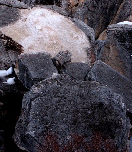
 I would guess that 95% of the people who drive by Madison Junction are looking at the river -- and justifiably so. But if you wonder where those huge boulders in the river originate, you just have to pivot 180 degrees and look to the rugged and loosely held ridge on the other side of the road. I had seldom done that, because mostly I was looking for hatches on the river. Or watching the elk that favor the lush spring grasses along the edge of the marshes.
 Pair in the Gallatin River&)
Common Merganser (Mergus merganser) Pair in the Gallatin River

Gallatin River Canyon Limestone Spire

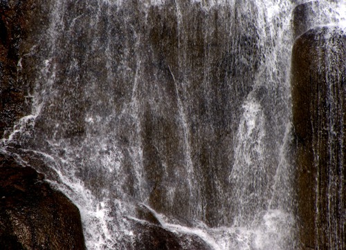
Seam Layer Cascade Closeup

Gallatin River and Limestone Spires
 Impoundments At Yellowstone National Park Boundary&)
North American beaver (Castor canadensis) Impoundments At Yellowstone National Park Boundary
 Homestead&)
North American Beaver (Castor canadensis) Homestead

US HWY 191 Traffic Jam on the Madison River Bridge
 Graze Along the Madison River &)
American Bison (Bison bison) Graze Along the Madison River
 Questions&)
American bison (Bison bison) Questions
 Considerately Uses A Bike Bridge&)
American bison (Bison bison) Considerately Uses A Bike Bridge
 in the Brush&)
American bison (Bison bison) in the Brush
 in the Madison River&)
Trumpeter Swan (Cygnus buccinator) in the Madison River
 Pair in the Madison River&)
Canada Goose (Branta canadensis) Pair in the Madison River

Madison River Riverscape

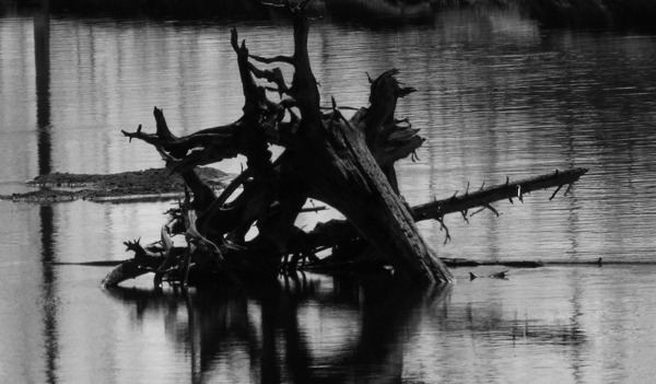
Madison River Stump Sculpture

The Madison River Reflects a Hill

Madison River Boulders

Raven Flies near Madison Junction
I was at Madison Junction one spring in the '60's and saw one of the most amazing sights I've ever seen in the wild. A large herd of elk were grazing at the edge of the timber on the far side of the river when a grizzly charged out of the timber at full speed, closed on one hapless elk that was fleeing as fast as it could, and brought it down with one swipe of its paw at the haunches -- which rolled the elk, and then the bear was on it. I was there with a friend, and we just stood open-mouthed watching that little drama unfold about 500 yards away. It reminded me to never bother to try to outrun a grizzly-- if an elk in its prime couldn't do it, a human stood no chance.
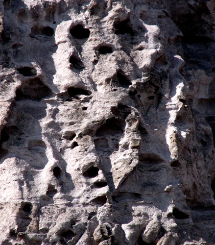
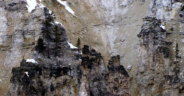
Anyway, back to the ridge behind the road -- the boulder factory. It's fascinating when you look at it up close.
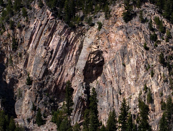
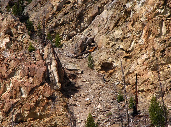
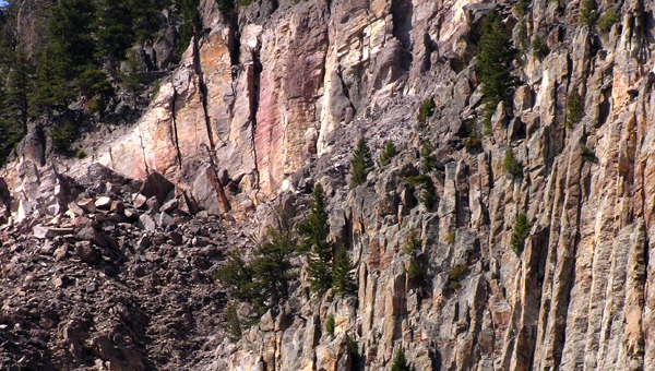
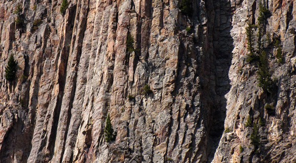 The wall columns look like basalt from the road, but not being a geologist, it's just speculation. Of course, in this geologically rich and diverse area, there's bound to be a lot more types of rock in any given area.

Madison River Canyon Wall Typical Formation

Madison River Canyon Wall Passage

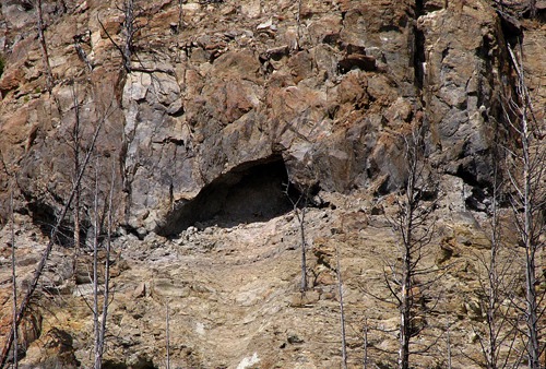
Madison River Canyon Wall Cave and Possible Bear Den

Madison River Boulder Source

Madison River Canyon Wall Vertical Columns
The Grand Loop Road Up the Gibbon River: At Madison Junction, we headed up the Gibbon River on US HWY 89 -- the Grand Loop Road -- on the way to The Grand Canyon of the Yellowstone -- luckily open despite the blanket of snow. This road is closed all winter.
On the canyon wall not far from the junction we saw a sign that said "Tuff Cliff" and in all the hundreds of times I'd driven by there, I'd never stopped to see what was so tuff about it.
As it turns out, the "tuff" in "Tuff" is a solidified dense cloud of volcanic ash. (Yellowstone is a nasty toxic hell-hole when it feel like erupting from its massive caldera -- which it periodically threatens to do. It spewed volcanic material hundreds of feet thick all the way to Washington State last time, so one wants to leave the Park when it starts.)
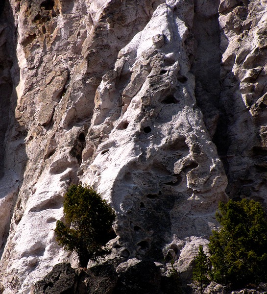
The tuff enveloped boulders when it cooled, and is now shedding them down slope when erosion eats a hole in their pods or earthquakes jar them loose. So tuff isn't so tough after all -- it's losing all its little boulders.
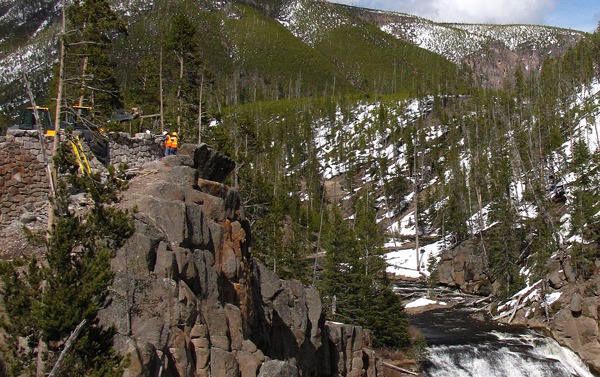
 The next stop on the trip was Gibbon Falls. So we stopped. However, according to the road construction foreman who came and chased me right-the-hell off, there was technically "no stopping" where we stopped.
They are doing a huge reconstruction of the road and parking area at Gibbon Falls, so if you plan to see it, prepare to park a mile away and sneak back, or "wait for a year and a half," like the foreman advised me.
The next stop on the trip was Gibbon Falls. So we stopped. However, according to the road construction foreman who came and chased me right-the-hell off, there was technically "no stopping" where we stopped.
They are doing a huge reconstruction of the road and parking area at Gibbon Falls, so if you plan to see it, prepare to park a mile away and sneak back, or "wait for a year and a half," like the foreman advised me.

Cliff Face at Tuff Cliff

Zitty Tuff Cliff Face as the Boulder Pods Open
Gibbon Falls: In olden times, they hacked the road past Gibbon Falls out of a cliff face that keeps trying to shake itself free of said road. So it's non-trivial to re-construct it into a more permanent fixture of the Park.
And in olden days, (and up until this spring) there was parking for only about 30 cars at the falls, and typically 100+ cars wanting to stop. That made for what the Park Service calls "issues." Now it looks like they are going to easily accommodate 100 cars in a new parking lot, and the dad-gummed road is moving way over to the other side of the canyon with new bridges and everything. Hence, "wait for a year and half" to go see it.
 In my 40 years of experience visiting Gibbon Falls, there are three basic truths at Gibbon Falls. One, no matter how hard you try to get there amid a myriad of other distractions, when you finally get there, the sun will be off the falls for the day. Two, if by some miracle, you get there when the sun is hitting the falls, there won't be a parking spot anywhere within walking distance. Three, if, by some miracle you get there at the time of day when the sun is right, and you find a parking spot, there will be a cloud camped over the sun for as long as you can endure staying there, plus three minutes. Hence, I parked in the mud downstream from the No Stopping sign (but not out of its sphere of influence, apparently) to get some shots of the sun on the falls. It was a miracle.
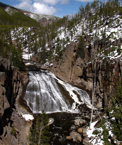
 Of course, we had no sooner loaded up and got out of the "no stopping" zone than they stopped traffic. A rather pompous road superintendent of some sort walked up and down the line of cars, clearly expecting something but getting little.
 Grand Canyon of the Yellowstone: We headed for the Grand Canyon of the Yellowstone. On the way, we went past the Gibbon Meadows area -- now mostly still under snow, but with a few signs of early life -- including a frog chorus that attracted attention.
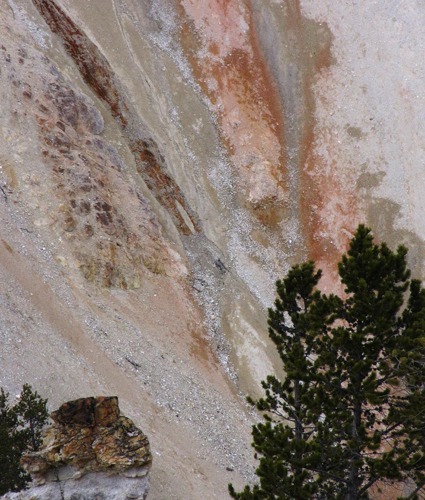
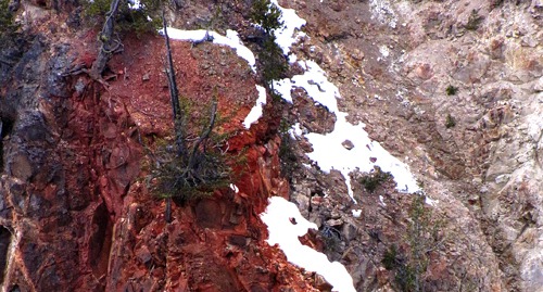
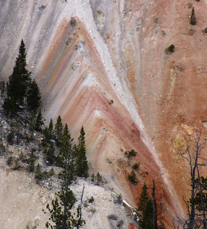
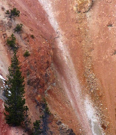
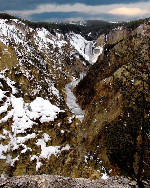
 At the turnoff to the Grand Canyon, there was still a little sun left. There were a surprising number of people there, considering how late in the day it was. (We had dinked around Bozeman debating the weather until we finally caved in and went, regardless, so we were running late.) The scenery in the canyon was simply amazing -- as vibrant as I've seen it. And while the Falls was spectacular, the walls of the canyon were actually more photographically interesting. So I shot the walls while the other people shot the falls.
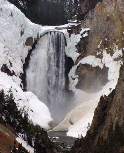
 Lower Falls of the Yellowstone River: And after the walls came the Lower Falls still partly encrusted in ice. We walked through the snow out to Artist's Point where there were a couple people with lots of camera gear. I was joking with one guy from Manitoba that there was only one perfect spot to really photograph the Lower Falls from Artist's Point, and I was standing in it.
He was edging closer and closer with his tripod, and finally I said, "I know I'm in the perfect spot, and for a small consideration, I'll move over one foot," and he started laughing. I moved over a foot, and got some very good additional shots too, and he set up his tripod in "the perfect spot" and got his shots.
Lower Falls of the Yellowstone River: And after the walls came the Lower Falls still partly encrusted in ice. We walked through the snow out to Artist's Point where there were a couple people with lots of camera gear. I was joking with one guy from Manitoba that there was only one perfect spot to really photograph the Lower Falls from Artist's Point, and I was standing in it.
He was edging closer and closer with his tripod, and finally I said, "I know I'm in the perfect spot, and for a small consideration, I'll move over one foot," and he started laughing. I moved over a foot, and got some very good additional shots too, and he set up his tripod in "the perfect spot" and got his shots.
 On the way out, I took a few more shots of the canyon walls -- it was hard to stop. The guy from Manitoba came along, and I said, "If you want the perfect shots of the wall, you'll have to stand here where I am," and he laughed, but when I left, he came over to the spot. In truth, it was hard not to see good shots almost anywhere along the walkway out to Artists' Point.
 We went to the Upper Falls to see if Louise and Allen could walk down into the canyon, but the trail still had too much snow on it for them. The Manitoba group soldiered on through the drifts. I didn't feel like walking in the snow, so I waited in the rig.

Construction Boys Working on a Retaining Wall at Gibbon Falls

Gibbon Falls Miraculously in the Sun

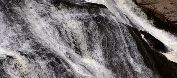
Gibbon Falls Starts the Plunge

Gibbon Falls Detail

Supervisor Working the Line of Stopped Cars
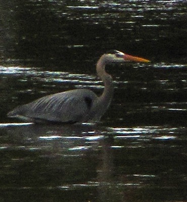
 Stalks the Gibbon River&)
Great Blue Heron (Ardea herodias) Stalks the Gibbon River

Snow Lingers on the Banks of the Gibbon River

Gibbon River Meadow

Grand Canyon of the Yellowstone Spires and Pines

Color Band with Tree and Outcrop in the Grand Canyon of the Yellowstone

Dead Tree on a Red Outcrop in the Grand Canyon of the Yellowstone

Inverted V and Trees in the Grand Canyon of the Yellowstone

Red Slide Past Trees in the Grand Canyon of the Yellowstone

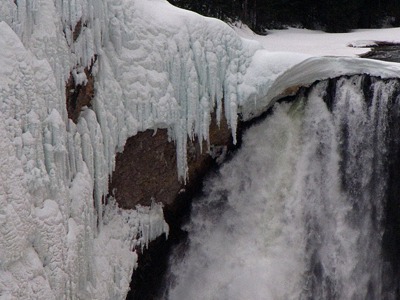
Yellowstone River Lower Falls in the Grand Canyon of the Yellowstone

Yellowstone River Lower Falls With Ice Buildup Detail

Yellowstone River Lower Falls With Hanging Ice Detail

Giant Ice Overhang As Tall as a Five-Story Building, Base of Yellowstone River Lower Falls

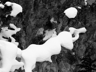
Roots and Canyon Snow Lace in the Grand Canyon of the Yellowstone River
&)
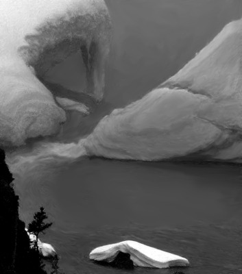
Snow Cling on Canyon Wall in the Grand Canyon of the Yellowstone River (Black and White)
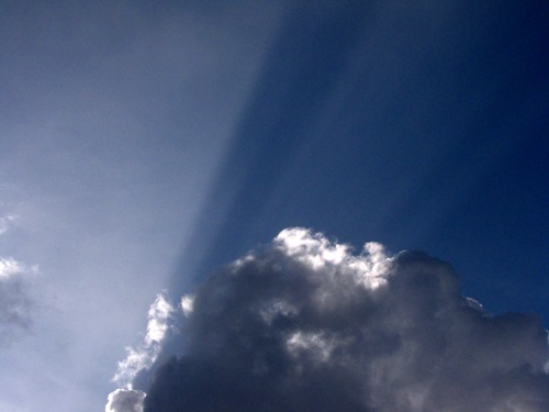
Clouds and Sun: I was half dozing when I realized there was a laughing elephant outside the sunroof.
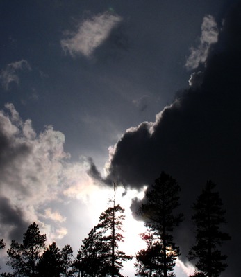 Soon one of those clouds right out of Da Vinci drifted over.
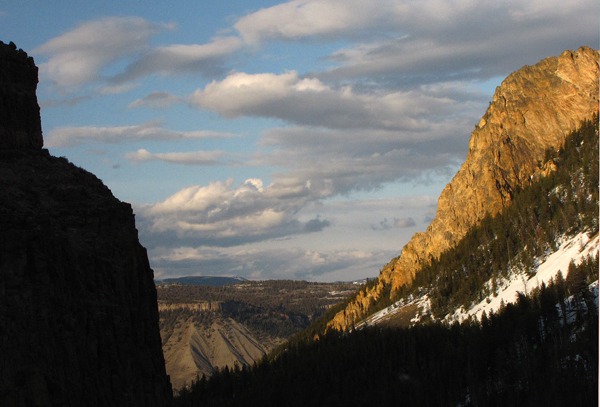
 We left the Grand Canyon of the Yellowstone area and headed for Mammoth and Gardiner, where we hoped to find dinner. As we drove to Mammoth, the sun was lighting up the peaks and ridges on their west-facing slopes. Sun at last -- the weather had cleared considerably, stretching the day and the photo shooting light for us.

Laughing Elephant Cloud

Low Rays and Cumulus Clouds
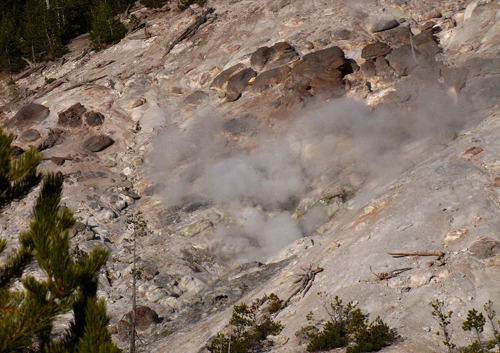
Roaring Mountain Geyser: We drove past Roaring Mountain, which as I recalled, used to roar more. It was more of a low growl now -- the water table in the Park keeps shifting and the geysers, they come, and the geysers, they go.
 Continuing along US HWY 89
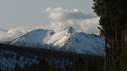
 As we rounded the corner below the Golden Gate Gap leading to Mammoth WY, Louise said, "The map says, Hoodoos." Well, we love hoodoos and decided to stop and check them out. Again this was an area I'd driven through over 100 times and looked at them in passing, but this time, we stopped. It's an amazing little scattering of travertine formations. They were formed by ancient hot springs on Terrace Mountain just down the road. They tumbled to this location in a large landslide.
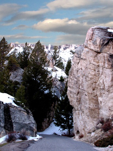
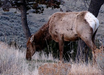
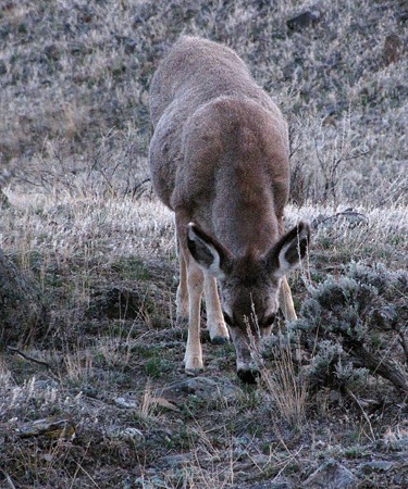
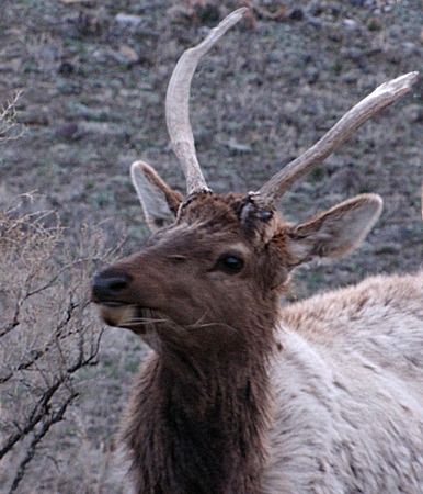
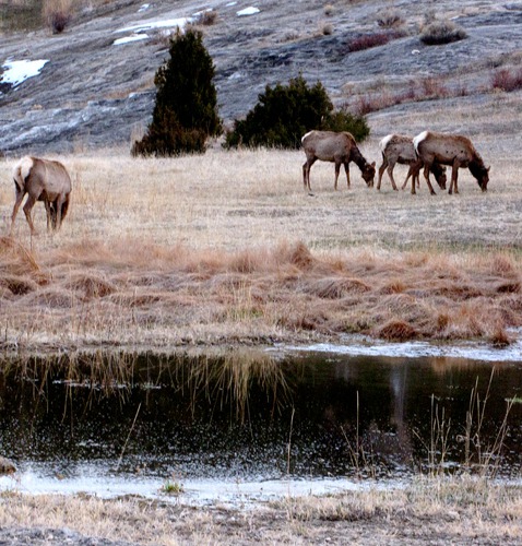
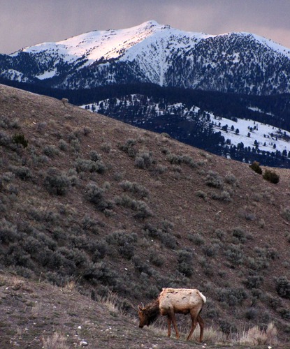
 As we neared Mammoth we started to see a few elk. They hang out near there in winter until spring frees the high country of snow. They were pretty scrufty in their falling-out winter coats, but it's always fun to see them and the deer along the Gardiner River.

Monolith at Roaring Mountain Geyser

The Throat of Roaring Mountain Geyser

The South Side of Electric Peak Viewed From Swan Lake Flat

Golden Gate Gap into Mammoth WY

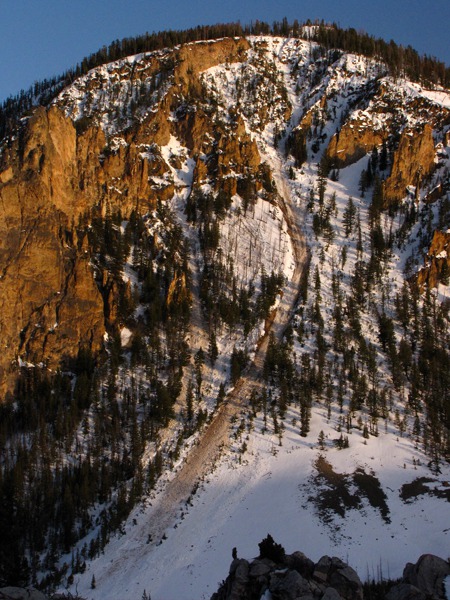
Active Avalanche Chute off Golden Gate Hill at the Golden Gate Gap

Road Through the Hoodoos

Toppled Hoodoo

Leaning Hoodoo
Mammoth WY to Gardiner MT: US HWY 89 continued north along the Gardiner River, and the Grand Loop Route turned east to the Lamar River Valley. We hoped to spot a few mountain sheep along the Gardiner River, but didn't see any this trip.
 The last shot of the evening was one we saw just as we were descending into the Gardiner River Canyon and the last of the light.
 We stopped at the Best Western on the north edge of Gardiner for a very nice dinner in the restaurant there. If you swing in there, ask for Jen -- she's a rock star waitress and a lot of fun. Got back to Bozeman around 11:00 pm -- 12 hours after we left, and a zillion scenes to enjoy. Thanks for the Free Day, Yellowstone. Much appreciated. We'll renew our All-Park pass soon.
 Grazing&)
Cow Elk (Cervus canadensis) Grazing
 Grazing at Dusk&)
Young Mule Deer (Odocoileus hemionus) Grazing at Dusk
 Experiencing Grazingus Interuptus&)
Spike Bull Elk (Cervus canadensis) Experiencing Grazingus Interuptus
and Pond at Dusk&)
Elk (Cervus canadensis)and Pond at Dusk
 and Sheep Mountain MT (elevation 10,462 feet)&)
Elk (Cervus canadensis) and Sheep Mountain MT (elevation 10,462 feet)
Brian, with Photos by Brian. Text and Photos copyright Goin Mobyle LLC. 2010.