April Trip to Montana, Day 5 -- Madison Buffalo Jump and the Bear Trap Canyon Wilderness Area, April 2010
A Warm Spring, Day 5, by Brian: The warm weather continues -- sunny days with temperatures in the 70s. Who can resist another day out?! We stretched our stay in Bozeman by a day to take advantage of the weather. Who knows -- in Bozeman, in spring -- when the next snow will hit? When I worked for the Forest Service, we'd often get snowed on in the hills until the end of June. We used to say Bozeman had two seasons -- white winter and green winter.
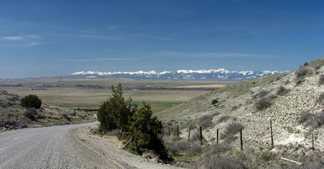
Madison Buffalo Jump State Park: This nice day my brother Allen joined us, and we headed for the Madison Buffalo Jump State Park on the Madison River. We drove 1-90 to the exit for Buffalo Jump Road at Logan MT. The Madison Valley and the Gallatin Valley are very different. The Madison Valley is much drier, and of course, now that Bozeman has been "discovered," the Madison is a lot more of what Montana used to be like when we were growing up there -- ranches, agriculture, and wildlife instead of third homes, au pairs, and Range Rovers.
 A lot of people I've met have a Hollywood vision of buffalo jumps -- Indians on horseback chasing bison over a cliff. In reality, the buffalo jump as an active hunting practice was a casualty of the horse, and once horses were introduced across the plains in the 1700's, the buffalo jumps were mostly abandoned.

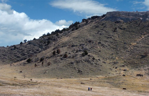
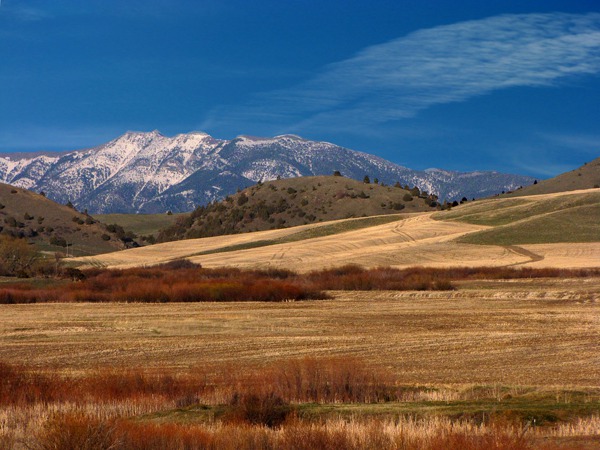
Dropping Into the Madison River Valley
The reason was simple -- for a jump to come into play, the bison had to first be in proximity -- and that was both undependable and usually highly time-constrained. Indians would have to wait until the bison happened to wander into traditional grazing grounds, and then entice or chase them on foot over the edge. The horse gave the Indians the ability to go to the bison -- not wait for the bison to come to them -- and it created a more nomadic and wide-ranging lifestyle.
The State of Montana has done a great job with their interpretive signs at the little shaded rest area atop the hill that looks out at the Jump.
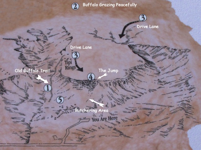
 To the left side of the photo, you can see an old bison trail that is now a hiking trail you can take to the top of the Madison Jump. Allen and Louise decided, for reasons unclear to me, to hump the Jump, and they made it all the way to the top and took in the bison's-eye view of the precipice.
 While they were perspiring their way to the top of the Madison Jump, I took a few shots of the area near the overlook and of the Tobacco Root Mountains on the far side of the Madison Valley.
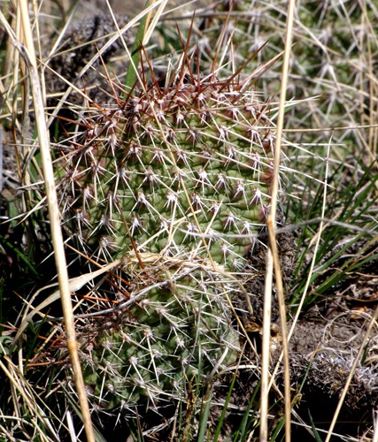 The Madison Valley, for a lot of its length, is dry enough to encourage prickly pear cactus -- something you don't find as much in the wetter, nearby Gallatin Valley. In eastern Montana, prickly pear is common, and you typically find it while you are crawling along on your hands and knees trying to sneak up on antelope. And not "find" in a good way.

The Madison Buffalo Jump Topography

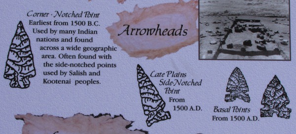
"Getting" the Points

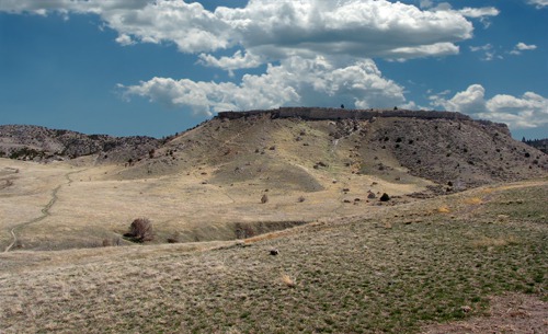
The Madison Buffalo Jump
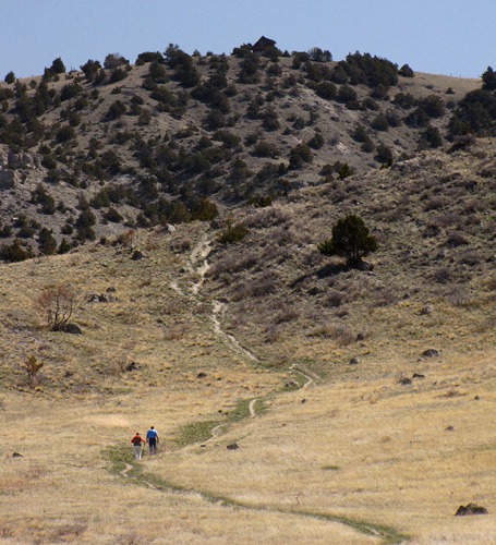
 and Allen (Blue) Start the Hump the Jump Campaign&)
Louise (Red) and Allen (Blue) Start the Hump the Jump Campaign
 and Allen (Blue) Climbing the Ridge&)
Louise (Red) and Allen (Blue) Climbing the Ridge
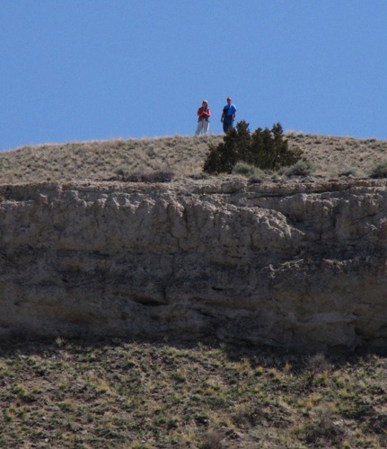
 and Allen (Blue) Looking at the Leap&)
Louise (Red) and Allen (Blue) Looking at the Leap

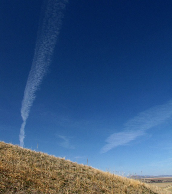
Contrails Over Ridge and Valley
&)
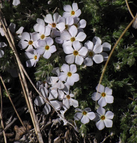
Early Blooming Hood's Phlox (Phlox hoodii)
&)
Plains Prickly Pear (Opuntia polyacantha)
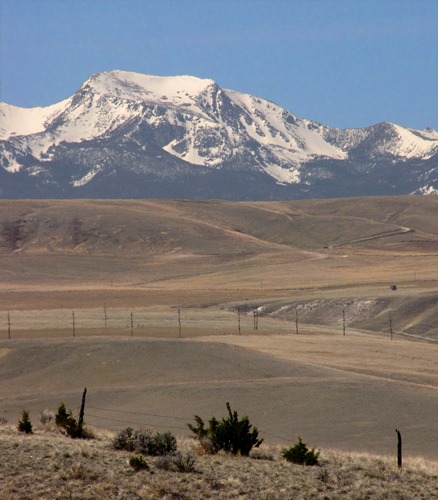
Tobacco Root Mountains: On the far or western side of the Madison Valley are the Tobacco Root mountains, and the most iconic (and tallest) of the peaks in that range is Hollowtop, (10,604 feet) which is on the west side of the small community of Pony that is hidden in the photo by the intervening ridge.
The Tobacco Root mountains were called a variety of things by explorers, but the name Tobacco Root seems to have stuck in the early 1900's because the Indians (probably Shoshone) dried the root of the mullein plant that is common there and mixed it with other plants (like manzanita leaves or kinnikinic) to make a tobacco substitute.
 Back to the Jump: For reasons I don't understand, Allen and Louise climbed down the cliff face on their return from the jump. Pretty exciting from their reports! They also reported wildflowers on top -- yellow bell, leafy bluebells, rabbitbrush, biscuitroot (coos), cushion phlox, shooting stars, and Hooker's townsendia. What a spring show!
 in the Tobacco Root Range&)
Hollowtop Mountain (Elevation 10,604 feet) in the Tobacco Root Range

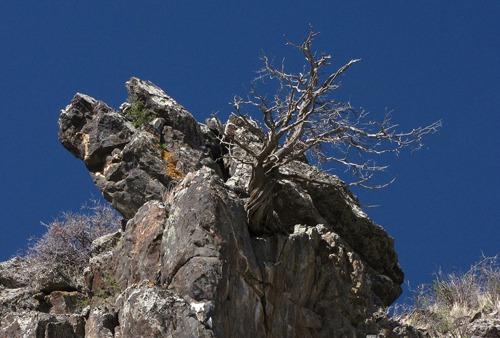
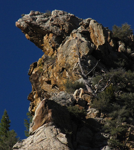
Rusty Side-of-the-Jump Hoodoos

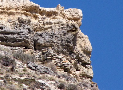
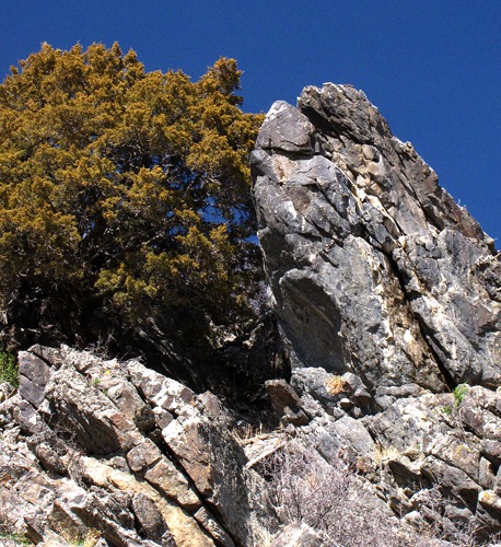
Jump-Watcher In the Cliff at Madison Buffalo Jump State Park MT
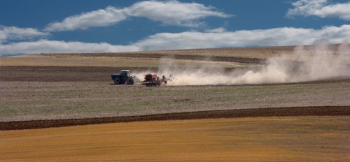
Madison River Valley and Greycliff: Back on Buffalo Jump Road we went, heading south until our road dead-ended at the Madison Road. We turned left toward the Greycliff Fishing Access Area on the Madison River. As we drove through the valley, we saw agriculture happening -- a farmer doing some planting in one of those spring windows when the fields are dry enough to work.
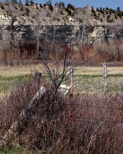
 Greycliff offers some good fishing, and a good views of the river backed by limestone cliffs that are actually more beige than grey. Since it's a set-aside, some of the native cover has re-established itself in that area, so there are a few pheasants making a comeback, and there's cover for white tail deer and rabbits galore. It was mid-day and hot, so there wasn't much stirring in the wildlife arena, but I took a shot of the fence-line cover that used to be prominent in Montana and provided a lot of pheasant and rabbit habitat before farming methods allowed plowing and cutting right up to the fence.

Agriculture Happening in the Madison River Valley MT

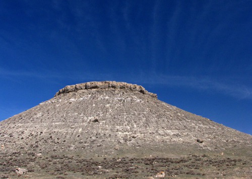
Mesa with Clouds Streaks
On my uncle Pete's ranch outside Bozeman, there were long fencelines covered like the one in the photo below, with rose bushes that provided rose hips for food, and dense cover. There were pheasants everywhere. Now, they are a rarity in the Gallatin Valley as farming methods have become a lot more efficient at the field edges, and valley ranches are being converted into subdivisions at an alarming rate.
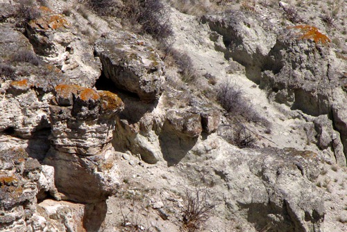
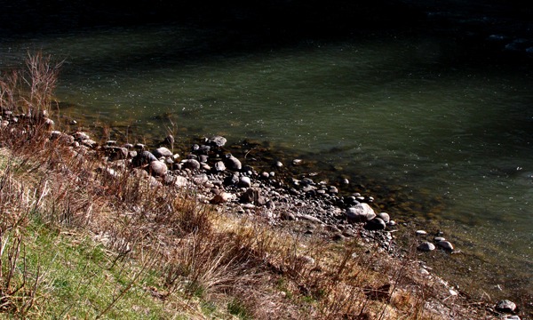
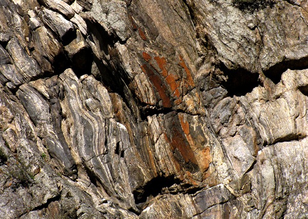
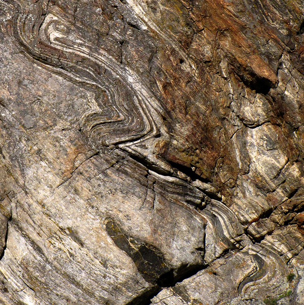
 Rocks: Just before the Madison gravel road intersects MT HWY 84, there is a cliff area near the river that I've always wanted to examine closer but never did take the time to do so. Louise and I always have interest in the geology of areas we visit, and in particular, just the patterns of light and dark, color and tension that exist in the rocks. So I took a few shots as we drove by.
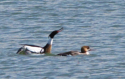
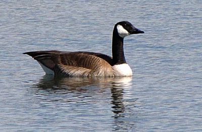
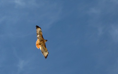
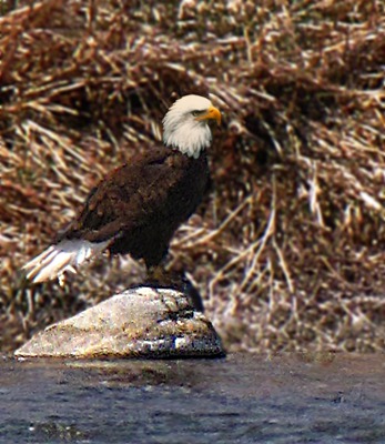
 Birds: As we headed for Ennis, and just before we intersected US HWY 287, we encountered a mini-bird fest. There were hawks, eagles, geese and mergansers near the river and in a road-side pond. The mergansers were a little far away for a good photo, but they were all about monkey business, and I did manage to capture a couple blurred mating-ritual photos.
 We followed US HWY 287 to Ennis for lunch.

Pheasant Cover Along Fence at Greycliff Fishing Access MT

Rock and Juniper On Madison River Bluff
&)
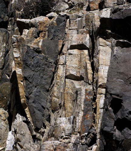
Madison River Rock Jumble (black and white)

Rock Layers Collide

Dead Tree and Rock Along a Madison River Bluff
 In Roadside Pond&)
Mating Common Mergansers (Mergus merganser) In Roadside Pond
 Patrols the Madison River&)
Canada goose (Branta canadensis) Patrols the Madison River
 Wheels Overhead&)
Red-tailed Hawk (Buteo jamaicensis) Wheels Overhead
 Rock in the Madison River&)
Bald Eagle (Haliaeetus leucocephalus) Rock in the Madison River
Elk: Just as we topped the pass that leads into the Ennis section of the Madison Valley, I spotted something out of the ordinary on the flats not too far from the road. As we got closer, we could see that it was a group of four cow elk -- way out of place this low this time of year. Their summer range still had a fair bit of snow on it, so I guess it was a rational thing to be doing, from an elk point of view. But normally you don't see them this close to the road this far down, this time of year.
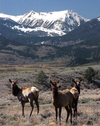 Some explanation emerged when we drove a little further down the hill toward Ennis and could look back up the valley behind the ridge in the photo. The ranch that used to be there when we were growing up, and which served as critical elk winter and spring range, had been subdivided into 10-acre ranchettes and the entire valley floor was covered with big houses, most of which looked unoccupied -- waiting for the people who now "summer" in Montana to arrive from California, Florida, and parts back east. So the elk could be excused their somewhat confused look as they milled around out of their habitual territory and near the highway.
 with Tobacco Root Backdrop&)
Elk (Cervus canadensis) with Tobacco Root Backdrop
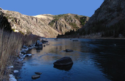
Bear Trap Canyon Wilderness: We had a quick lunch at a diner in Ennis, and then retraced our route to the Madison River and the Bear Trap Canyon Wilderness. The Bear Trap Canyon is the first wilderness area to be managed by the bureau of Land Management (BLM). The area is 6,347 acres and is accessible only from the north end on the nine-mile Bear Trap Canyon National Recreation Trail. The cliffs the border the canyon are 1,500 feet high. The river offers fishing and whitewater rafting. And the scenery is spectacular!
The Bear Trap was always a favorite summer haunt of ours -- the fishing was amazing, and in those days, there wasn't much fishing pressure on the part that you had to hike into. The Bear Trap is alive with poison ivy and, in the summer, rattlesnakes, but if you mind your P's and Q's, you can get in and out without much suffering.
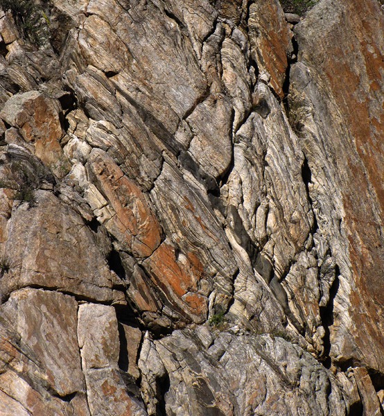
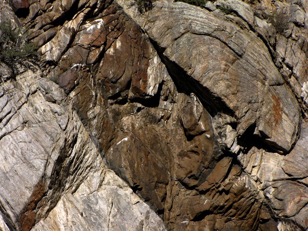
As we walked along, the sun was starting to cast long shadows on the river, and it illuminated the canyon wall behind us. The wall became alive with interesting shapes and "sculptures" and I took quite a few shots of things that I hadn't really focused on before -- because in the past I'd always be looking at the river for rising trout or a hatch of some kind. Or wondering if the wind was going to die down enough to get a fly line to sit on the water. The Bear Trap is notorious for wind. And that propagates no end of leader knots when you are fly fishing.
 I did see one snake while we were in the Bear Trap. Fortunately, it was petrified.
 A couple women passed us on the trail and reported that they'd seen a bear a little further in -- past the Wilderness Area boundary sign. They did, however, forget to give enough detail, as in "black or grizzly," "cub or 600 pound grumpy-as-hell, just-out-of-hibernation-adult" or anything that would have proven more valuable. So since they seemed to have survived the encounter in one piece, we didn't pay the report much attention.
The sun was starting to dip below the canyon wall where we were standing, but still lit the wall at the "curve of the canyon" ahead of us.
A couple women passed us on the trail and reported that they'd seen a bear a little further in -- past the Wilderness Area boundary sign. They did, however, forget to give enough detail, as in "black or grizzly," "cub or 600 pound grumpy-as-hell, just-out-of-hibernation-adult" or anything that would have proven more valuable. So since they seemed to have survived the encounter in one piece, we didn't pay the report much attention.
The sun was starting to dip below the canyon wall where we were standing, but still lit the wall at the "curve of the canyon" ahead of us.

Canyon Shadows at Water's Edge, Madison River MT

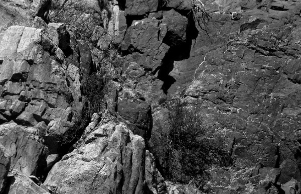
Bear Trap Canyon Wall Layers Converge

Layer Slide Closeup

Rock Rust

Slow-Moving Rock Snake

Bear Trap Protrudance
I've always loved that last evening light in the Bear Trap -- we typically fished until we couldn't see and then walked out in the dark, so I had a lot of experience with it. Most of the time in the past, I didn't have a camera along. It's amazing in there when the wind dies and the sun sets. And it's far enough up river that you aren't supposed to launch inner tubes or drift boats above there, so you don't get the 2,000 a day inner-tube rafters circled around full beer coolers that the lower stretch of the canyon gets in summers now.
 As we started to walk out, Louise spotted a little color along the trail -- getting a quick bloom in before the summer heat descended.
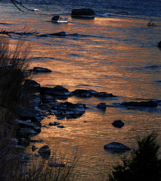
 As we finished the walk to the rig, the afterglow on the far canyon wall was starting to reflect in the river, giving it a rich peach tone that made a glowing ribbon of the river for as far as you could see up the river.
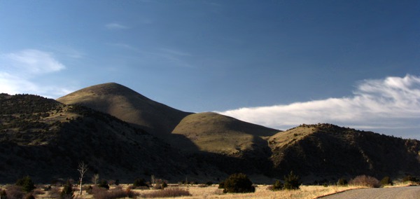
 We left the Bear Trap and at the mouth, the sun was still hitting the hills west of the river -- at a spot where we used to find teepee rings as kids, and were always on the lookout for arrowheads.
 We drove back to Bozeman on MT HWY 84 and got to the edge of the Gallatin Valley in time to see the sun hitting the Bridger Range on the east side of the valley. It was a visually perfect way to end a great spring day. A week later they closed the road in Yellowstone Park due to snow, and Bozeman was freezing and windy once again.
 Brian, with Photos by Brian
Text and Photos copyright Goin Mobyle LLC 2010
Brian, with Photos by Brian
Text and Photos copyright Goin Mobyle LLC 2010

Bear Trap and the Madison River Near Wilderness Boundary
&)
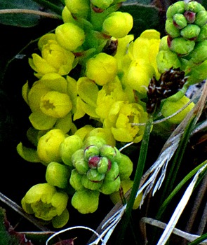
Oregon Grape (Mahonia repens)
&)
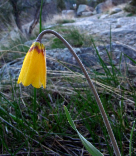
Yellow Bells (Fritillaria pudica)

Reflected Afterglow on the Madison River

Hills at Bear Trap Canyon Mouth

Bridger Range East of Gallatin Valley MT