Crane Quest, Day One, by Louise: 24 March 2010: We're in Valentine, NE, after a lovely day of wandering through the Nebraska Sandhills from Rapid City to Valentine NE. This huge area of wind-blown sand dunes covered with short-grass prairie lies north of the Platte River and west of the Loup River.
 We drove south on SD HWY 79 to US HWY 385 and turned east at Chadron NE, on US HWY 20.

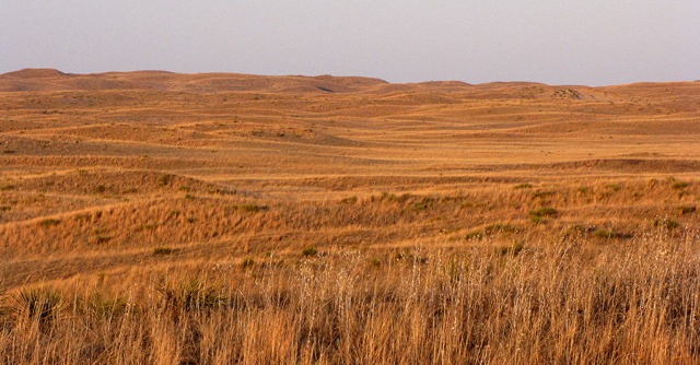
Sandhills Stretch to the Nebraska Horizon All Around
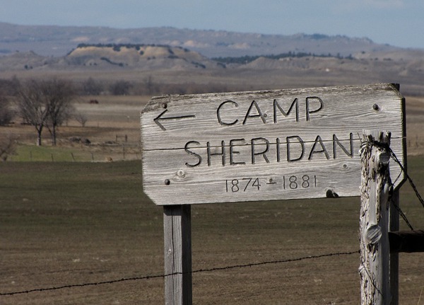
Beaver Creek Road NE: Soon enough, we succumbed to the empty spaces on the map and headed to the dirt. In Hay Springs NE we read the historical marker about Spotted Tail Agency and Camp Sheridan, built in the 1870's to administer the Sioux reservation. Crazy Horse and his followers surrendered there. So off we went to explore.
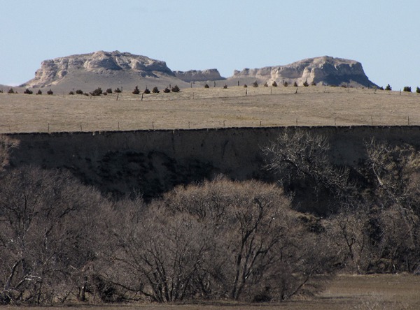 Beaver Creek Road led us north from Hay Springs to the Pine Ridge area -- a rocky, eroded, pine-covered ridge that defines the topography of this corner of Nebraska. It is one of several geological extensions of the Black Hills.
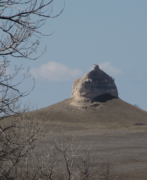
 Anyway, formations with descriptive and insulting names such as Squaw's Tit Butte provided photo opportunities.

Sign for Camp Sheridan on Beaver Creek Road

Sheridan Gate Formation Above Camp Sheridan

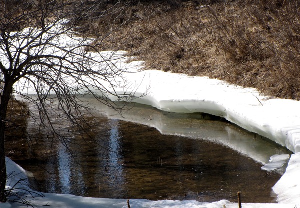
Thaw Hole in Beaver Creek

Squaw's Tit Butte West of Beaver Creek Road
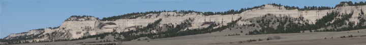
Beaver Wall Escarpment: The Beaver Wall Escarpment is in the middle of the Spotted Tail Agency and old Camp Sheridan. Spotted Tail was a famous Lakota (Sioux) leader and a contemporary of Crazy Horse. From the top of Beaver Wall, you can see the buttes of Crawford 50 miles to the southwest and the outline of the Black Hills 75 miles to the northwest. Sheridan Gates is the local name for two large buttes through which early settlers and military soldiers passed. Wagon ruts are still visible. The road followed the rugged cliffs of the Beaver Wall twenty miles north with the Metcalf Wildlife Management Area to the east along the cliffs.
We headed east on Craven Road to NE HWY 87 to continue the loop back south to US HWY 20.
 I saw a new-born calf -- such a beautiful day to be born with warm sun shining! It was lying on the ground, slick with after-birth, and the cow was licking it clean. Lots of little wobbly calves chasing through the sun today!

Beaver Wall Escarpment

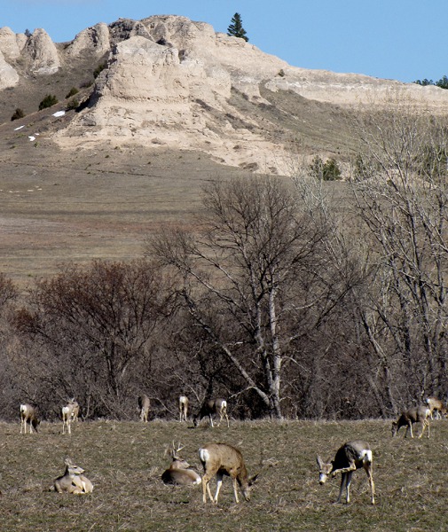
Deer Fest in the Metcalf Wildlife Management Area
In Rushville NE, we again headed east on US HWY 20 (Scenic Byway Bridges to Buttes) to Gordon NE. Huge white grain elevators like rural skyscrapers mark the location of the towns. The old railroad is gone now, and is a rails-to-trails trail. The Cowboy Trail starts in Norfolk NE and spans 321 miles west to Chadron. It is the largest Rails-to-Trails project in the United States. 192 miles of the trail between Norfolk and Valentine is improved limestone surface.
Now as the sun was lowering, the shadows flowed around the hills. They're not rolling hills -- too sharp for that. They're not rugged except for the occasional rock outcrop. I guess they are sand dune-like. Time to read Willa Cather to see how she described it! Or Mari Sandoz. Nebraska has produced some wonderful writers!
At Nenzel, we left the main road again, this time headed to the Niobrara River and the Samuel R. McKelvie National Forest on County 16F. My late husband, Mark, and I canoed that river once, and therein lies a tale I'll share one of these days. The Forest is 116,079 acres, and is a combination of prairie grasslands and pine forest "islands". Most of the existing forested sections were man-made, planted by hand over the past 75 years.
Leesha enjoyed exploring the small park at river's edge, nice since just outside of Chadron she got a sandbur in her paw. Those really, really hurt and can flatten a bike tire. So she was limping until I could pull it out. Fortunately, no burs at the river.
 We drove through the forest -- some eastern red cedar and pine, but mostly grass -- to Merritt Lake Recreation Area. Road 16F to 97 took us to the valley of the Snake River 26 miles southwest of Valentine.

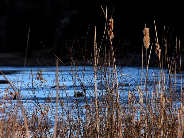
Late Evening Sun on the Niobrara River

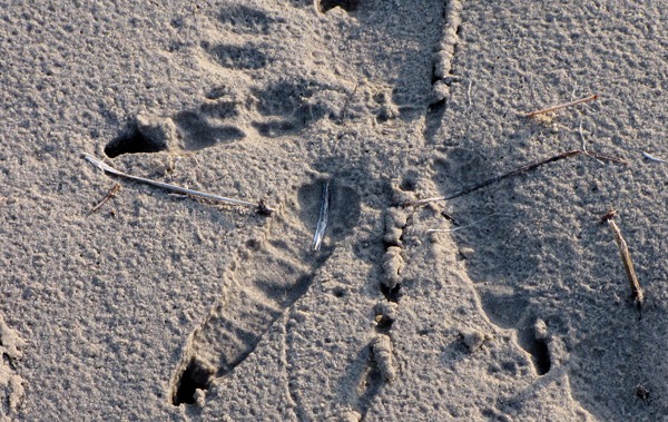
Hint of Crane Along the Niobrara River

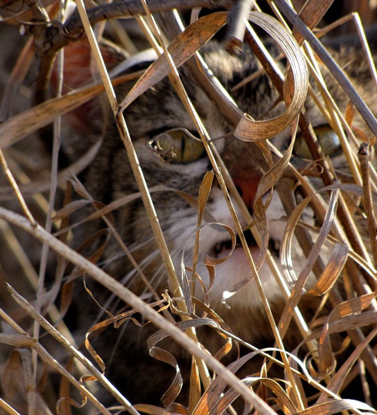
Fierce Furry Purry Keeps Us Safe from Mice Along the Banks of the Niobrara River
Merritt Reservoir offers some of Nebraska’s best fishing, along with boating and camping. It is a deep lake with excellent inflow from the Snake River and Boardman Creek.
The sun was just setting, and the birds were settling in with a variety of honking, whistling, chirping, squawking, and quacking.
 NE HWY 97 took us along the Snake River to Valentine as we drank in the stillness and the vast darkness of this nurturing landscape.

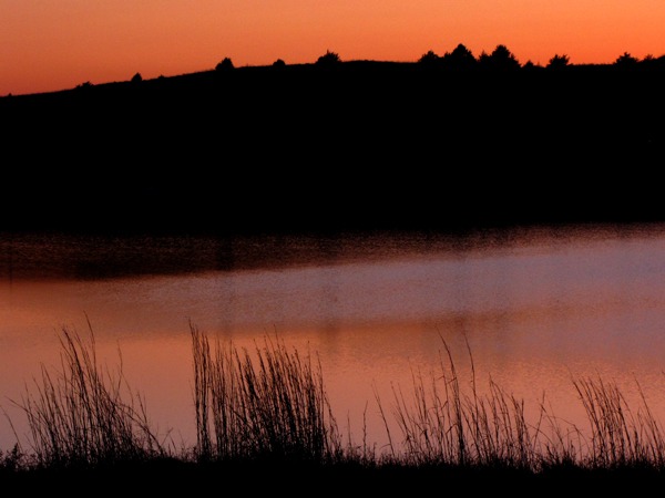
Last Light on Merritt Reservoir Recreation Area NE
Now we're at the Tradewinds motel in Valentine -- Leesha loves the room and so do we. Very reasonable price, clean, nice folks.
So we're well on our way to Kearney NE to watch the sandhill crane migration on the Platte River at the Rowe sanctuary. Six friends from Minneapolis and San Francisco are joining us -- birders are devoted folk! Tomorrow we're going to explore two wildlife refuges, the Cowboy Trail, Smith Falls State Park, and whatever else we can find around Valentine.
Louise with Photos by Brian
Text and Photos Copyright -- Goin Mobyle LLC 2010