Niobrara National Scenic River, by Louise: 25 March 2010: waterfalls, bison, sand bluestem, red squirrels -- we saw all that and more today along the Niobrara National Scenic River. The Niobrara River is protected for seventy-six miles from Borman Bridge in Valentine east to NE HWY 137.
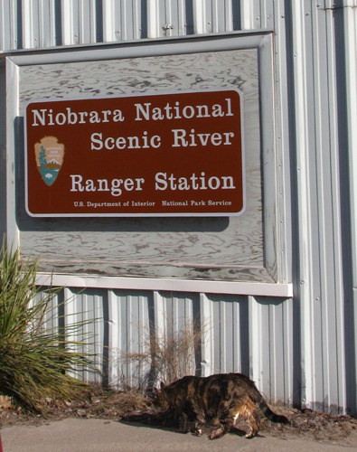
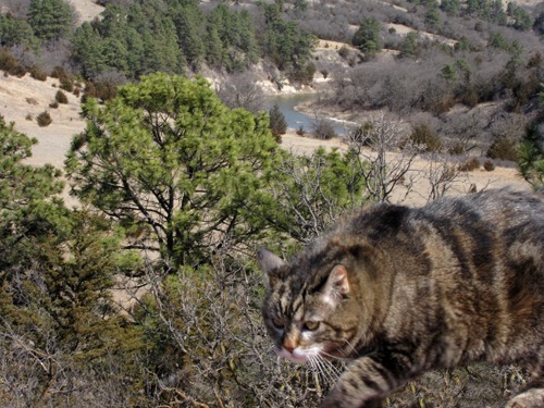
Our first stop was the National Park Service office in Valentine where Furry Purry, our trusty hiking cat, got her first out-of-the-car stretch. The NPS administers the Scenic River, and rangers had all the maps and other info a floater would need to tackle this river. No floating for us today although I have been on the river twice over the years.
 Fort Niobrara National Wildlife Refuge: Armed with the map, we headed to the Fort Niobrara National Wildlife Refuge just outside Valentine on NE HWY 12, the Outlaw Trail Scenic Byway. This lovely road starts in Valentine and goes across the state to South Sioux City IA -- 231 miles.
 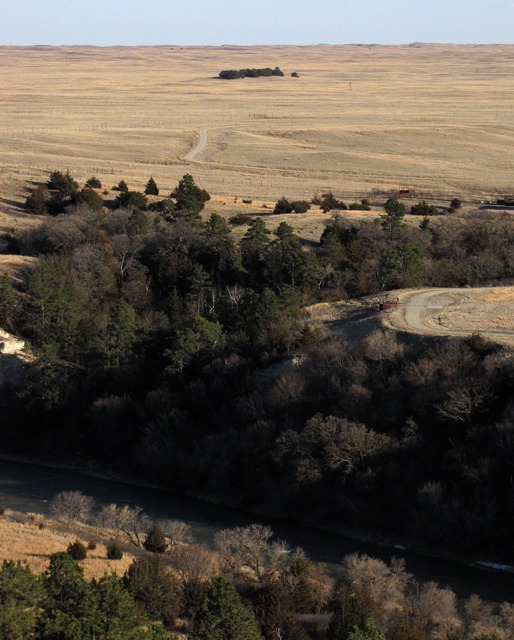 Anyway, back at the Refuge -- six different plant communities converge along the Niobrara River on Fort Niobrara National Wildlife Refuge, thereby providing habitat for a rich and unusual diversity of wildlife. The Refuge is 19,131 acres.

Furry Purry Stops in for a Map

Sweeping View of the Niobrara Prairie and River Canyon
The Fort Falls trail just inside the entrance took us along the river through mud and frozen ground and leafless deciduous trees. No spring here yet. After sloshing for a short way, Leesha and Brian headed back to the car.
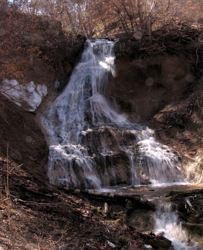
 But then the trail headed up the escarpment to a gorgeous waterfall -- Fort Falls. I continued on the loop back to the car now walking through a forested environment of sunshine, pine trees, and juniper in the Refuge's wilderness area.

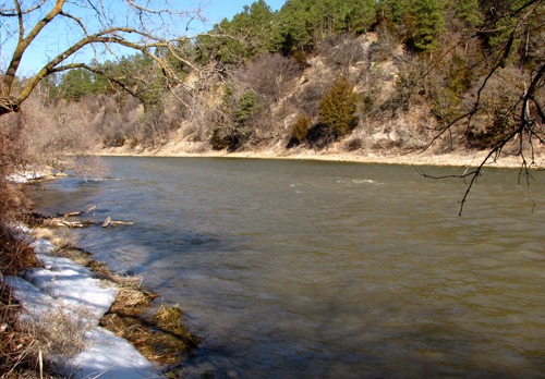
Niobrara River from Nature Trail in Fort Niobrara National Wildlife Refuge

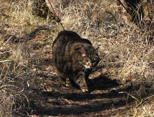
Furry Purry Hikes in Fort Niobrara Wildlife Refuge
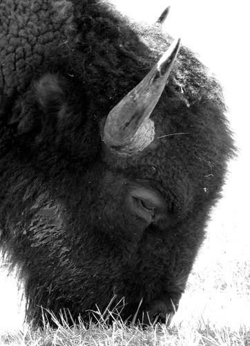
Next we drove the Refuge's 3.5 mile auto tour and found bison but, much to Brian's disappointment, no elk.
 Fort Falls: And the tour provided easy access to Fort Falls (named for the nearby yesteryear Fort Niobrara) so Brian and Leesha got to see and photograph the site.
 Leesha hiked hard today, motoring along most of the trails with relative ease for an 18-year old cat who doesn't move very fast any more or get more than three feet from us. I had to carry her down the many flights of metal stairs to the bottom of the falls, though. Too big for a kitty, not to mention the sharp and open grid pattern!
 Onward!
&)
Fort Niobrara National Wildlife Refuge Bison Grazing (Black and White)

Furry Purry Psyching up to Hike to Fort Falls

Fort Falls at Fort Niobrara National Wildlife Refuge
We drove the river road to Berry Bridge thinking that the sandy, rutted track reminded us of our inadvertent Pony Express Trail adventure in Nevada. The commercial campgrounds reminded us of the broken-down picnic tables and porta-potty-in-the-hot-weeds deals that spring up all around Sturgis during the motorcycle rally. We could imagine the "wild and scenic" river lined with river-floating party animals with boom boxes camped out in the mashed-down weeds, the chiggers, and the sand burrs. We'll pass!
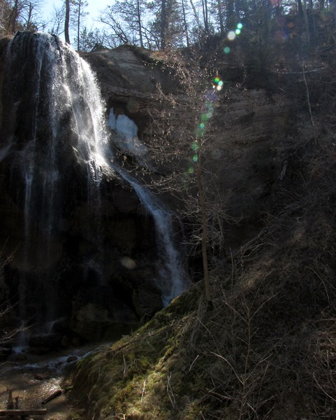
Smith Falls State Park: We had to head back to NE HWY 12 at this point and then head back down to the river two miles east at Smith Falls State Park. There was no staff at the park, but the trails were open so we headed to Nebraska's highest waterfall at 63 feet high. Leesha opted to stay in the car this time. Afternoons are for cat naps! She missed a beautiful sight!
 Then back to NE HWY 12 and then off again three miles east at Sparks. It's amazing to drive along "top" -- the grassy sandy slightly rolling hills and then suddenly drop down into the river environment of water, trees, tall grass, and dense bushes.

Smith Falls in Smith Falls State Park NE
Big Rapids: This time we drove to Brewer Bridge and continued our journey right along the river.
The Rocky Ford rapids violently interrupted the fairly tranquil river -- the NPS advises those in open boats to portage this one.
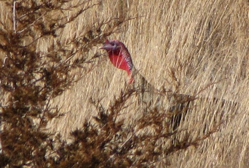
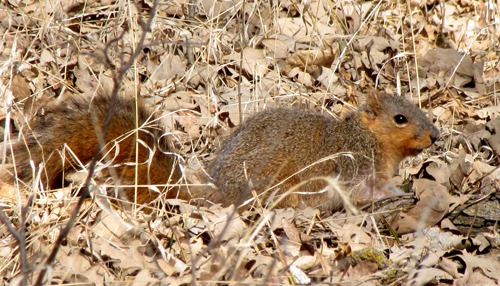
 And on we went through bur oak forests, the trees gleaming with orange lichen, and fat turkeys and squirrels feasting on the acorns.
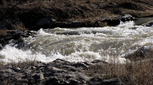
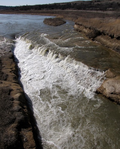
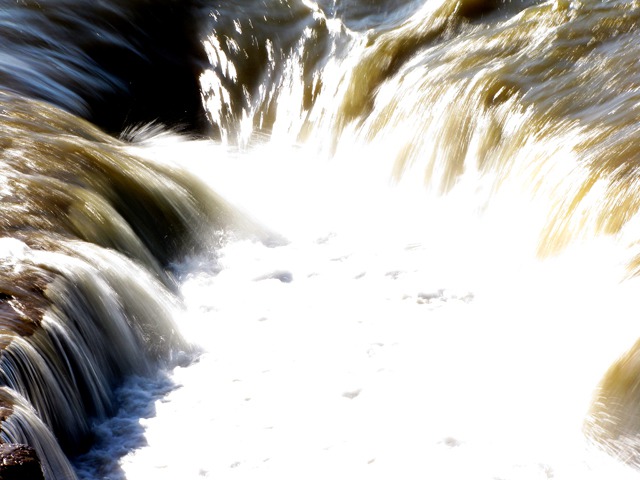
 The NPS folder says the Norden Chute is dangerous and must be portaged. So, I thought, an irrigation ditch. Wrong! Take a look at this formation! We watched the thundering water from the bridge. This is a class 4 rapid.
 Niobrara Valley Preserve: At Norden Bridge we turned south to the Niobrara Valley Preserve, a Nature Conservancy property. By this time, the Preserve office was closed and we were tired, so back we came to a good steak dinner at the Cedar Canyon Steakhouse in Valentine.
 Louise with Photos by Brian
Text and Photos Copyright Goin Mobyle LLC, 2010
Louise with Photos by Brian
Text and Photos Copyright Goin Mobyle LLC, 2010

Rocky Ford's Class 4 Rapids on the Niobrara River

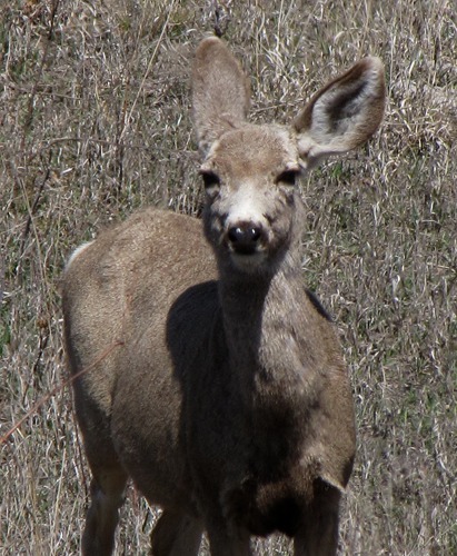
Deer Residing in Oak Woods Near the Niobrara River

Oak Forest Turkey Slips Into Cover

Acorn Fattened Squirrel

The Niobrara River's Nasty Notch -- Norden Chute

Churn at the Head of Nasty Notch -- Norden Chute

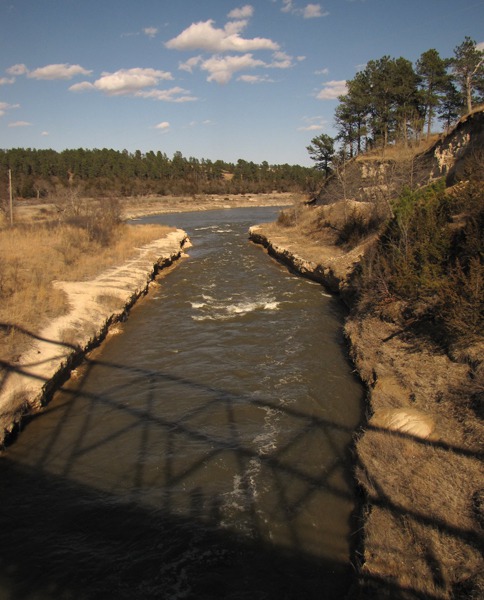
Our Shadows From Norden Bridge Before Heading Back to Valentine for Steak