On the Road to the Cranes, by Brian: 26 Mar 2010. We left Valentine at first light this morning -- which for us means around 9:30 am. Henderson's IGA grocery store just down the road from our motel was our first stop -- and what a great bunch of folks in there. By the time I'd left, three or four people had helped me -- they gave us a small chunk of dry ice for the cooler from back in the butcher shop, (because that's all the room we had in there so we couldn't fit a bag or brick) and even wrapped it in newspaper for us. We'll stop in there again whenever we're in Valentine for sure.
We drove south on US HWY 20/83 and stayed on US HWY 83, which runs from Canada to Mexico if you have the time and inclination, to Valentine National Wildlife Refuge -- and it took all the discipline we had to keep from turning off on any of the numerous side roads through the preserve. We'll do that on our return to Rapid City next Tuesday. But we had promises to keep and miles to go and besides, you could barely see the ducks for the whitecaps being blustered up on the swamp ponds.
 We turned off US HWY 83 in Thedford NE -- which is the county seat of Thomas County and home to about 200 people. Needless to say, it didn't take us long to see town, but there was an art gallery there we'll go back to see when we have more time.

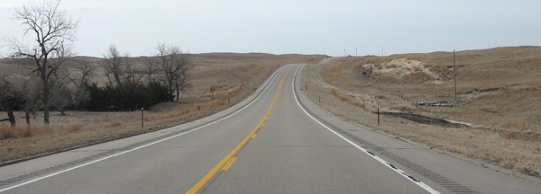
US HWY 83 Over Rolling Sand Hills South of Valentine NE
Nebraska Redneck Art: What we did see were two dead raccoons that had been shot and tossed in the pullout by the historical marker. One had been posed with a beer bottle. Yesterday we saw two porcupines that had been shot in fields near the Niobrara River. Some of these Nebraskans are a trigger-happy bunch. Of course, they have a tradition -- they killed the last native elk in Nebraska in the 1880's.
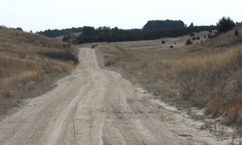
In Thedford, we turned onto NE HWY 2 -- the Sand Hills Scenic Byway. Soon, however, Louise found Gaston Road, (Nebraska National Forest Service Road 259). We crossed the Loup River, and off we went in a cloud of sand and dust.
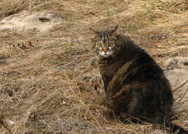
 We saw eastern bluebirds, but the wind was howling, and they were skittish. Furry Purry sprang from the car at a roadside stop, but it only took a short while for the wind to convince her it was time to revisit her little cat cave in the car.

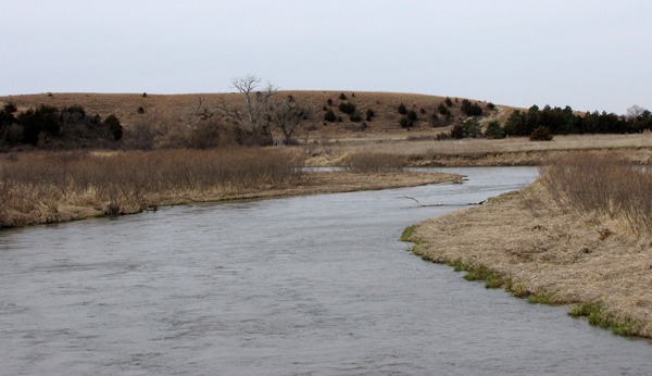
A Loop in the Loup River off Gaston Road
Nebraska National Forest -- Really!: We were headed into the 90,000 acre Bessey Ranger District of the Nebraska National Forest -- and when we saw the boundary sign, we guessed a lot of people might think it was ironically named.
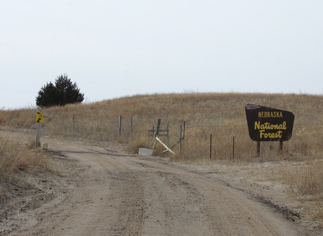 We did soon find other trees, of course -- a whole bunch of juniper and healthy stands of planted Ponderosa Pine from the Bessey Forest Nursery down on the middle fork of the Loup river about 30 miles from this boundary sign. The District is between the Middle Loup and Dismal Rivers.

Nebraska National Forest and Its Tree
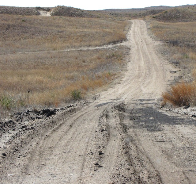
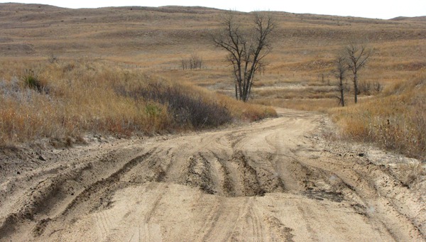
"Worst Road in the Forest:" Gaston Road was a road of grand ambition in days gone by. Parts of it had been paved with what was probably a poor grade of asphalt laid on top of shifting sand, and by and by, it crumbled like bleu cheese and mixed with the sand to make for an interesting driving experience -- and not one that I would recommend in moist conditions.
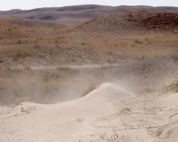
 As we were driving along dodging the quicksand in the road, I saw a little dune next to the road I thought might make an interesting photo. I pulled perpendicular to it so I could shoot it out of Louise's window and asked her to roll down the window. She did, and just at the moment the wind started gusting to 50 knots and blew a shower of sand into the car.
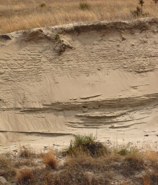
 Blowout: In the Sand Hills, there's a phenomenon known as a "blowout" where the wind and rain open a wound in the little blue stem grasses that cover the underlying sand. We soon saw a classic example -- these blowouts actually have their own little ecosystems that include a specific species of penstemon flower, (too early in the year for their bloom.)
 After climbing over a number of gooshy lumps, slogging through a few sand wallows, and gaining some elevation, we spotted our first pine trees of the Nebraska National Forest.
 There are still cattle allotments in the National Forest -- the legacy of a very early district ranger who forged relationships with the early ranchers; together they started a tradition of responsible grazing in the area.
 Ironic Forest: Ironically -- or not -- after planting all these Ponderosa pines all over the Nebraska National Forest, they can't harvest any of them because the logging trucks can't drive on those sand-based roads. So it's a forest for a forests' sake -- and a boon to all manner of recreation seekers, a large number of whom apparently come to Nebraska to shoot something. And it's not that we're anti-hunting, but all the Nebraska emphasis on visitation for killing everything from prairie dogs to coyotes to rabbits to squirrels to pheasants to deer, (and apparently anything else that moves) just somehow seemed a tad unseemly.

The Sand/Asphalt Mix of Gaston Road

Miniature Sand Blizzard at Gaston Road's Edge

Gaston Road Sand Hole Driving Challenge
&)
NE Sandhills Blowout Fronted by Yucca and Sand Bluestem (Andropogon hallii)

Our First Pine Tree Sighting in the Nebraska National Forest

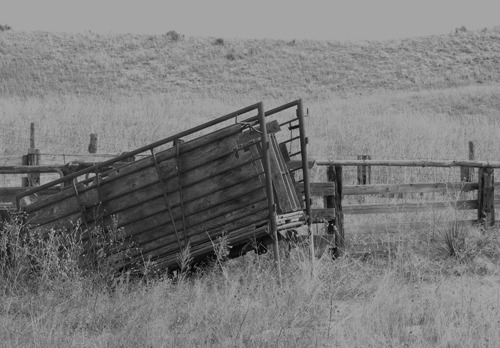
Old Cattle Loading Chute Along Gaston Road

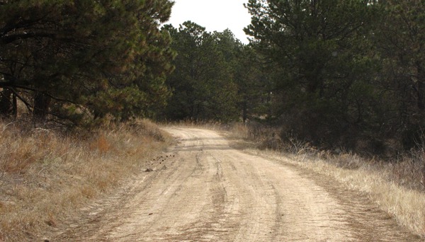
Sand Road Through Planted Ponderosa Pine

Furry Purry Takes to the Nebraska National Forest

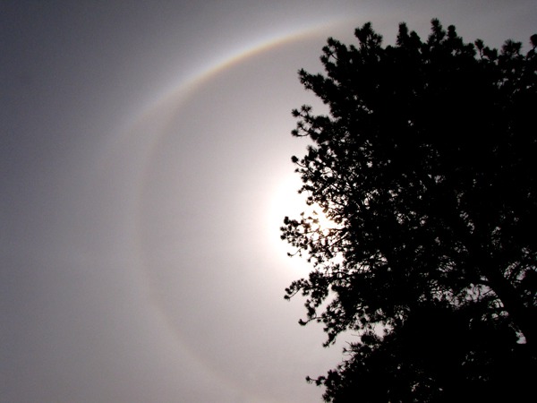
Sun Dog Behind a Nebraska Ponderosa
Bessey Ranger District Visitors' Center:
After passing by a number of other tempting turns, we turned on Nebraska National Forest Service Road 203 and followed it to Bessey Ranger District Visitors' Center on the Middle Fork of the Loup River, a river which had been high and angry not too long before we got there -- the evidence of the cleanup was fresh. We stopped in the very nice ranger station for some new maps, and found out that the road we'd been on "was the worst road on the forest" which may explain why we didn't see another car for 35 miles.
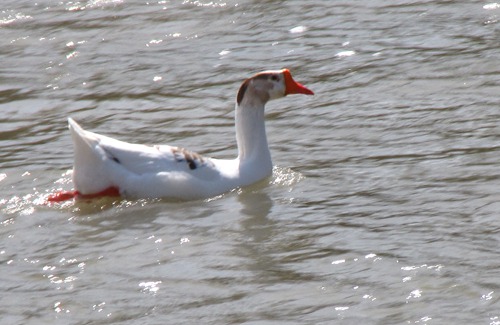
After we left the ranger station we crossed the Loup and Louise spotted some white birds near the bridge. Thinking that they might be swans, we parked and walked back. They proved to be geese -- domestic, not Canadian, but they were as skittish as wild geese would have been. I guess if we lived in such a trigger-happy state, we'd have briskly paddled out of range too, domestic or not.
 Then we went back to NE HWY 2, one of Charles Kuralt's top ten picks as a scenic route, but we're thinking he didn't traverse it when it was all gray above, all brown below, with the wind whipping across the road at 30 knots.

Goose on the Loose in the Loup
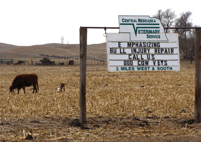
Bulls Repaired While You Wait: On the outskirts of the town of Broken Bow NE, we spotted both a sign and evidence that the sign told the truth about a service you don't see advertised as often as one would suspect, if the problem really was a problem. We rolled down the window to take a photo of the sign and of the evidence of the truth of the sign behind the sign, and got a car-full of no-bullshit bullshit smell from a small feedlot. We whipped up the windows, cranked on the fan, and gagged our way into Broken Bow.
 Despite the recent encounter with cow smell on steroids, we did a burger stop in Broken Bow, which has a town square very reminiscent of those found all over Texas -- a one-square block central park with stores facing it all the way around. In the middle sits the obligatory band gazebo.

Bull Repair Service and Proof it Works
Broken Bow NE: Broken Bow, we found out reading a roadside sign, got its name from early settler Wilson Hewitt's attempts to start a post office in the middle of what was known as the Sod House Frontier -- so called since there wasn't a tree of note for hundreds of miles for building houses. He submitted a number of names that the postal service rejected as too similar to other approved names until he remembered someone recently finding a broken, discarded Indian bow. The Post Office accepted Broken Bow, and the post office was born, followed soon by the town.
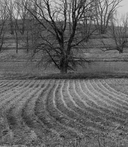
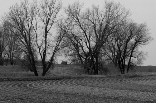
There were a few interesting photo ops on the way to Kearney, if you like light and shadow and texture, but don't mind the lack of color.
 We were focused on getting to the Best Western and hanging out for a spell before all our friends who are doing crane convergence with us show up for dinner, but took time to muse about the Dismal River, which we'd seen roads to from up in the Forest.
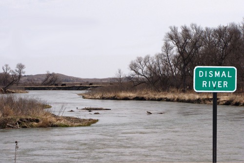 Later, back in the motel, we got the scoop on the Dismal.
&)
Trees and Fields in Fallow Nebraska Field (black and white)
&)
Trees and Fields in Fallow Nebraska Field (black and white)

Dismal River Crossing, Nebraska
Dismal River: From the NE state website: "Known by some couples as the divorce river, the Dismal is not a river for the novice canoeist. It runs deep and fast, with a current of 6 to 8 miles per hour. Its continually winding, with areas of heavy deadfall that isn't visible until canoeists are too late into the turn. Barbed wire fences frequently cross the rivers. Most fences are not marked and are difficult to see. Use caution. The low bridges can be obstacles that challenge even an avid canoeist. Springs abound on this river. Caution; Do not wade in these areas because quicksand may be found near the springs.
Brian, Louise, with Photos by Brian Text and Photos copyright Goin Mobyle LLC 2010
Okay, we're convinced not to canoe the Dismal. Doin' the Dismal won't be one of our posts. The river got its name a long time ago, but the appellation seems modernly apt.
Brian, Louise, with Photos by Brian Text and Photos copyright Goin Mobyle LLC 2010