From Valentine to Rapid City: 31 Mar 2010: So finally we have to head home. Leesha took a good hike around the Trade Winds motel this morning for one long last sniff of the place; she really likes Nebraska.
In Valentine, we took Patricia Schemmer's advice (an artist we met the night before out on the Valentine Refuge.) We headed to Plains Trading to admire Pat Schemmer's pottery. Talk about versatile -- she photographs fish, makes lovely pottery, teaches classes, and works as the rural art teacher in the area.
The bookstore plainstrading.com enfolds you in that independent bookseller atmosphere of great books. Works by Ivan Doig and James Harrison graced the first table. I just wanted to curl up in a chair and read the day away!
The owner, Duane, also ranches in the area and is trying grapes and fruit trees on his place. He had just been to Kearney to see the cranes, too -- a man with a deep appreciation for the wild and natural places of the world. He's a wonderful bookman, too.
Leesha Walks the Streets: Leesha walked the sidewalks of downtown Valentine -- as noted, she loves Nebraska and always wants us to drive slowly through towns with the window down so she can sniff. That works everywhere except near the zillion feedlots.
So off we went west on US HWY 20 to SD. The pavement part of that leg didn't last too long; soon we headed north on the gravel Lakeview/Crookston Road. At the junction with US HWY 18, we turned west and then southwest on BIA Road 1 on the Rosebud Lakota reservation.
 After driving some of these roads on the reservations you can understand why the tribes wonder what the heck BIA has done with the road-maintenance money!! Impassable mud greeted us more than once. Horribly pot-holed asphalt when we found it wasn't much better. Don't do this trip in a Prius.
 Off on BIA Scenic Road 5: Just west of the town of Rosebud, we found BIA Scenic Road 5, a decent paved road that headed south along the Little White River through Crazy Horse Canyon. What wild and beautiful country!
 The tribe has set up public use areas at Ghost Hawk Lake, Beads Lake, Chases the Woman Lake, and Spring Lake.
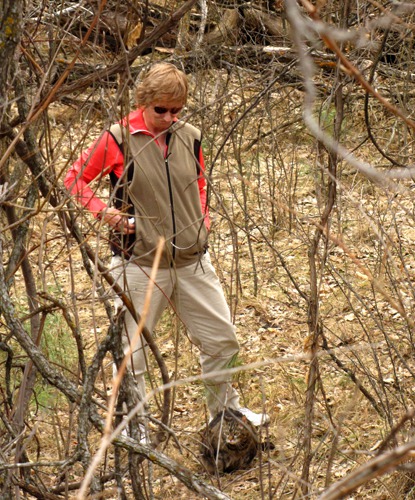
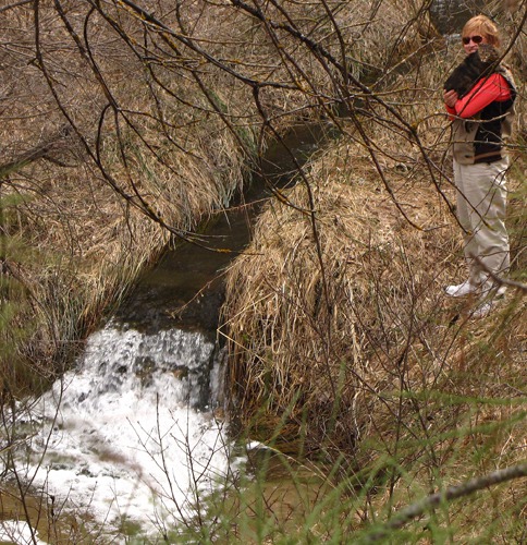
We all had a walk at Chases the Woman road beside a small waterfall. Leesha loved padding through the leaves beneath the still-bare oak and cottonwood trees. We saw our first butterfly of the season -- a huge mourning cloak. They're brownish black with a yellow border along the entire bottom of their wings.
The tribe has set up public use areas at Ghost Hawk Lake, Beads Lake, Chases the Woman Lake, and Spring Lake.
We all had a walk at Chases the Woman road beside a small waterfall. Leesha loved padding through the leaves beneath the still-bare oak and cottonwood trees. We saw our first butterfly of the season -- a huge mourning cloak. They're brownish black with a yellow border along the entire bottom of their wings.
 Too bad we were on our way home, and Brian had a meeting on 1 April -- because we had to skip the Sioux museum in St Francis, the Salt Camp B&B on BIA Road 7, and the Elk Valley B&B on US HWY 18. But that just leaves us more to see on our next trip!
 We drove by the abandoned town of Vetal SD. The town had a post office from 1912 to 1967 and was named after an early settler, Vetal Valandry.
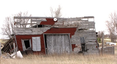
 West on US HWY 18 to LaCreek National Wildlife Refuge: So onward now west on US HWY 18. We turned south just east of Martin to LaCreek National Wildlife Refuge. At Tuthill, we turned east and explored the first pond of the Refuge. Just off the Refuge to the east we spotted another pair of Trumpeter swans. Swans were restored here in the 1960's when the U.S. Fish and Wildlife Service brought 57 cygnets from the Red Rock Lakes NWR in MT.

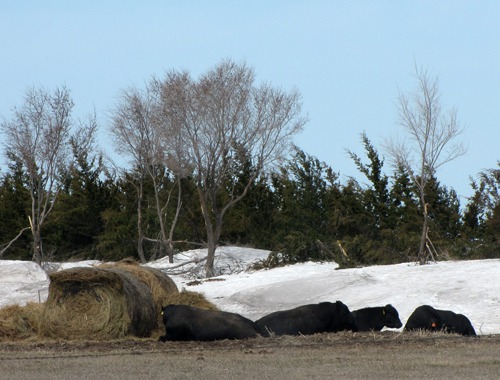
Angus Bulls and Lingering Drift

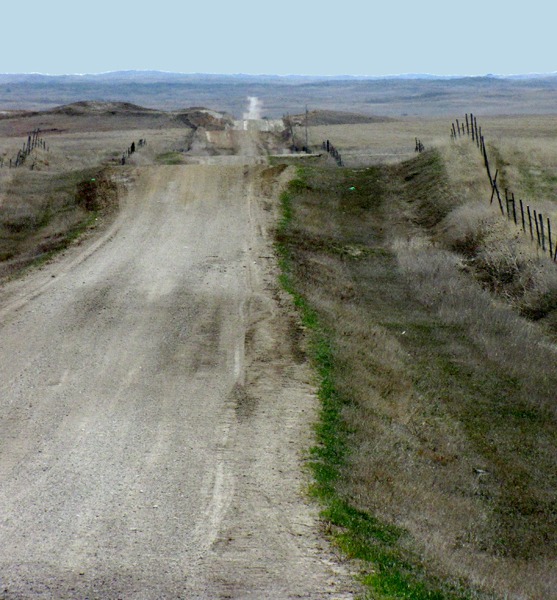
Rolling Road Across the Sandhills, BIA Road 1
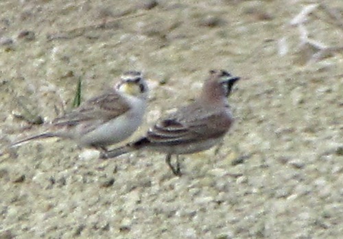
 Pair on BIA Road 10&)
Horned Lark (Eremophila alpestris) Pair on BIA Road 10

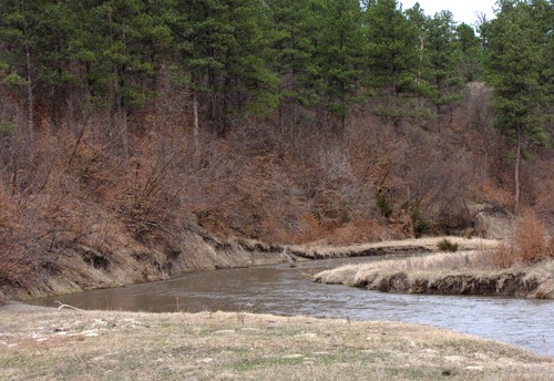
Little White River from Crow Dog Bridge on BIA Scenic Road 5

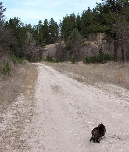
Furry Purry Goes Out on Chases the Woman Road

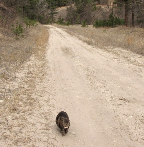
Furry Purry Comes Back on Chases the Woman Road

Louise and Furry Purry Dead-Leaf Hiking

Louise and Furry Purry on Chases the Woman Creek

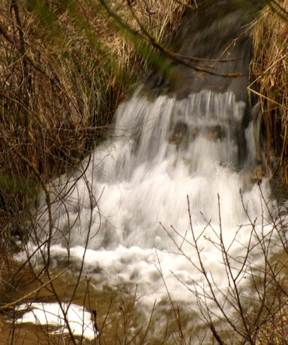
Little Falls On Chases the Woman Creek

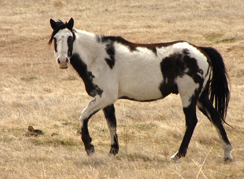
A Rosebud Paint Horse

The Vetal SD Garage

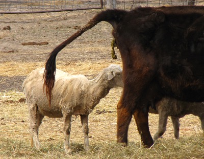
A Vetal Cow Shows a Certain Contempt For Sheep
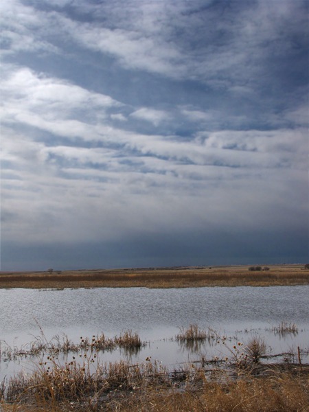
The LaCreek National Wildlife Refuge area of wetlands, marshes, and ponds was restored by the Civilian Conservation Corps (CCC) and the WPA workforces during the 1930s. Springs bubble up out of the Ogallala aquifer into this sandhill country making ideal habitat for water birds. This Refuge is on the far northern edge of that sandhill country the encompasses all of western Nebraska.
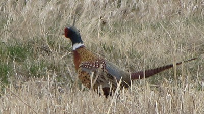
 So we drove the auto tour, flushing pheasants in what seemed like every twenty feet as we drove. Hunting is allowed on this part of the Refuge, and the birds are very aware of that! At the next pond, I walked the mowed grass trail and flushed little cotton tail bunnies. We also saw white pelicans here.
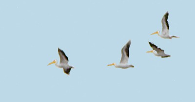
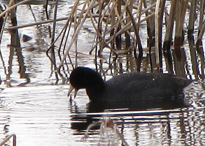
 A Second Auto Tour Route -- Then we drove another auto tour near the headquarters and spotted buffleheads, muskrats, red-winged blackbirds, meadowlarks, mallards, northern shoveler ducks, northern harrier hawks, American coots, killdeer, and northern flicker.
 One of the Refuge staff, out for a bird-watching walk with his dog Jumper, pointed out a bald eagle's nest in the trees to the south.
It nurtures our souls to be way out on the prairie seeing and hearing bird calls, wind, and frog choruses from all sides. It's noisy and quiet at the same time -- and the sky stretches unbroken by buildings or cell towers to the horizon in all directions.
One of the Refuge staff, out for a bird-watching walk with his dog Jumper, pointed out a bald eagle's nest in the trees to the south.
It nurtures our souls to be way out on the prairie seeing and hearing bird calls, wind, and frog choruses from all sides. It's noisy and quiet at the same time -- and the sky stretches unbroken by buildings or cell towers to the horizon in all directions.
 On Toward Wounded Knee -- After we left the Refuge, at Batesland we headed straight west on Mouse Creek Road to Wounded Knee on the Pine Ridge Reservation. We'll head back to that tragic area one day when we have time to explore and honor the massacre there. The huge, broken, wild country has many stories to tell, I think.
Chief Spotted Elk (Big Foot) led his people from the Stronghold Table area to Wounded Knee hoping to surrender at Pine Ridge. However they were massacred by the US Seventh Cavalry on 29 December 1890. Those Sioux who didn't die in the shooting were hunted down on the prairie, and many wounded were left to freeze to death in the blizzard that followed.
On Toward Wounded Knee -- After we left the Refuge, at Batesland we headed straight west on Mouse Creek Road to Wounded Knee on the Pine Ridge Reservation. We'll head back to that tragic area one day when we have time to explore and honor the massacre there. The huge, broken, wild country has many stories to tell, I think.
Chief Spotted Elk (Big Foot) led his people from the Stronghold Table area to Wounded Knee hoping to surrender at Pine Ridge. However they were massacred by the US Seventh Cavalry on 29 December 1890. Those Sioux who didn't die in the shooting were hunted down on the prairie, and many wounded were left to freeze to death in the blizzard that followed.

LaCreek National Wildlife Refuge Pond and Sky
 on the Edge of LaCreek National Wildlife Refuge&)
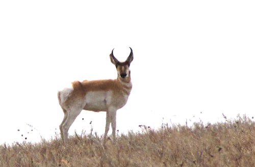
Pronghorn (Antilocapra americana) on the Edge of LaCreek National Wildlife Refuge
 Rooster&)
Ring-Necked Pheasant (Phasianus colchicus) Rooster
 in Flight&)
American White Pelicans (Pelecanus erythrorhynchos) in Flight
&)
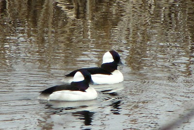
Bufflehead Ducks (Bucephala albeola)

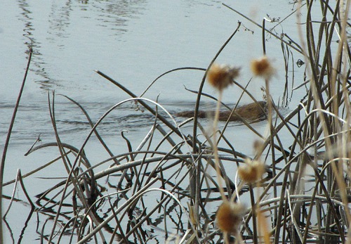
Glimpse of a Muskrat
&)
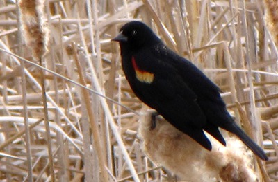
Red-winged Blackbird (Agelaius phoeniceus)
&)
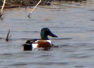
Northern Shoveler Duck (Anas clypeapa)
 Takes a Bite&)
American Coot (Fulica americana) Takes a Bite
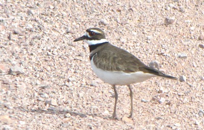
 on the Rocks&)
Killdeer (Charadrius vociferus) on the Rocks

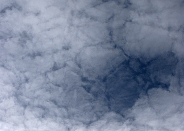
Sky Pattern Over LaCreek National Wildlife Refuge

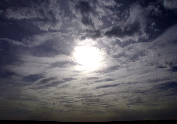
Sun Heads for Horizon
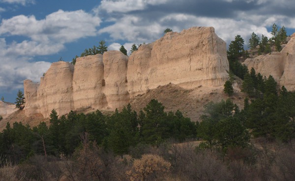
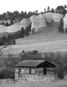
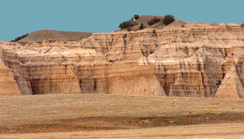
Along Wounded Knee Creek to Rocky Ford -- We headed north on BIA Road 27 along Wounded Knee Creek toward Rockyford. The canyon is spectacular with eroded cliffs; this area is just south of Badlands National Park.
 Then we turned west on BIA Road 2 along the southern boundary of the Badlands, one of our favorite areas.
 And finally through Red Shirt and Hermosa and home. Leesha knew when she was back in familiar territory; she was in my lap and sniffing from the Badlands onward! She got what we call "sharp" -- her face gets narrow and she's on top alert.
So home and tired!!! What a wonderful trip! We averaged about 160 miles a day and even that was a little fast at times. We can't wait to go back and canoe the lakes and ponds at Valentine and LaCreek NWRs. We want to explore the public use areas on the Rosebud Reservation. And so much more!
Thank you for joining us on our crane quest.
And finally through Red Shirt and Hermosa and home. Leesha knew when she was back in familiar territory; she was in my lap and sniffing from the Badlands onward! She got what we call "sharp" -- her face gets narrow and she's on top alert.
So home and tired!!! What a wonderful trip! We averaged about 160 miles a day and even that was a little fast at times. We can't wait to go back and canoe the lakes and ponds at Valentine and LaCreek NWRs. We want to explore the public use areas on the Rosebud Reservation. And so much more!
Thank you for joining us on our crane quest.

Rock Formations Along Wounded Knee Creek
&)
Old Cabin Along Wounded Knee Creek (black and white)

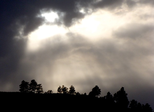
Evening Sunburst Over Wounded Knee Creek

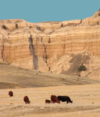
Cattle Graze at Edge of Badlands

Edge-of-the-Badlands Wall
Louise with photos by Brian. Text and Photos copyright GoinMobyle, LLC. 2010