We left our friends Gary and Deb at Lake Conconully and headed to points south -- just because. We were on a loop, so we were simply looking for looping opportunities. "Grand Coulee Dam is impressive -- let's go there." And there we went. It's some hard scrabble country after you leave the lush Okanogan Valley -- scab lands, some call it. Inch-thick soil on top of lava, a lot of it. But there are some great views and lots to see if you are looking.
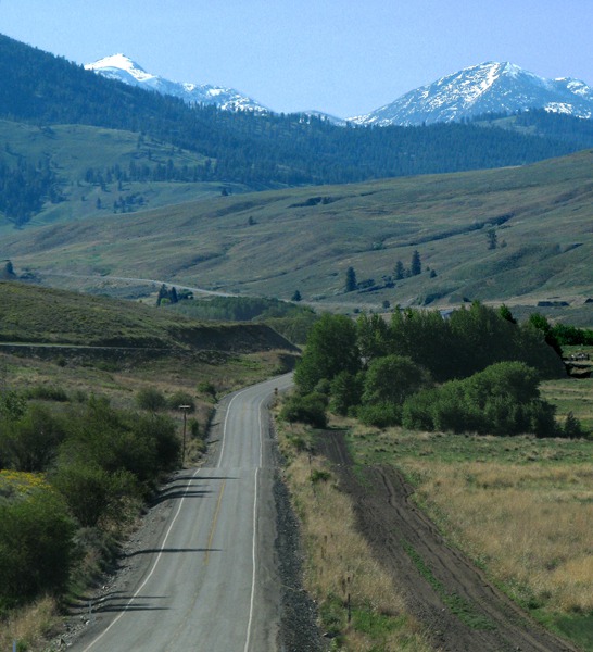
We headed east and south on WA 155 from Omak to Grand Coulee. According to our geology book, Roadside Geology of Washington, this is the Okanogan micro-continent, the first major addition to the West Coast. It comprises a distinctive highlands region of northeastern Washington. The Columbia river traces the eastern and southern margins, and the Okanogan River flows on the western edge. Geologically, Washington is made up of these distinctive island-sized continents. The first 20 miles east of Omak cross old continental crust, rocks that were once far out in the Pacific. The dominant rocks are gneiss on the southwest corner of the Okanogan dome.
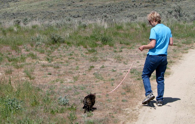
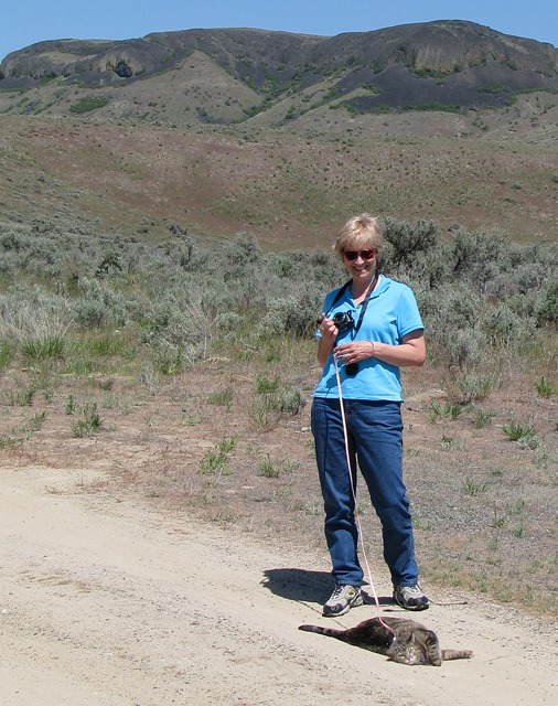
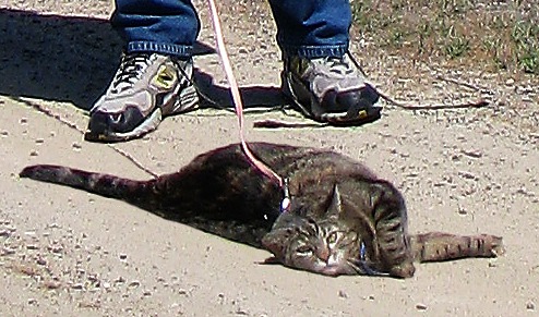
 We stopped so that we could eat something and Furry could get out and get a little stretch and roll in the dirt.
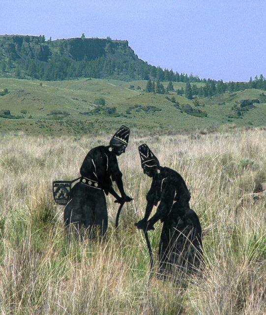
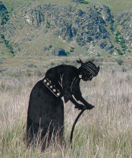
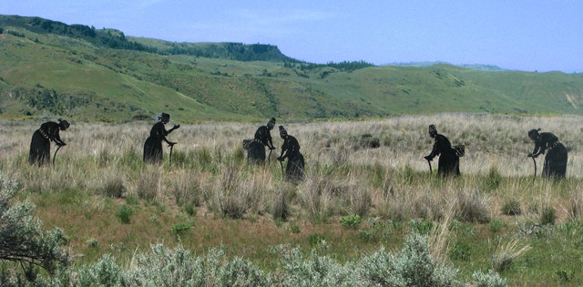 Not far away, in the field, were a set of metal sculptures of Native American root gatherers. These steel sculptures depict local women as they gather roots -- "root diggers". The sculpture is by Virgil "Smoker" Marchand, a renowned Colville artist and are cut steel. A beautiful sight, indeed! The site is part of the Coulee Corridor Scenic Byways tourism project which has the goal of educating travelers and providing a cultural experience along WA 155.
We were driving across the Colville Indian Reservation, formed by order of President Ulysses Grant in 1872 -- another shameless land-grab done without treaty. We carry local histories with us and try to read about the areas we're exploring, in this case, Exploring Washington's Past. Sometimes the history is painful to read.
Not far away, in the field, were a set of metal sculptures of Native American root gatherers. These steel sculptures depict local women as they gather roots -- "root diggers". The sculpture is by Virgil "Smoker" Marchand, a renowned Colville artist and are cut steel. A beautiful sight, indeed! The site is part of the Coulee Corridor Scenic Byways tourism project which has the goal of educating travelers and providing a cultural experience along WA 155.
We were driving across the Colville Indian Reservation, formed by order of President Ulysses Grant in 1872 -- another shameless land-grab done without treaty. We carry local histories with us and try to read about the areas we're exploring, in this case, Exploring Washington's Past. Sometimes the history is painful to read.
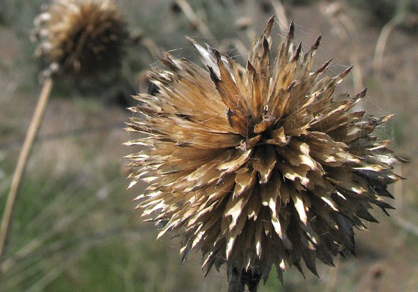
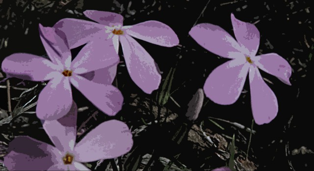
 In the same field I saw a couple interesting flowers and seed heads. Even out there in that windswept area, a local spider used the seed head as a web framework.
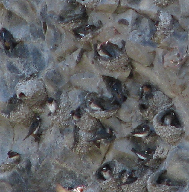
 Not far down the road from the sculptures, we saw a group of swallows swoop over the road, and in the rocks on the hillside were thousands of them in hundreds of nests. We stopped in the driveway of a house, but the person living there made it clear he didn't want us there, so we didn't linger long. I got a lot of fuzzy swallow pictures in my haste, but got enough to give an idea of how they were living their little bird lives.
 At Nespelem, the road dropped drop down toward the Columbia River.
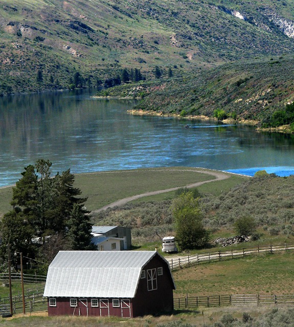
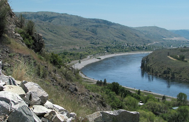
 Around the bend, and there you are. This mighty river drains out of western Montana, Canada, Idaho, Oregon, and Washington. Truly the Missouri of the west.
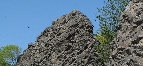
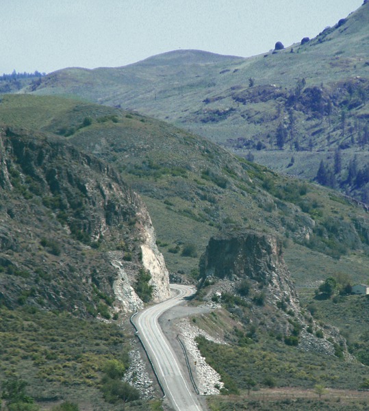
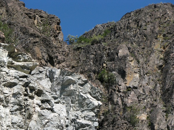
 The canyon walls along that stretch are a rock slide waiting to happen. And we imagined, brimming with rattlesnakes. Not good hiking to say the least. The geology book identifies these rocks as pale grey granite that formed after the subcontinent became part of the North American continent.
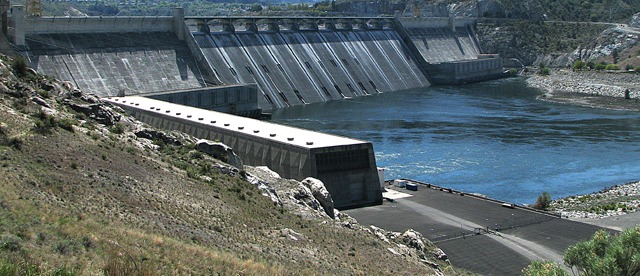
 And at last, the Grand Coulee Dam. The name "Grand Coulee" derives from the coulee formed by ice-age floods that "cataclysmic" doesn't even begin to describe. During the last Ice Age, walls of water miles wide and hundreds of feet deep thundered out of Lake Missoula in Montana as ice dams collapsed and let Rhode Island-sized impoundments loose upon the land, scouring canyons hundreds of feet deep as they went. So of course, we found a book -- Glacial Lake Missoula by David Alt -- to learn more. "Glacial Lake Missoula was among the largest lakes ever impounded behind an ice dam. The ice dam broke when the water behind it got deep enough to float it. Each time that happened -- several dozen times--the lake dumped a catastrophic flood on eastern Washington and the Columbia River. Those lakes and floods are among the largest of known geologic record."
In subsequent segment posts we'll have more details on both Grand Coulee Dam (as Leesha learns about hydroelectric power) and Dry Falls in Grand Coulee -- a falls that dwarfed Niagara Falls when the watery hells were unleashed from Lake Missoula.
And at last, the Grand Coulee Dam. The name "Grand Coulee" derives from the coulee formed by ice-age floods that "cataclysmic" doesn't even begin to describe. During the last Ice Age, walls of water miles wide and hundreds of feet deep thundered out of Lake Missoula in Montana as ice dams collapsed and let Rhode Island-sized impoundments loose upon the land, scouring canyons hundreds of feet deep as they went. So of course, we found a book -- Glacial Lake Missoula by David Alt -- to learn more. "Glacial Lake Missoula was among the largest lakes ever impounded behind an ice dam. The ice dam broke when the water behind it got deep enough to float it. Each time that happened -- several dozen times--the lake dumped a catastrophic flood on eastern Washington and the Columbia River. Those lakes and floods are among the largest of known geologic record."
In subsequent segment posts we'll have more details on both Grand Coulee Dam (as Leesha learns about hydroelectric power) and Dry Falls in Grand Coulee -- a falls that dwarfed Niagara Falls when the watery hells were unleashed from Lake Missoula.
 Text by Brian and Louise, Photos by Brian. Text and Photos Copyright 2011 -- Goin Mobyle, LLC.

Down the Okanogan

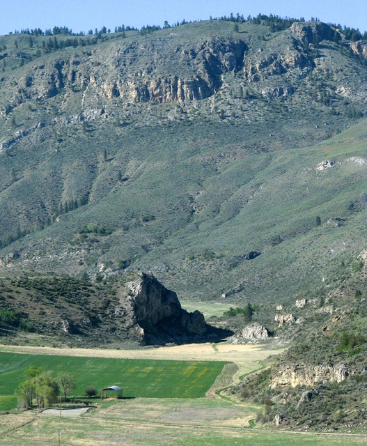
Ranch in the Gap

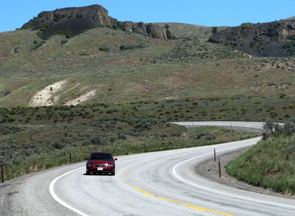
Road and Bluffs

Furry on a Leash and Stretch Break

Furry Opts for a Road Roll

"Ahhh, nothing like a little dirt in the fur."

Root Digger Sculptures

Two Root Diggers
- Two Root Diggers

Root Digger Sculpture Close Up

Weed Head Web

Roadside Blooms

The "Swallow Rocks"

Swallow Condos

Road Down To The Columbia

Columbia and a Barn

Fierce Canyon Wall Composition

Columbia Gorge Above Grand Coulee Dam

Grand Coulee Dam