Day Fifteen -- Torrington WY to Rapid City SD, 19 Aug 2010: Last night when we pulled into Torrington WY and checked into the motel, there was a sign in the room that said, "If the noise from the coal trains bothers you, call the front desk for earplugs." Luckily, we didn't need them. This morning before we headed out, Furry Purry took a little stretch break to chase a few grasshoppers on the sidewalk in front of the motel. Torrington is a combination railroad town, ag, and college town, and on the way out, we drove by the ubiquitous grain elevator and corrals.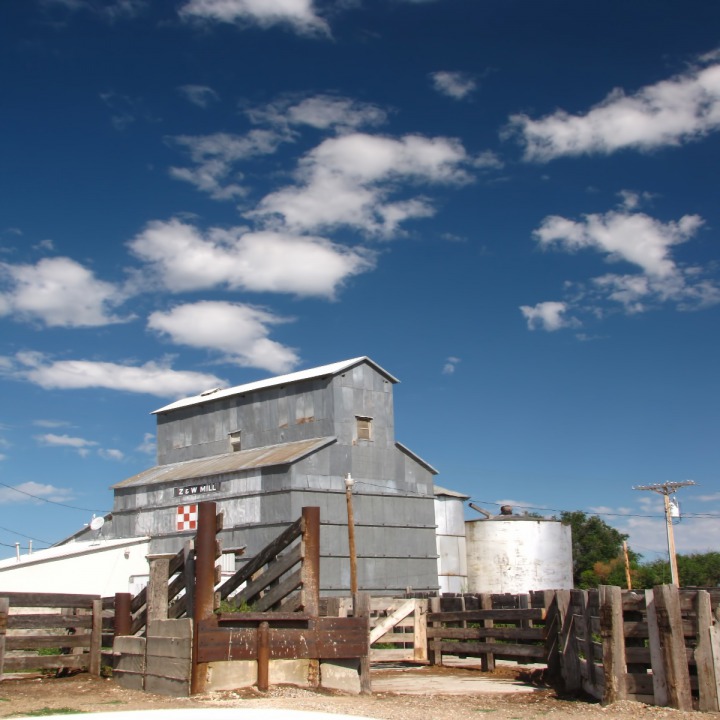 The prairie outside town is characterized by broken country and rough rock outcrops.
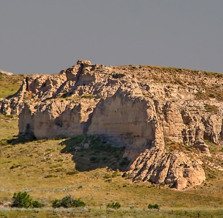 Here and there are remnants of what used to be lush cottonwood draws, now greatly shrunk by cattle grazing, and backed by series after series of mesas, buttes, and plateaus.
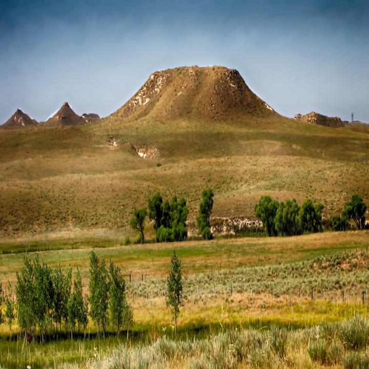

Torrington WY Feed Mill and Corral

Rock Outcrops Outside Torrington WY

Prairie Butte And Cottonwoods
Off the Pavement at Jay Em. We left the pavement of US HWY 85 and turned back west through the little wide spot in the road called Jay Em. There was a still a little microcosm of the riparian area that would have been typical of these cottonwood groves before pioneer days.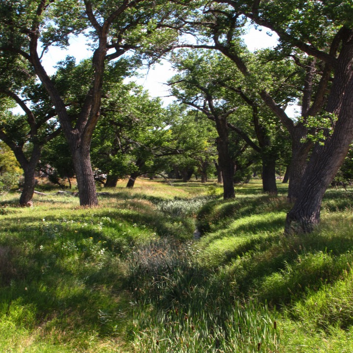 We drove out the "back" of Jay Em on Fort Laramie Road which snaked its way across the prairie.
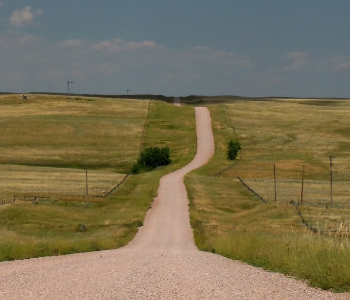 Scattered beside the road were more rough-hewn rock outcrops.
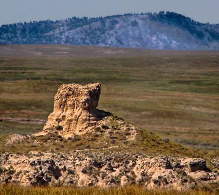 The prairie birds were enjoying a little bit of easy living with all the bugs and seeds and vegetation in full fettle.
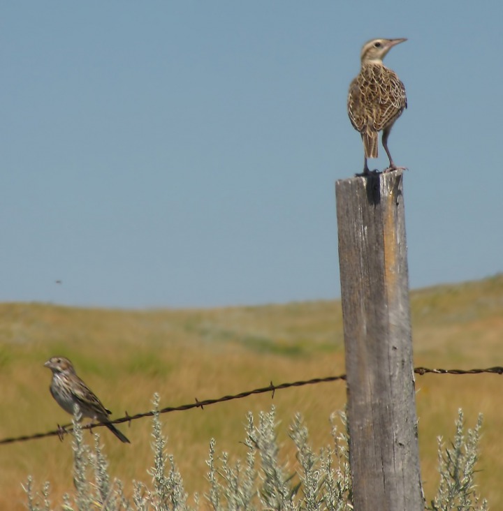 Meadowlarks were in abundance, often fronting old windmills, which were scattered generously along the roads.
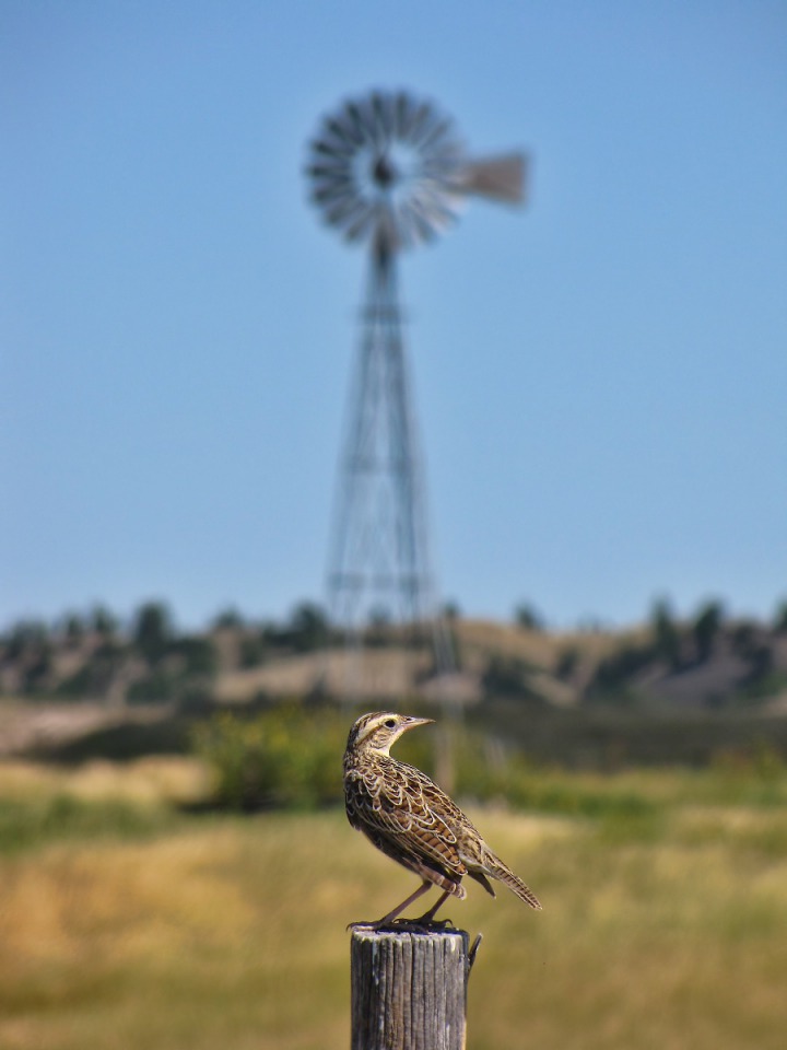 If you have ever tried to pull a tight barbed-wire gate up and hook it, you'll immediately appreciate the benefits of a leveraged gate closing device like this one.
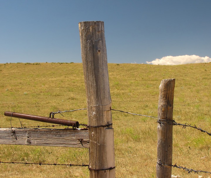 Water is life on the parched prairie, and wind-mills feed critical water to the range cows that graze out here.
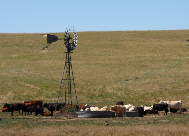 Where there is water and grasshoppers, there are lots of meadowlarks; this time of year, a lot of young ones as well.
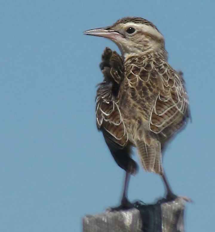 When you can stagger the calving in a cattle herd, you get a lot of age groups represented. Sometimes, a bit of frolicking is tough to tell from a bit of bullying.
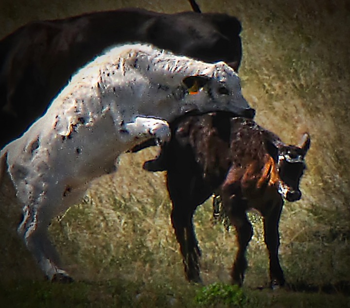 Easy Enough to Get Lost -- There are dirt roads in abundance on the eastern Wyoming and western South Dakota plains, and before GPS (and sometimes even now because the map names often don't "align") a fella can get plum turned around out here. Communities (in this case, the Moore Springs Community) often put up their own scattered sign posts just to help those trying to find a particular ranch or small town orient themselves.
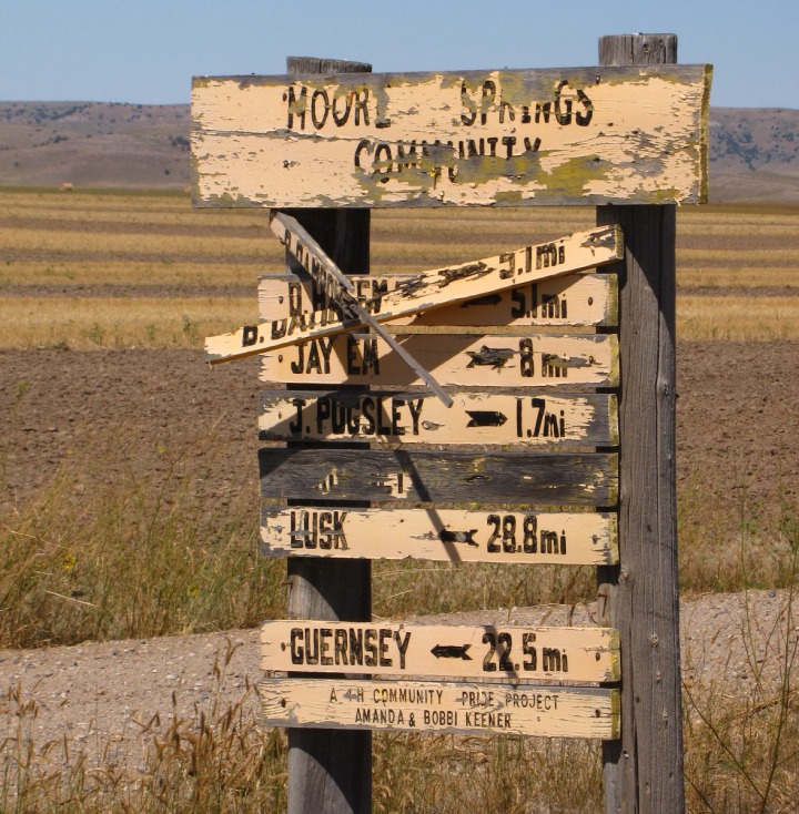 At Moore Spring We Took The Rawhide Butte Road -- Also known as County Line Road in our Benchmark Maps Atlas. It's not uncommon at all for a road to have three or four names depending on which reference you are using. So it's good to pack sandwiches and have lots of gas, and a general sense of which way is west when you are out in this country. It's not a bit unusual to find yourself, as we did, on the road way less traveled.
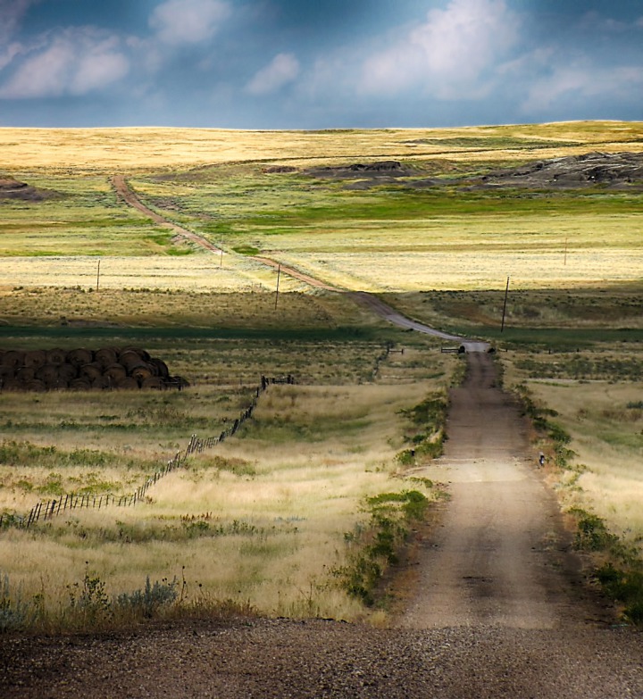 Some small persistent water sources, like Muskrat Creek in the distance, spawn lines of cottonwoods out on the prairie.
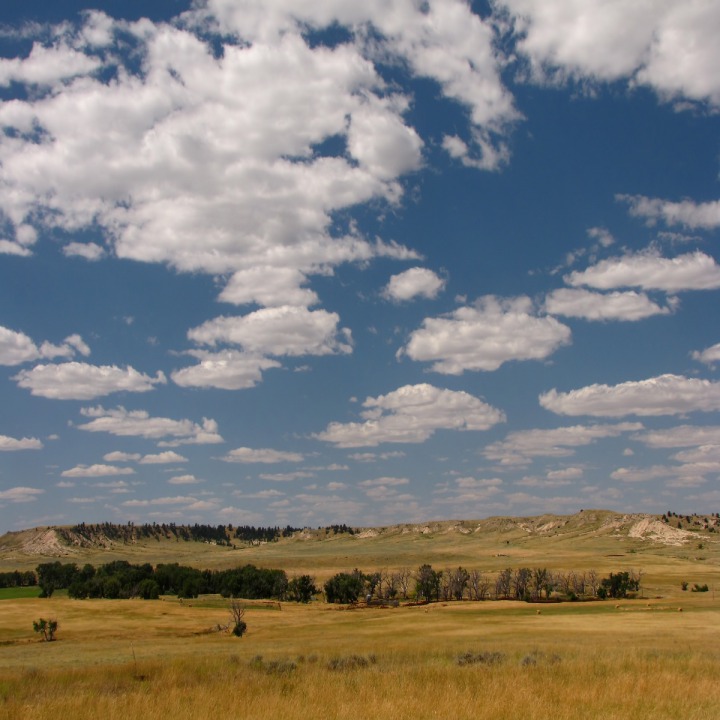 Some of the denizens out here get by on very little water, like these two lonely pronghorn bucks.
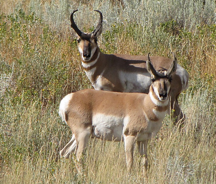 Not far below the surface there are layer upon layer of what looked to us like limestone deposits (most of this area was once the bottom of a vast inland sea).
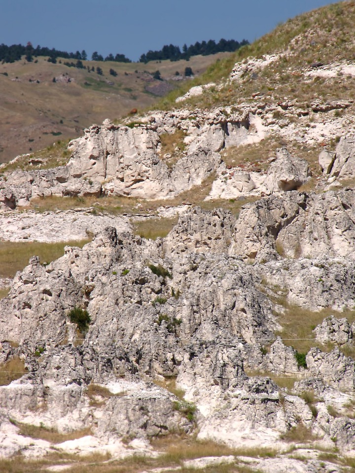 Not hard to see that this country makes for some tough plowing. Here, there, and rarely, a timbered hill rises up off the prairie.
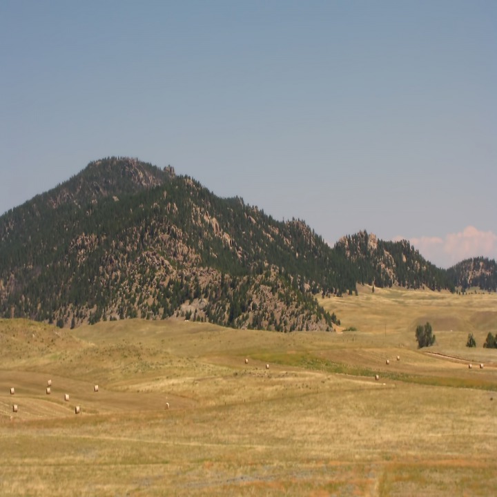 The ground supports a rich diversity of plants where they haven't been grazed or stomped to death by the cattle. One tough customer in this country is the prickly pear, this one with some summer fruit.
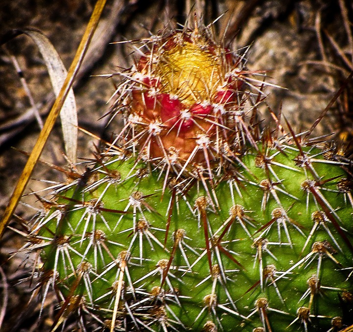 Just where you think there isn't enough forage for anyone, there are Angus cattle grazing away.
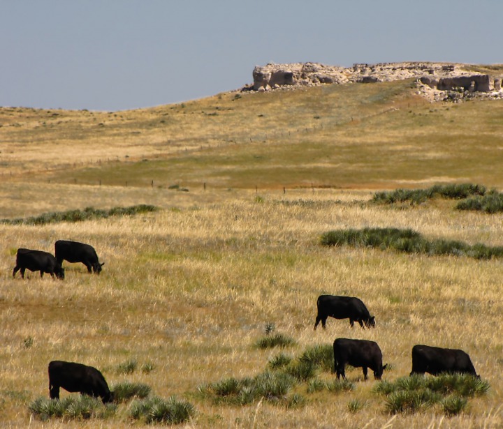 Horses, with very little else on their days' agendas, gather and gossip around the water cooler.
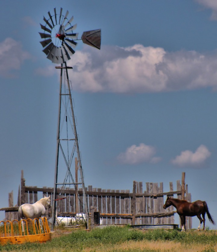 It Gets Just Plain Hot -- It gets hot with very little shade. So every small shadow becomes precious.
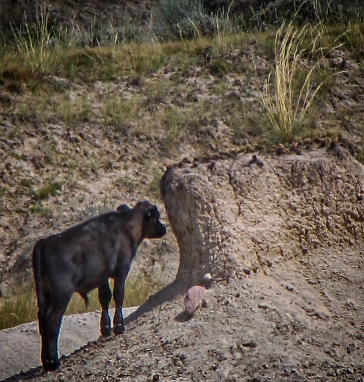 Watering holes draw a crowd -- and at night, all the remaining wild critters visit them as well.
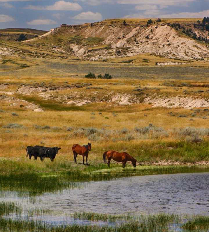 A windmill shares a small landscape vignette with a conical butte.
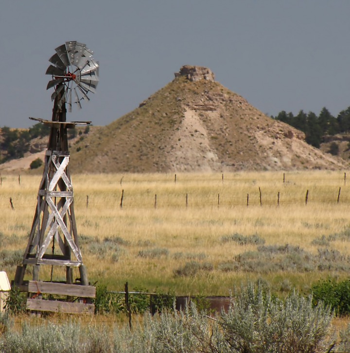 You see things on the prairie that are sometimes whimsically out of place -- like this old bridge sitting in a bone dry field. You can make up a dozen funny backstories for these things -- "Old Henry had it in his head he was going to build himself a fish pond out here once, and have a bridge across it to sit on to fish." Lots of old ranchers with their wild ideas and their disappointments in this country.
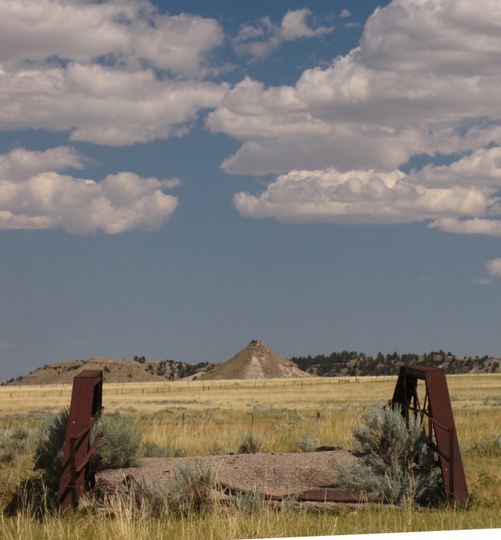 You Have to Look Close for Entertainment -- We've heard a lot of people who have meandered through this country say, "Man, there is NOTHING out there!" And to them, there probably isn't. But if you want to really slow down and look, it can be very entertaining and interesting. We were probably 25 miles into the trip home, and we'd already stopped and seen all the scenes above. And we hadn't put a dent in getting home yet. All around we found interesting shapes, shadows, and rocks.
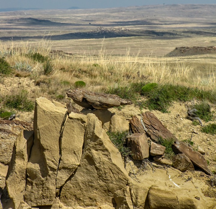 We like the sculpture-like twists and turns and colors of geology, so we find plenty to notice.
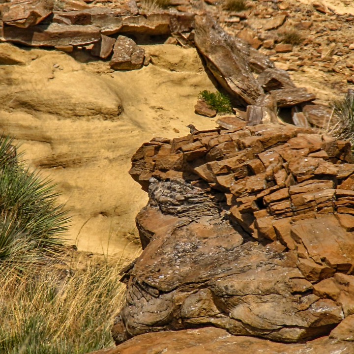 Even the lonesome road snaking its way across the waving grass presents interesting visuals.
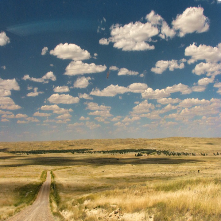 We noticed, stopped, and admired this cheerful little rotund sentinel looking out over the plains.
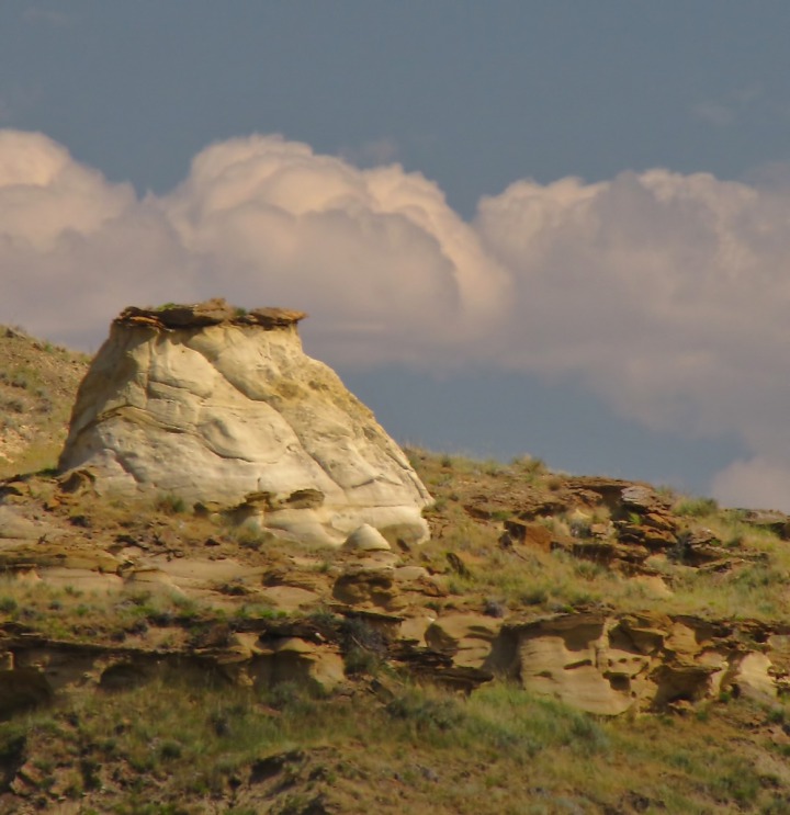 Cottonwood Oasis -- Periodically, even in the hot dry environment, you'll find these cottonwood oases scattered across the broad dry sweep of the plains, like these along Lance Creek.
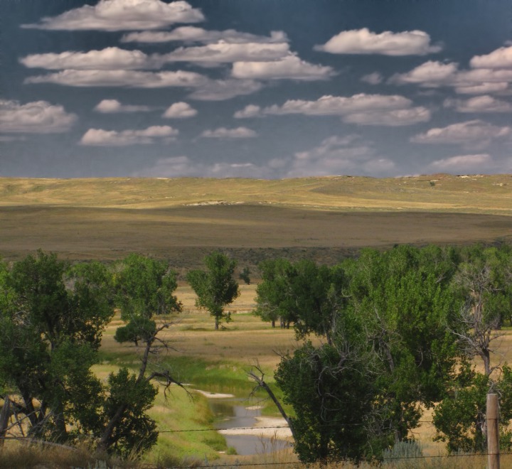 After Wasserburger Road "T'd" into US HWY 85, we followed the main road north a few miles to "Old US HWY 85" and took that "short cut" over to US HWY 18, bypassing Mule Junction where US HWY 85 and US HWY 18 come together. Not long up "old 85" we came to The Flattop and a ranch along west Mule Creek.
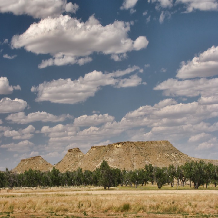 The ranch had a classic red barn.
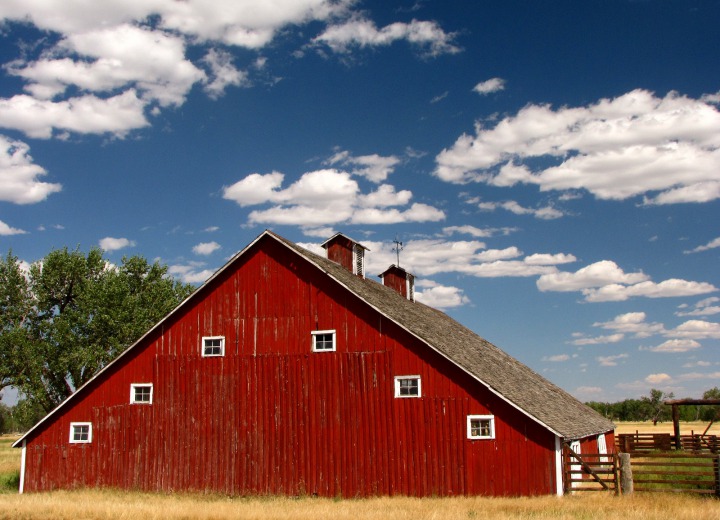 And the barn had a classic gate with a cow skull.
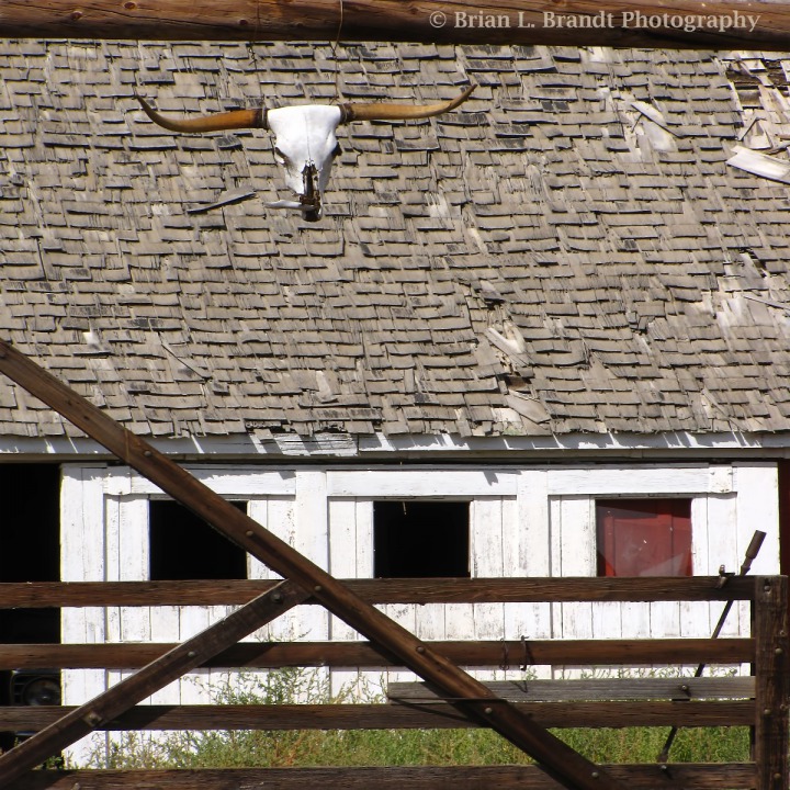 That area from Mule Creek junction through and past Edgemont is amazing for its prickly poppies.
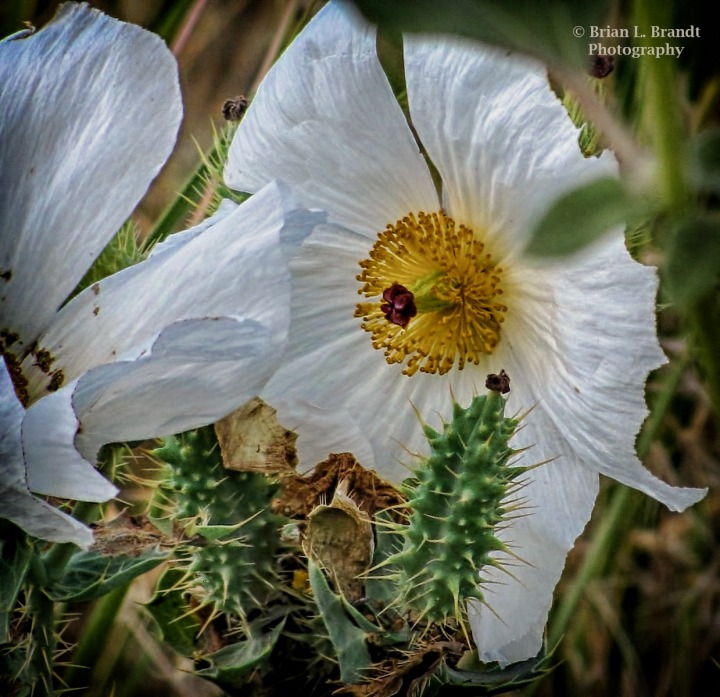 Old US HWY 85 is definitely the road less traveled now -- but that didn't stop these two pronghorn bucks from giving us "the dubious eye" as we slowly drove past.
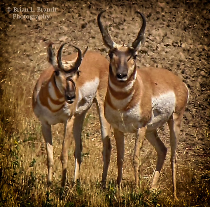 There were still a surprising number of flowers still in bloom on that road. This rather fetching white flower, with its "trumpet bursts" of blooms, was one we couldn't identify.
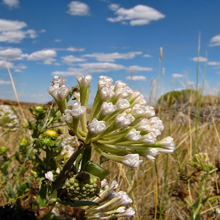 Once you have lived in this gold and blue-hued country, with the sweeping skies, the color palette seems to seep into your DNA. You find yourself so drawn to these color ranges.
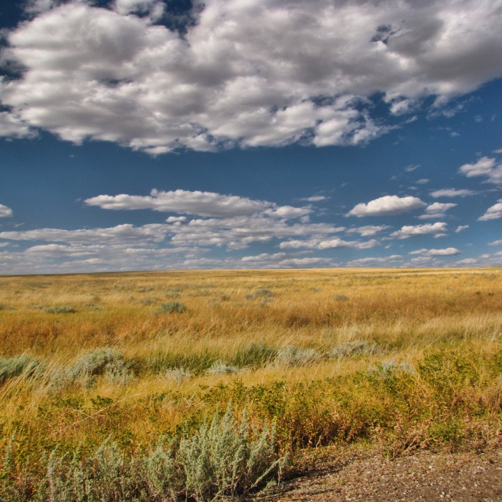 The landscape upon close inspection is full of so many interesting shapes and patterns, like this eroded gully and far butte.
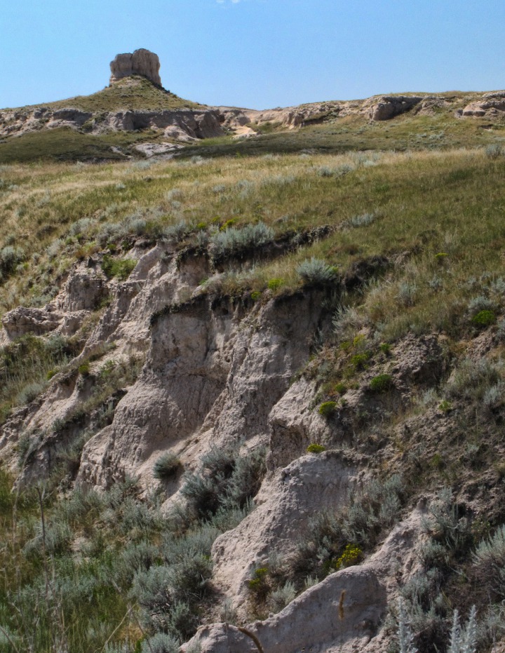 Red Canyon Rendezvous -- Brian had spent some time with an Edgemont rancher who had converted his operation to organic beef, and so he knew of the Red Canyon Road. So soon after we drove through Edgemont, we turned onto that road, and started the last of our numerous dirt road side trips of the day. Not far inside the canyon, there was a "watcher in profile" on the canyon wall.
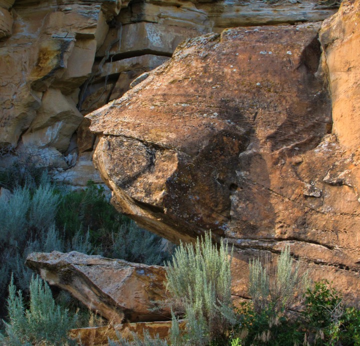 Wind and water have had a field day sculpting both hard and soft stone in Red Canyon. Wind and water can also turn the road quickly impassible, so it pays to keep one eye on the sky when going through. But those forces leave some amazing rock patterns in their wake.
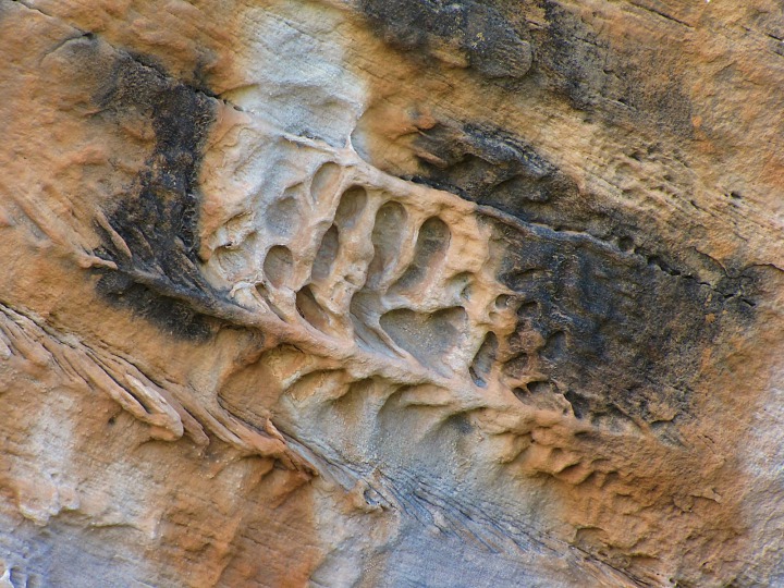 After we left Red Canyon we continued on for miles back out onto the open plains again.
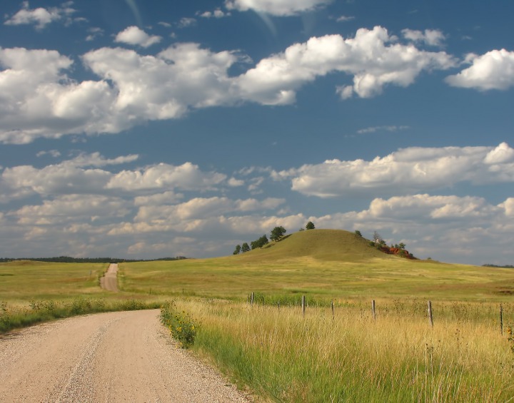 After you leave Red Canyon, you can see more red rock formations off in the distance.
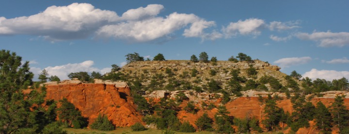 The road runs on toward the formations and deeper into the Black Hills.
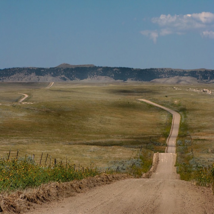 We took a slight detour over to the Red Rock formations back to the west where Red Canyon Road meets County Road 12.
 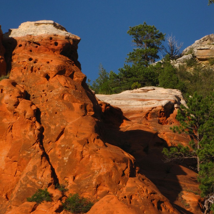 The formations in the late light of evening were well worth the slight back-track.
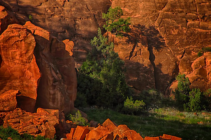 Then we turned and headed north and east again, back up County Road 12 to the main highway intersection.
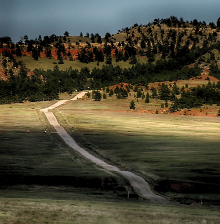 We had taken a very long, full day to get within 60 miles or so of home. We headed to Custer SD and enjoyed, along with some ridgeline trees with a great view, the beginning of sundown.
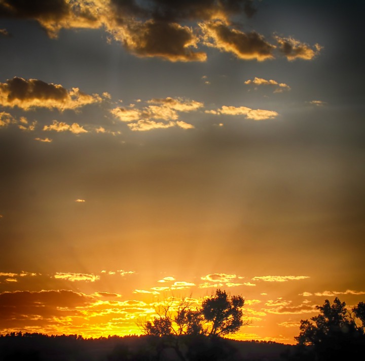 As we got closer to Custer, the sunset went on full display.
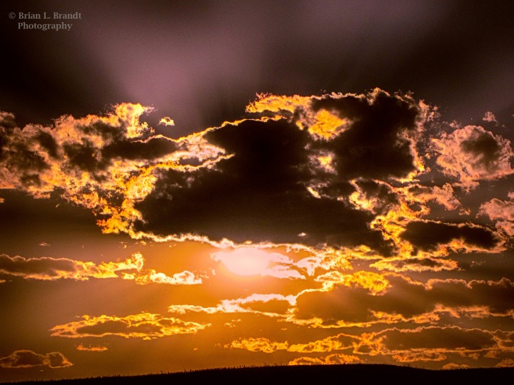 And, as we lost the last of the light, and were nearly home again after 15 days on The Road to Taos, the full moon gave us a welcome glow.
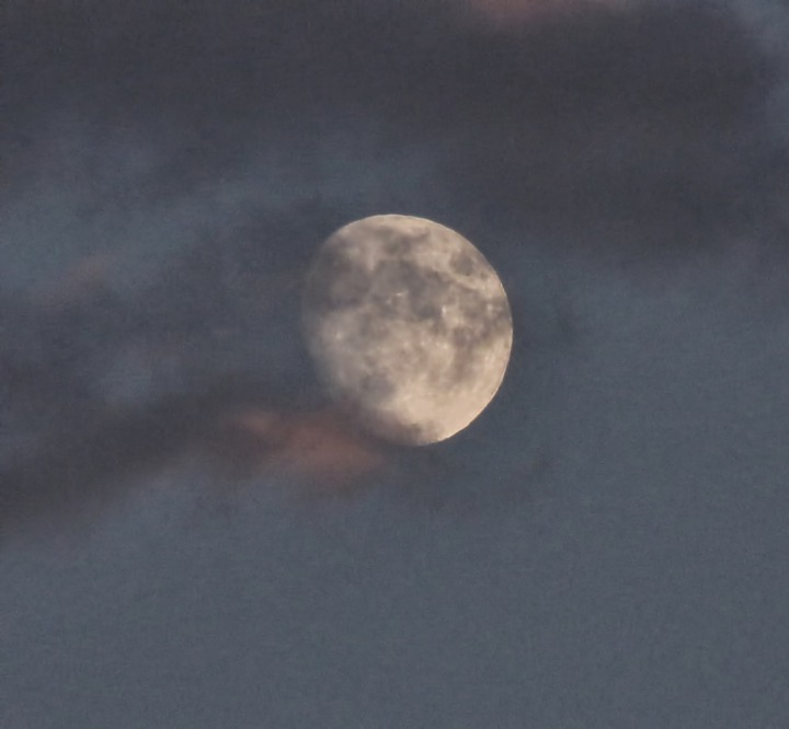

Small Protected Riparian Area in Jay Em WY

Fort Laramie Road Across the Prairie out of Jay Em WY

Prairie Outcrop
 and a Lark Bunting (Calamospiza melanocorys)&)
Western Meadowlark (Sturnella neglecta) and a Lark Bunting (Calamospiza melanocorys)
 and a Windmill&)
Western Meadowlark (Sturnella neglecta) and a Windmill

Custom Made Gate Closing Device

Cows Around a Windmill-Fed Water Tank
 on a Post&)
Another Young Western Meadowlark (Sturnella neglecta) on a Post

A Bit of Bullying

Moore Springs Community Pride Project -- Distances to Prairie Places

The Road Way Less Traveled

One Lingering Cottonwood Draw
 Bucks&)
Two Lonesome Prairie Pronghorn (Antilocapra americana) Bucks

Jagged Rocky Hillside -- Some Tough Plowing

Occasional Timbered Hill Rising from the Plains
 with Late Summer Fruit&)
Prickly Pear Cactus (Opuntia Polyacantha) with Late Summer Fruit

Angus Grazing the Plains

Horse Gossip Around the Water Cooler

Small Steer Seeks Shade

Welcome Water on a Hot Prairie Day

Windmill and Conical Butte

Bridge to Wherever

Rock Sentinels Watch Over Prairie

Close-Up Prairie Geology

More Dry Road Across Hot Prairie

Cheerful Little Sentinel Gnome

Cottonwood-Lined Oasis Along Lance Creek
 and Cumulus Clouds&)
Cottonwoods, The Flat Top, (Elevation 4212) and Cumulus Clouds

Red Barn In the Cottonwood Bottoms

A Gate and a Cow Skull
&)
Crested Prickly Poppy (Argemone polyanthemos)
 Bucks&)
Dubious Pronghorn (Antilocapra americana) Bucks

Fetching White Flower

Prairie Golds and Prairie Blues

Prairie Gully and Far Butte

Red Canyon Profile

Stone Flows In Red Canyon

Road Out of Red Canyon

Red Rocks After Red Canyon

The Road to Black Hills Edge

Red Rocks Wearing White Caps

Red Rock Heads Watching a Tree Grow

Road to Custer or Hot Springs

Trees Enjoying Sundown

Sunset Gleaming Across Black Hills

Moon Rises to Meet the Trip's Ending
Text by Brian and Louise. Photos by Brian. Text and photos copyright Goin Mobyle, LLC, 2010