Day Three -- From Eagle to Montrose, CO, 7 August 2010: We left Eagle CO, with the idea of making tracks for Montrose CO, via Glenwood Springs and the North Rim of the Black Canyon of the Gunnison. As it turned out, we bit off a chunk and a half this day, and we got into Montrose well after dark. But what a pre-dark party we had, as you'll see later on.
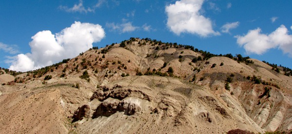
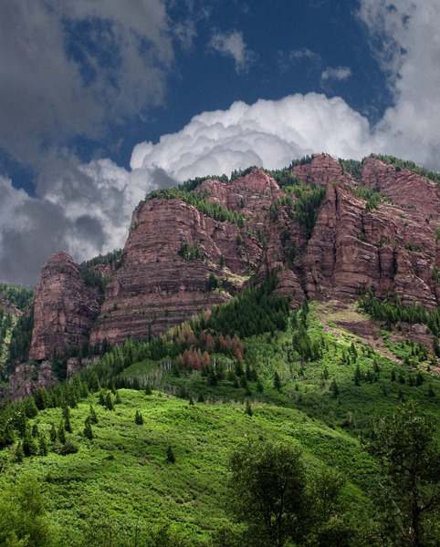
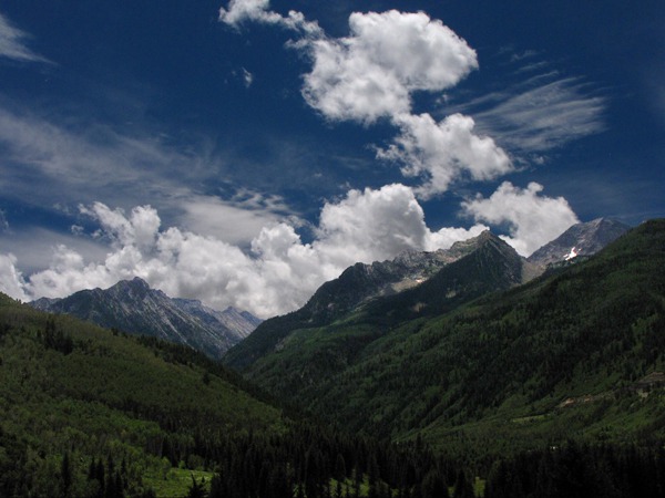
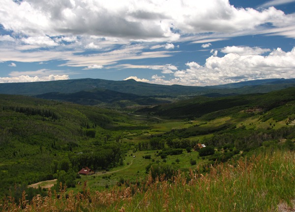
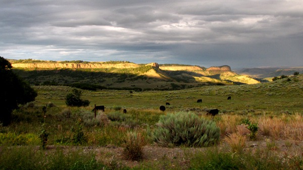
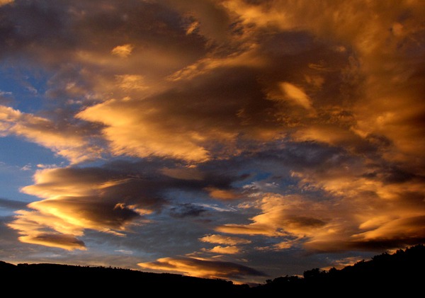
We barely made it five miles out of Eagle on US HWY 6 along the Eagle River before the amazing scenery started to demand capture.
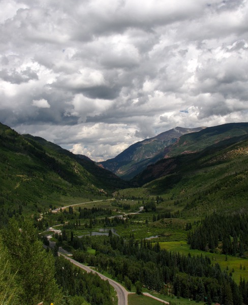
 We found a non-freeway path to get to Glenwood Springs -- at least on the map. However, it turned out the map was old enough that we ended up at the dead-end trailhead for the bike path that runs through Glenwood Canyon along the river all the way to Glenwood Springs.
That path looked like the ideal way to see that 12-mile stretch of canyon -- better than zipping along at I-70 with Colorado drivers fixin' to come up your tailpipe if you slowed down long enough to actually see anything.
We found a non-freeway path to get to Glenwood Springs -- at least on the map. However, it turned out the map was old enough that we ended up at the dead-end trailhead for the bike path that runs through Glenwood Canyon along the river all the way to Glenwood Springs.
That path looked like the ideal way to see that 12-mile stretch of canyon -- better than zipping along at I-70 with Colorado drivers fixin' to come up your tailpipe if you slowed down long enough to actually see anything.

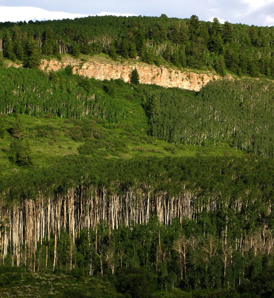
Folded Cliffs Outside Eagle CO

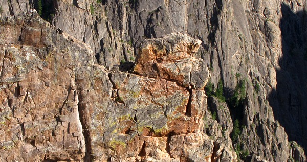
Red Cliffs Outside Eagle CO

Round Bluff Outside Eagle CO
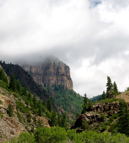
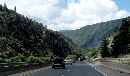
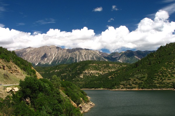
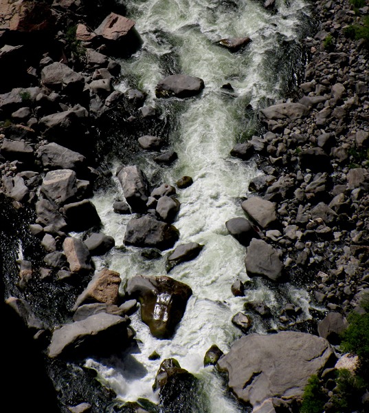
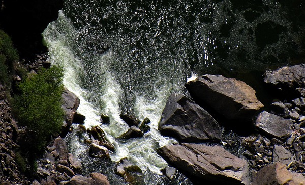
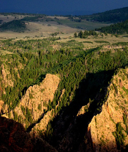
Glenwood Canyon: But the canyon, what we were able to see of it, was very picturesque. 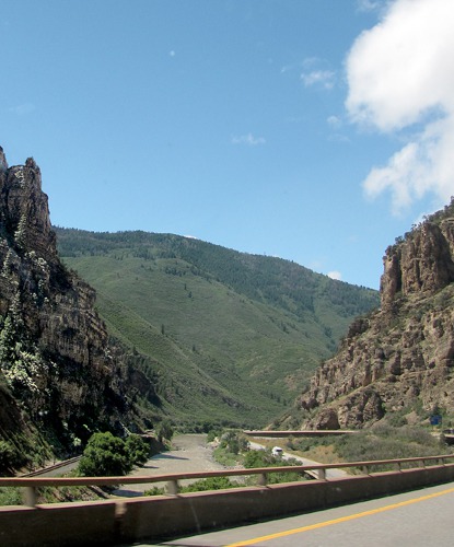 The canyon was formed relatively recently (geologically speaking, that is), in the Pleistocene era by the Colorado river ripping down through layers of sedimentary rock all the way down to the Precambrian rock. The rock layers are Mississippian Leadville limestone, Devonian thin-bedded Chaffee limestone and shale, Ordovician Manitou dolomite and interbedded shale, Cambrian Sawatch quartzite, and coarse pink Precambrian granite (1.7 billion years old).

Glenwood Canyon Along the Colorado River on I-70
I'd been through here several times before, but always at 70 mph with a string of cars on my tail, and sometimes nearing dusk, so I didn't have a full appreciation for it until this trip. Upon reflection, it makes a lot of sense to map out the rest areas in advance, some of which come up very quickly on curves, and get out and enjoy the sights of the canyon. Or take the bike path -- otherwise it will be pretty much a blur as you try to keep from getting run over by local drivers who seem to drive the canyon at high speed for sport.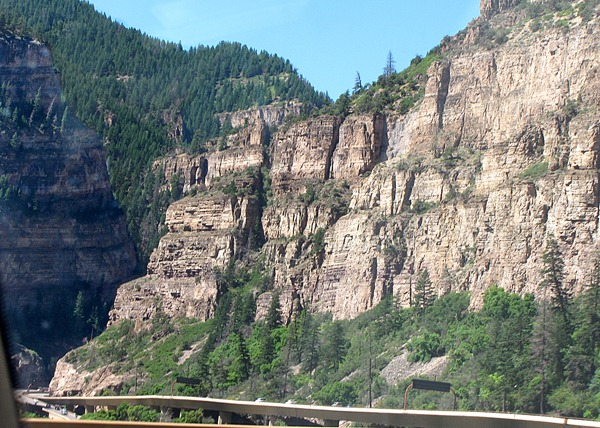
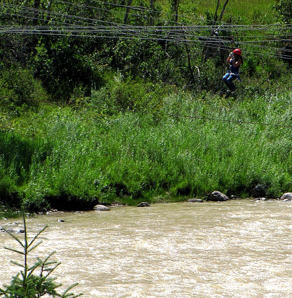
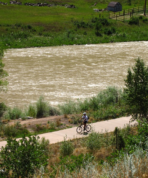
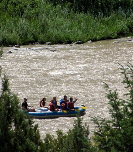
 There was a lot of recreational monkey business going on in the canyon.
 Glenwood Springs: Finally we cleared the canyon and hit the edge of Glenwood Springs, most important in my mind because that's where Doc Holiday finished his run and played out his last hand at the sanitarium for TB patients. It was an historic spot for Ute Indians who used the natural hot water until James Landis arrived in the area in 1879 and laid claim to the hot springs.

Glenwood Canyon Along the Colorado River on I-70

Glenwood Canyon Side Canyon

Glenwood Canyon Zipline Adventures on I-70 outside No Name CO

Biking Glenwood Canyon

Rafting the Colorado River in Glenwood Canyon
With rumors of silver nearby, Camp Defiance, which eventually morphed into Glenwood Springs, was set up, and the Indians were forcibly removed to Utah in 1881, an act by which "western Colorado was opened to entry and settlement" according to the Glenwood Pioneer Historical Society, making the country "safe" for the foul-mouthed, whiskey-breathed, whore-chasing miners; the claim jumpers who hoodwinked and murdered them; the tin-horn gamblers who swindled them; the saloon-keepers, usurious mercantile-shop owners, and bordello madams who sucked them dry, and the land speculators who came along after them.
 Glenwood Springs is at the confluence of the Colorado River and the Roaring Fork River, in the Roaring Fork Valley.

Entering Glenwood Springs
We didn't pause in Glenwood Springs, not because it's not a charming spot with brew pubs, boutiques, and real estate offices galore, but mostly because it was packed to the rafters, and it was too hot for Furry Purry to stay long in the car.
So we pressed on through without the benefit of Glenwood Springs charm or hospitality. There's a great historic hot springs "plunge" that Teddy Roosevelt, Buffalo Bill Cody and I have all visited before, and it's worth the time to stop take a dip and and look around if you get there in that part of the year where you can actually find a parking spot.
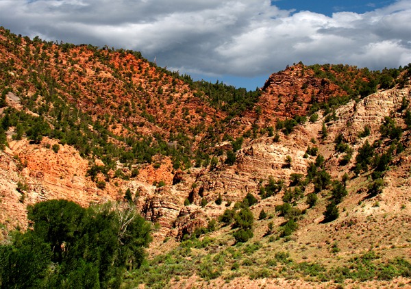
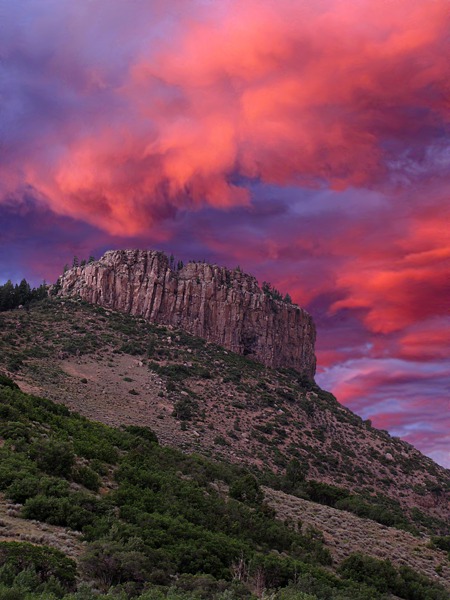
On to Redstone: We headed out of Glenwood Springs on CO HWY 82 and then turned on CO HWY 133 toward the town of Redstone, established in the late 19th century by industrialist John Cleveland Osgood as part of his coal mining empire. A dominant feature of Redstone is Cleveholm Manor, commonly called "Redstone Castle," an opulent 42-room Tudor Style mansion that Osgood built for his second wife, the Swedish Countess Alma Regina Shelgrem.
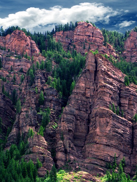
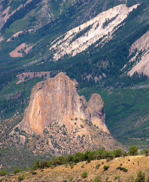
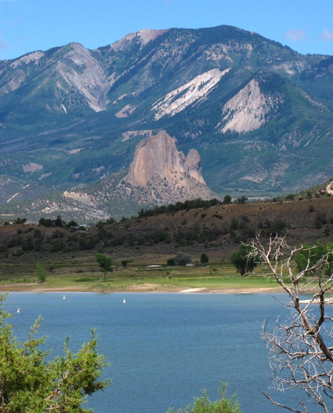
Redstone Geology and Mt Sopris: The canyon leading to Redstone from Glenwood Springs cuts through the Maroon formation, sand, clay and gravel washed from the Ancestral Rockies. The giant cliffs are backed by 12,000 foot peaks of Tertiary intrusive -- volcanic rocks from eruptions during Tertiary times. Just spectacular.
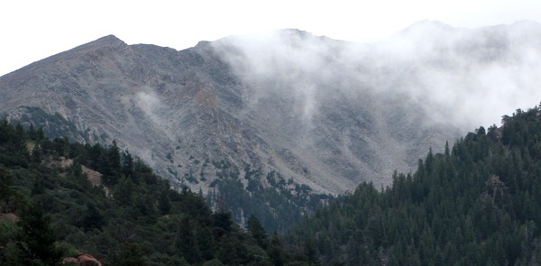 Mount Sopris is a Tertiary intrusion of crystalline igneous rock called quartz monzonite which contains two types of feldspar, some quartz, and a few dark minerals. The mountain, at the confluence of the Crystal and Roaring Fork Rivers, actually has twin peaks, both 12,600 feet high. "The large area of broken rock that slopes down the face of the northern peak is known as a rock glacier, a field of boulders that creeps slowly downhill as a unit with much the same effect as an ice glacier." (Gregory, p. 126)
"Like their less rocky cousins, slow-moving rock glaciers reshape their valleys by grinding rock with rock and build up morainelike ridges at their lower ends. They develop in high, steep, glaciated areas where large quantities of jointed rock, pried apart by frost, become imbedded in ice." (Chronic, p. 230) Mount Sopris is in the Maroon Bells-Snowmass Wilderness area at the north end of the Elk Mountains.
Mount Sopris is a Tertiary intrusion of crystalline igneous rock called quartz monzonite which contains two types of feldspar, some quartz, and a few dark minerals. The mountain, at the confluence of the Crystal and Roaring Fork Rivers, actually has twin peaks, both 12,600 feet high. "The large area of broken rock that slopes down the face of the northern peak is known as a rock glacier, a field of boulders that creeps slowly downhill as a unit with much the same effect as an ice glacier." (Gregory, p. 126)
"Like their less rocky cousins, slow-moving rock glaciers reshape their valleys by grinding rock with rock and build up morainelike ridges at their lower ends. They develop in high, steep, glaciated areas where large quantities of jointed rock, pried apart by frost, become imbedded in ice." (Chronic, p. 230) Mount Sopris is in the Maroon Bells-Snowmass Wilderness area at the north end of the Elk Mountains.

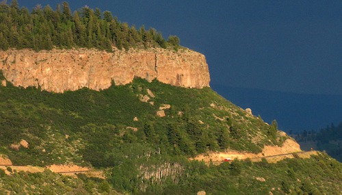
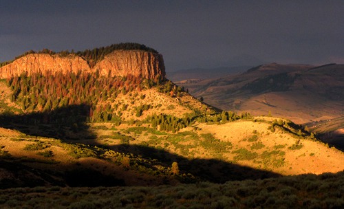
The Red Cliffs of Redstone CO

Clouds Shroud Mt Sopris North of Redstone

Red Cliffs and Aspens Near Redstone CO
Redstone Mining: Redstone had row upon row of coke ovens from the turn of the century, all in varying states of decay. The men who manned the coke ovens lived in houses built for them by Osgood that had indoor plumbing and electricity. Osgood goes down as a paternalistic coal mining baron.
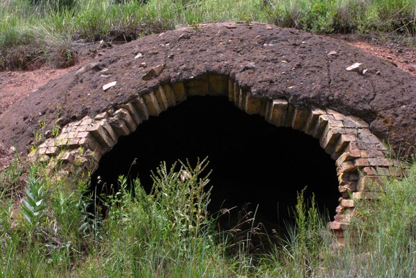

Maw of a Coke Oven in Redstone CO
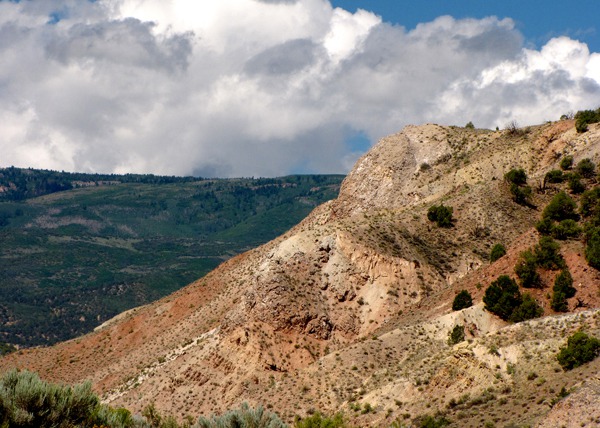
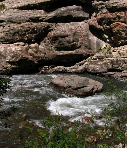
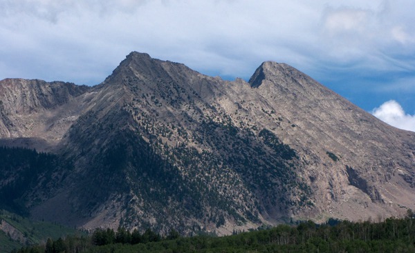
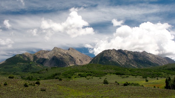
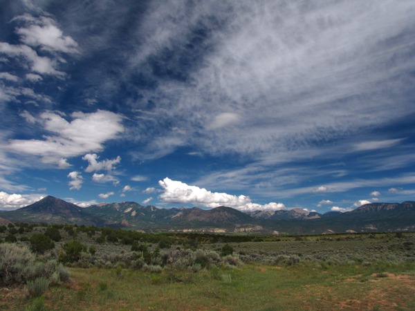
Raggeds Wilderness: We headed out of Redstone; the road followed the Crystal River. The high peaks of the Elk Mountains were visible to the east and the Raggeds to the south.
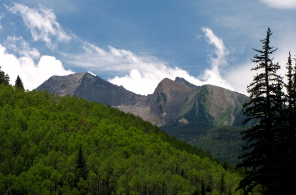
 As we went over McClure Pass on CO HWY 133, we could see the edge of "The Raggeds" wilderness area off to the east. The peaks were sharp and dazzling. The wilderness is just shy of 65,000 acres with fifty miles of trails. A lot of it is reputed to be "tough hiking."
 After McClure Pass, we dropped down to the head of the valley of East Muddy Creek.

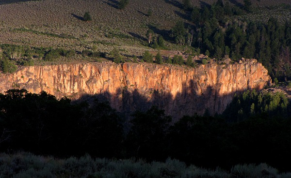
Crystal River Carves Redstone Canyon

Peaks South of Redstone CO

Looking Back to Redstone From McClure Pass

Redstone Canyon Looking North

Two Peaks at the Edge of Raggeds Wilderness

Edge of The Raggeds Wilderness
On to Paonia: Just before we shot out onto the flats at Paonia, we drove along the long, narrow Paonia reservoir with the Ragged Wilderness peaks as a backdrop. We were in the Gunnison River drainage now.
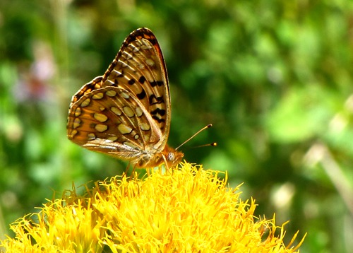
 Along the edge of the reservoir, the rabbit brush was in full bloom and full of butterflies. At the dam, the North Fork of the Gunnison River began, flowing west and south to the Gunnison.
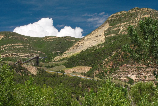
 Farther down the canyon, near Somerset, we saw a huge pipe coming down off the side of the mountain, apparently a huge coal sluicing operation to bring coal down to a railroad yard along the highway. The pipe was big enough to drive through.
 Paonia: We drove through Paonia with its myriad orchards -- a real fruit capital of CO, in spite of being at 5,645 feet. Fruit stands lined the road, although we were probably tailing off the end of the fruit season by this time. Wineries also beckoned. We were tempted to stop, but we hadn't even gotten to our primary objective of the day yet -- the North Rim of the Black Canyon of the Gunnison. It was still fifty miles hence.
In Hotchkiss, we turned south on CO HWY 92, another "highly scenic" recommendation from friend, Dave.
Paonia: We drove through Paonia with its myriad orchards -- a real fruit capital of CO, in spite of being at 5,645 feet. Fruit stands lined the road, although we were probably tailing off the end of the fruit season by this time. Wineries also beckoned. We were tempted to stop, but we hadn't even gotten to our primary objective of the day yet -- the North Rim of the Black Canyon of the Gunnison. It was still fifty miles hence.
In Hotchkiss, we turned south on CO HWY 92, another "highly scenic" recommendation from friend, Dave.

Valley After Topping McClure Pass

Paonia Reservoir Fronts the Raggeds
 Alongside Paonia Res&)
Fritillary Butterfly On Rubber Rabbitbrush (Ericameria nauseosa, formerly Chrysothamnus nauseosus) Alongside Paonia Res

Coal Sluicing Operation on CO HWY 92 to Delta CO
Finally, the North Rim: At Crawford State Park, just past the town of Crawford, we turned off on Black Canyon Road for the drive to the North Rim portion of the National Park. Along the edge of the West Elk Mountains, to our east, Needle Rock thrust up from the valley floor. There was a gravel road that wandered over toward the base of it, but we didn't have enough daylight to burn to make that side trip. So many wonderful side trips had flown by so far today!
 Seems to us like Coloradoans put in stock dams on every creek and then call them state parks! Anyway, finally we were on a gravel road -- definitely the road less traveled.
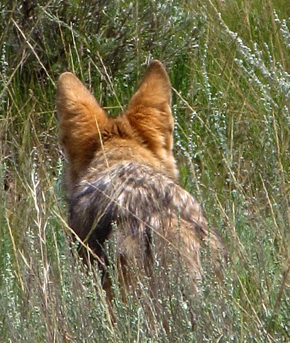
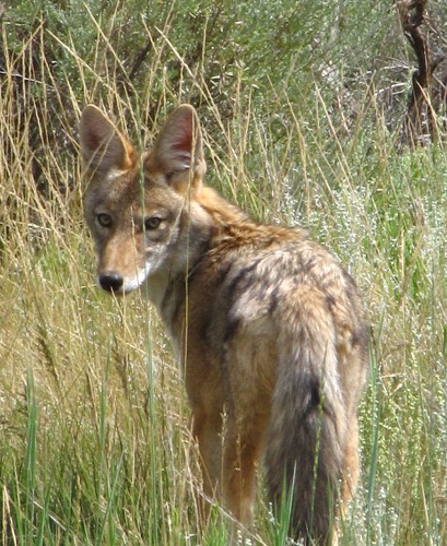
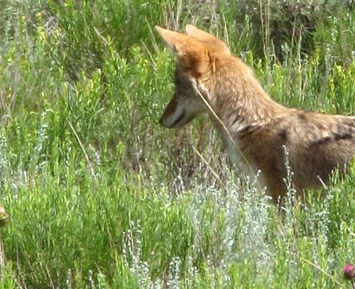
 We started the climb up off the valley floor to the North Rim, and the deciduous trees and shrubs gradually gave way to pinon pine and sage brush. We had just passed the Black Canyon of the Gunnison National Park boundary when I caught a movement out of the corner of my eye, easy to do since we were finally able to drive slow.
It was a coyote, deep in rodent hunting mode. He looked back at us once, but pretty much just continued his day's work while we watched him for ten or fifteen minutes until he meandered out of sight in the tall sage. Look at those ears! He's found something for sure! Furry Purry was sleeping in her little purple house, completely unimpressed by it all.
We started the climb up off the valley floor to the North Rim, and the deciduous trees and shrubs gradually gave way to pinon pine and sage brush. We had just passed the Black Canyon of the Gunnison National Park boundary when I caught a movement out of the corner of my eye, easy to do since we were finally able to drive slow.
It was a coyote, deep in rodent hunting mode. He looked back at us once, but pretty much just continued his day's work while we watched him for ten or fifteen minutes until he meandered out of sight in the tall sage. Look at those ears! He's found something for sure! Furry Purry was sleeping in her little purple house, completely unimpressed by it all.
 Chasm View Nature Trail:
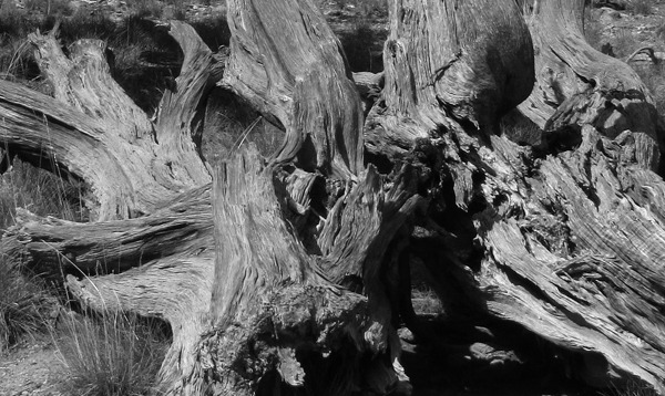
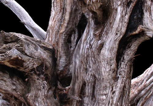
We stopped at the North Rim visitor's center, and then drove to the start of the Chasm View Nature Trail at the North Rim campground. Furry Purry got out grudgingly because it was still pretty warm, but she seemed to cotton to the idea of stretching after riding in her little purple house in the air conditioning for a whole bunch of hours getting to the rim. We hiked through a forest of pinon pines and juniper all gnarled and tangled from being buffeted by wind and snow all their live-long lives, not to mention summer heat and no rain.
Chasm View Nature Trail:
We stopped at the North Rim visitor's center, and then drove to the start of the Chasm View Nature Trail at the North Rim campground. Furry Purry got out grudgingly because it was still pretty warm, but she seemed to cotton to the idea of stretching after riding in her little purple house in the air conditioning for a whole bunch of hours getting to the rim. We hiked through a forest of pinon pines and juniper all gnarled and tangled from being buffeted by wind and snow all their live-long lives, not to mention summer heat and no rain.
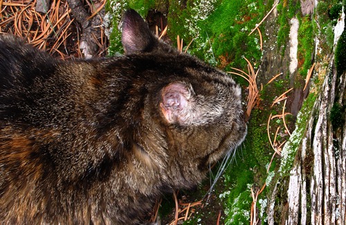
 There were lots of things for a cat to see along the trail. And lots of things to sniff.
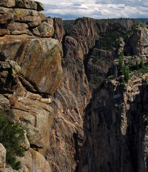
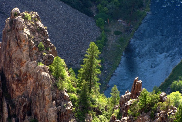
 Soon after we started the walk, we came out of the pinons and there, quite suddenly, yawned the narrow and incredibly deep canyon, cut by the Gunnison River over the last two million years. We had read it was 1000 feet wide and up to 2500 feet deep. It's hard to get your head around those figures until you are standing there -- and even then, it's more than a little surreal.

Needle Rock Formation outside Delta CO

Needle Rock Formation and Crawford Reservoir

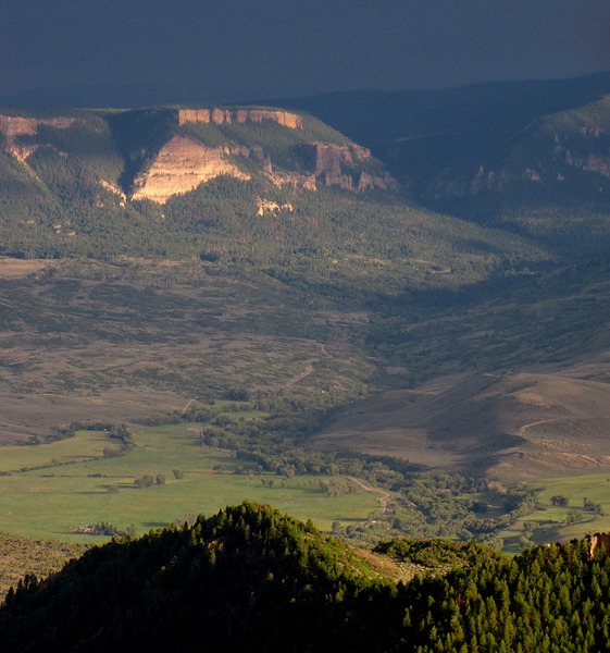
San Juan Mountains east of Delta CO
 )
Coyote (Canis latrans) "Earing Up" some Prey in Black Canyon of the Gunnison National Park CO
 in Black Canyon of the Gunnison National Park CO&)
Coyote (Canis latrans) in Black Canyon of the Gunnison National Park CO
 Fixin' to Vole Pounce in Black Canyon of the Gunnison National Park CO&)
Coyote (Canis latrans) Fixin' to Vole Pounce in Black Canyon of the Gunnison National Park CO

Pinon Tangle in Black Canyon of the Gunnison National Park CO

Pinon Trunk in Black Canyon of the Gunnison National Park CO
 in Black Canyon of the Gunnison National Park CO&)
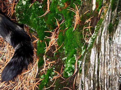
Moss Log and Friend (Leesha's Tail) in Black Canyon of the Gunnison National Park CO

Furry Purry Sniff Tests a Moss Log in Black Canyon of the Gunnison National Park CO
 and Pine Needles in Black Canyon of the Gunnison National Park CO&)
Scarlet Gilia (Ipomopsis aggregata) and Pine Needles in Black Canyon of the Gunnison National Park CO
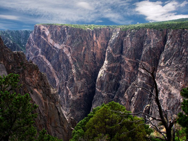
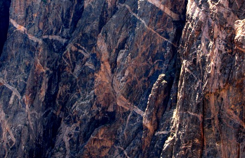
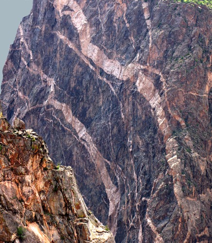
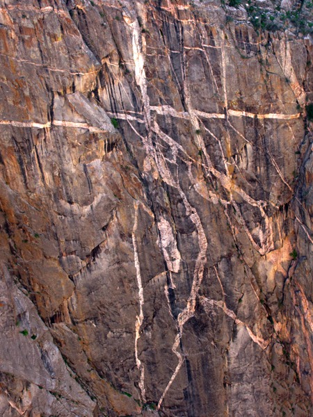
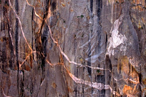
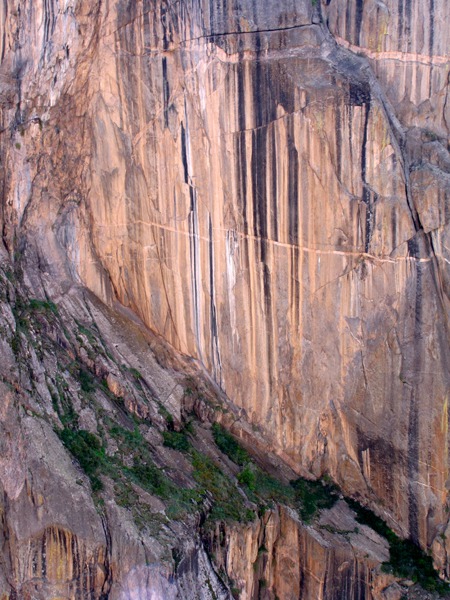
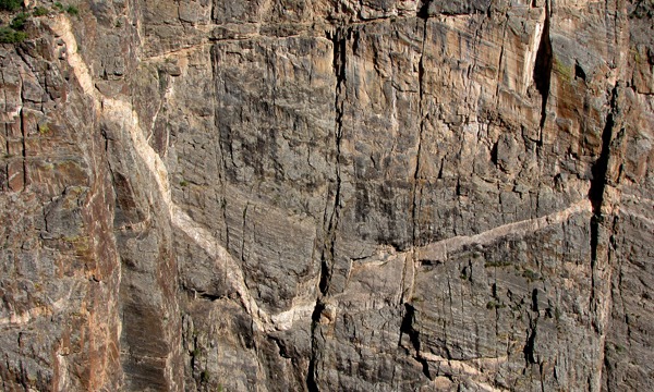
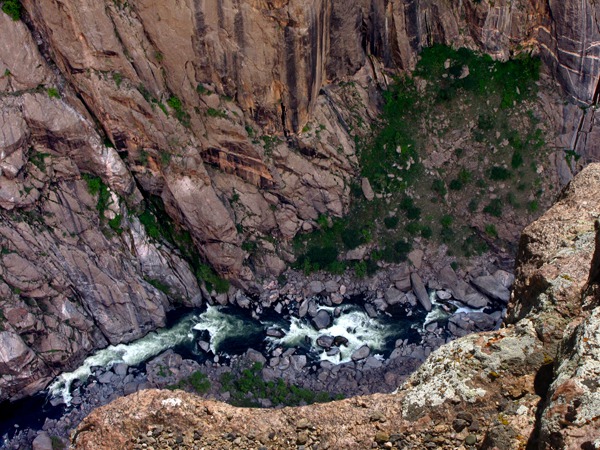
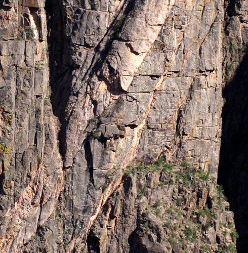
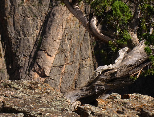
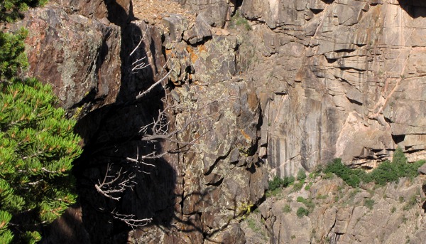
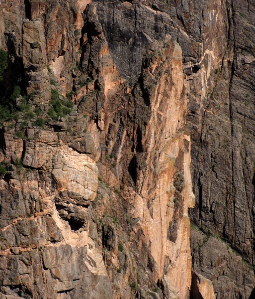
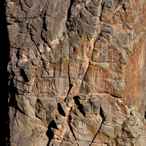
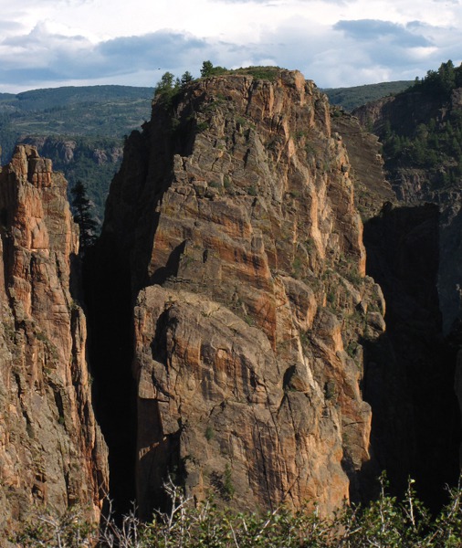
The Park protects the deepest fourteen miles of the gorge, a narrow slit in the earth that sunlight penetrates only at mid-day. Canyon depths range from 1,730 to 2,700 feet; at The Narrows, the canyon is only 1,300 feet wide at the Rim and the river 40 feet wide at the bottom. The North Rim walls plunge almost vertically to the turbulent river below. The rock is very old, very hard, and very durable -- hence the almost vertical ramparts of Precambrian schist, granite, grey quartz monzonite, and Black Canyon gneiss, 1.8 billion years old.
The pink and white swirls that decorate the black gneiss ramparts are crystalline pegmatite created by magma extrusions that leaked onto cracks and hardened.
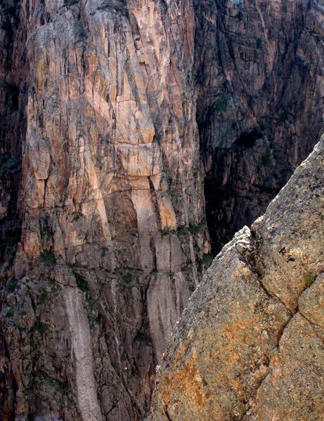
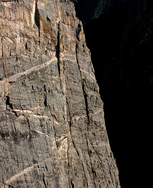
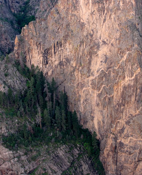
The Painted Wall is the highest cliff in Colorado, 2,300 feet high. It's one of the more dramatic cliffs in the canyon, and we were lucky that there was still enough light on it to appreciate the candy-cane maze of seams running across the face.
This is a place where deep geologic time overwhelms infinitesimal human time, where you can feel the bones of the planet and disappear into the processes that shaped them.
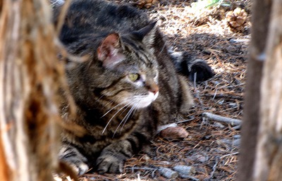
 Not long after hitting the rim, Furry Purry decided to take a little cat break on the limbs of a pinon that allowed her a bobcat view of the canyon.
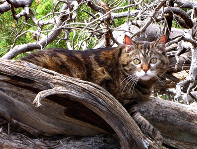 Furry Purry was the purrfect companion for such a jaunt, cat-wise. She stayed right at Louise's feet -- perhaps intuiting the bears and coyotes that would probably emerge right smack after dark. In any case there was no danger of her getting too close to the edge or wandering off. She always stayed within a few feet of us, no matter where we took her, so she was easy to keep track of.
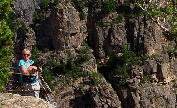
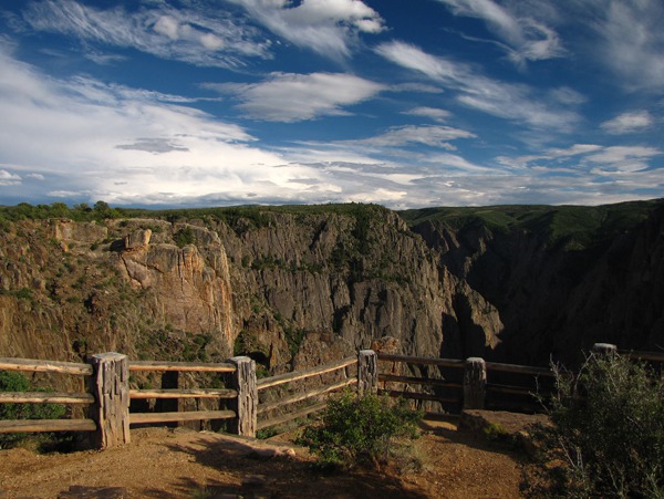
 We continued slowly along the edge. There were handrails in a few places, but otherwise it was a gene-pool cleansing trail for those who strayed too near the edge. We always talk about the difference between the US and Europe. In the US in a lot of places like this they put up big "DANGER" signs at the edge of 2,000 foot drop-offs, just in case you miss the implications of going unceremoniously over the edge. In Europe, they just figure that if you are that stupid, they don't want you cluttering up the countryside or polluting their gene pool any longer.
 As you walk along the rim, like at the Grand Canyon, the scenes change in endless detail. And as the sun moves, so do the details as shadow and light patterns come into play. Foregrounds and backdrops blend because the walls are so relatively close together compared to the depth of the canyon. A photographer could spend a month there and never run out of material.
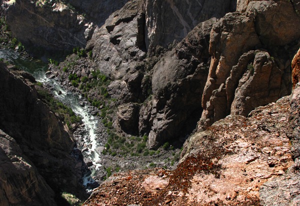
 Almost out of view straight down, the river runs along through dense boulder fields. The first guys to make it through the canyon tried it once with boats which were quickly reduced to splinters, and then came back later with air mattresses (who knew they had them in the 20's?) and made it through. Of course, they were looking for a way to dam up the river and make the world safe for alkali leaching agriculture.
 On an air mattress!??? Can't even imagine it!
As we walked further down, more shapes and patterns emerged as the sun started to dip lower. It was a wonderful evening -- warm and not very windy.
On an air mattress!??? Can't even imagine it!
As we walked further down, more shapes and patterns emerged as the sun started to dip lower. It was a wonderful evening -- warm and not very windy.
 We looked up the canyon as the sun started to get low enough to create amazing shapes and shadows among the rocks at the edge of the precipice.
 Louise took Furry Purry to a guard-rail overlook and let her peer over the edge. I was wondering as I watched them how many cats ever got a chance to look straight down 2,500 feet if you weren't a bobcat, mountain lion, or a snow leopard. Furry Purry was in elite company, but characteristically only mildly interested -- not gaga -- over the opportunity. It's hard to know in her little cat brain just what she thought of a river so far down below that it looked like an ink line on dark paper.
 The trail turned along the edge of a side canyon and back toward the rig. Furry Purry took advantage of a little shade to take a small cat breather.
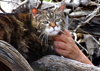
 There were some amazing sights starting to emerge as the sun started casting longer and longer shadows. The only other person on the trail was a motorcycle guy who parked not far from us, and who was sitting quietly reading a book as we passed by. Furry Purry walked over to see what he was reading and got a few nice pets.
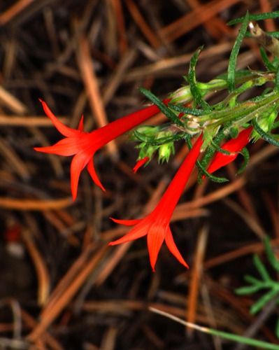
 In surprising places, brilliant life sprang out of the rocks.
 Furry Purry decided it was time to head for the car, so she started back the way we'd come, but we finally convinced her that we were on a loop, and at some point she gathered momentum for heading in the new direction to get back. She had an amazing sense of how to retrace her steps if need be -- considering she was an indoor cat for 18 of her 20 years. But that bobcat energy she had served her well when she was outdoors with us.

Pinon and Painted Wall in Black Canyon of the Gunnison National Park CO

Furry Purry in the Pinions in Black Canyon of the Gunnison National Park CO

Furry Purry in the Pinions with a Rub in Black Canyon of the Gunnison National Park CO

Painted Wall from North Rim in Black Canyon of the Gunnison National Park CO

Painted Wall Detail in Black Canyon of the Gunnison National Park CO

Painted Wall from North Rim Close Up in Black Canyon of the Gunnison National Park CO

Near Pinon and Far Wall in Black Canyon of the Gunnison National Park CO

Stick Man on South Canyon Wall in Black Canyon of the Gunnison National Park CO

The Gunnison River Way Below in Black Canyon of the Gunnison National Park CO

Gunnison River 1500 Feet Down in Black Canyon of the Gunnison National Park CO

Gunnison River Pool at the Canyon's Bottom in Black Canyon of the Gunnison National Park CO
 Wall Detail in Black Canyon of the Gunnison National Park CO&)
Opposing (South) Wall Detail in Black Canyon of the Gunnison National Park CO

Wall Ledge on South Canyon Wall in Black Canyon of the Gunnison National Park CO

Layer Curve on Canyon Sidewall in Black Canyon of the Gunnison National Park CO

Looking Up-Canyon Near Sundown in Black Canyon of the Gunnison National Park CO

Canyon Wall Layers Turned Vertical in Black Canyon of the Gunnison National Park CO

Furry Purry Looks Down 2500 Feet in Black Canyon of the Gunnison National Park CO

What Furry Purry Saw in Black Canyon of the Gunnison National Park CO

Furry Purry Takes a Shade Break in Black Canyon of the Gunnison National Park CO

Canyon Wall Seam Detail in Black Canyon of the Gunnison National Park CO

Cliff Edge At Sundown in Black Canyon of the Gunnison National Park CO

Near Trunk and Far Wall in Black Canyon of the Gunnison National Park CO

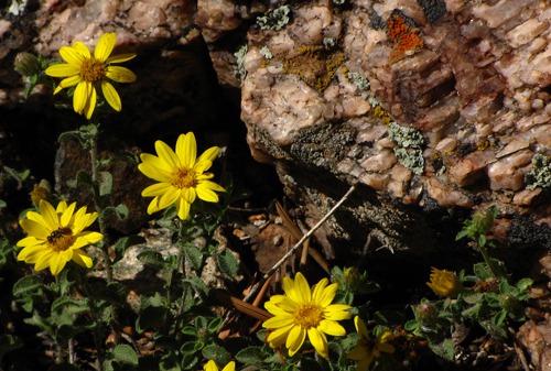
Yellow Flowers with Bug and Lichen and Quartz in Black Canyon of the Gunnison National Park CO
 at Cliff Edge in Black Canyon of the Gunnison National Park CO&)
Broom Snakeweed (Gutierrezia sarothrae) at Cliff Edge in Black Canyon of the Gunnison National Park CO

Tree Out of Shadow and Canyon Wall in Black Canyon of the Gunnison National Park CO

Side Canyon Wall Detail in Black Canyon of the Gunnison National Park CO

Side Canyon Wall Fissure Detail in Black Canyon of the Gunnison National Park CO
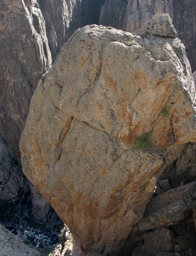
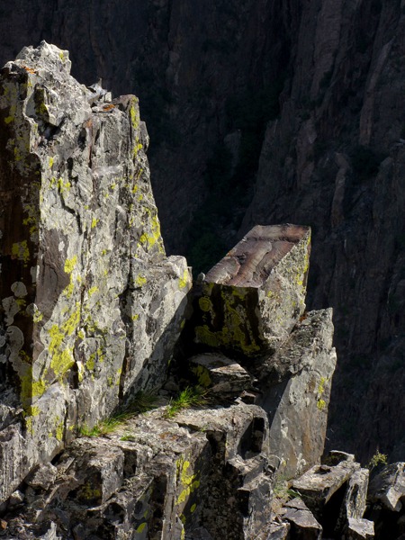
We got back to the rig and loaded up for the North Rim drive up-canyon to the end of the road to see what was up there. One of the first things we saw was a huge balancing rock the size of a cabin teetering over the edge. And seemingly held up by precious little support, although given its weight, it must have had some decent underpinnings or it would have plunged 2,000 feet down in quick time and after the huge dust cloud settled and the roar subsided, would probably have blocked the whole dad-gummed river.
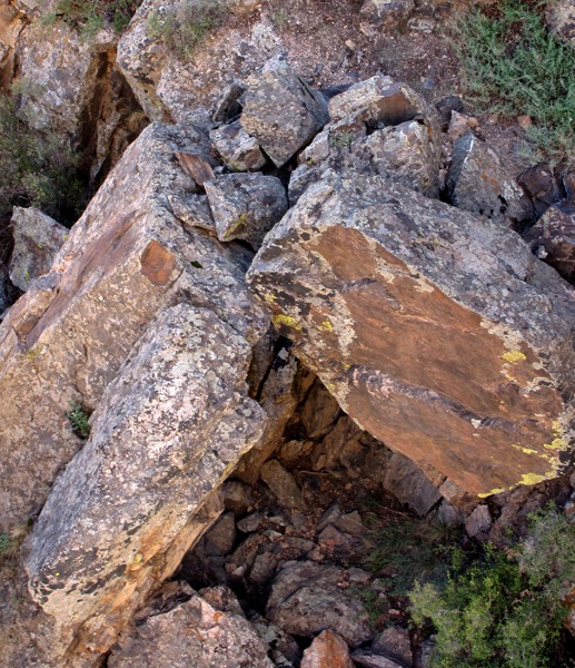
 Nearby a large number of other rocks all balanced higgledy piggledy looking like they were all waiting for an excuse to make a break for the water. Many looked like they had started the trip, only to get hung up on other rocks who were more intent on staying put.
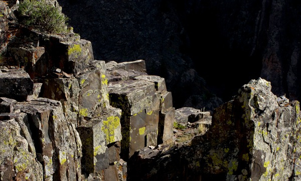 We drove further up-stream on the rim -- there were more interesting formations around every corner.
 One of the next named features we came to was "The Camel." I could see that -- and it was certainly dry enough for camels.
 All along the rim there was evidence of life. At one point, Furry Purry declined to get out of the car, and twenty minutes later Louise found a huge pile of fresh bear scat on the trail out to the rim. That Furry Purry and her instincts! Two things she doesn't like -- heat and bears!
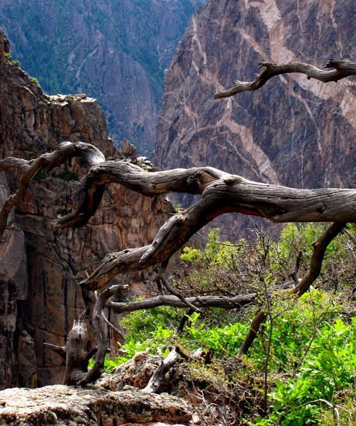
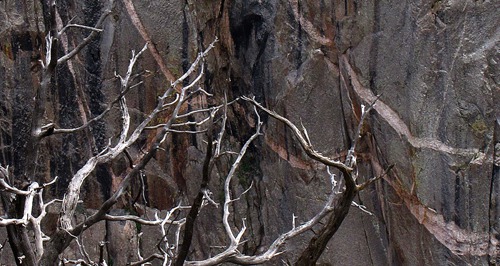
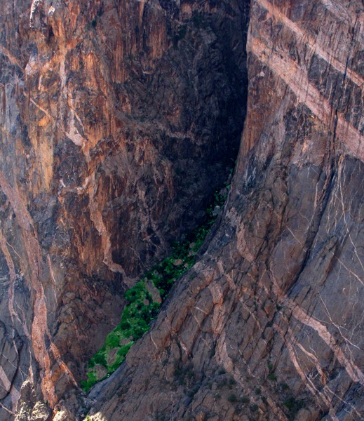
 In the canyon it was the same story. Trees had found that sparse soil in tiny crevices and on shelves and set up shop.
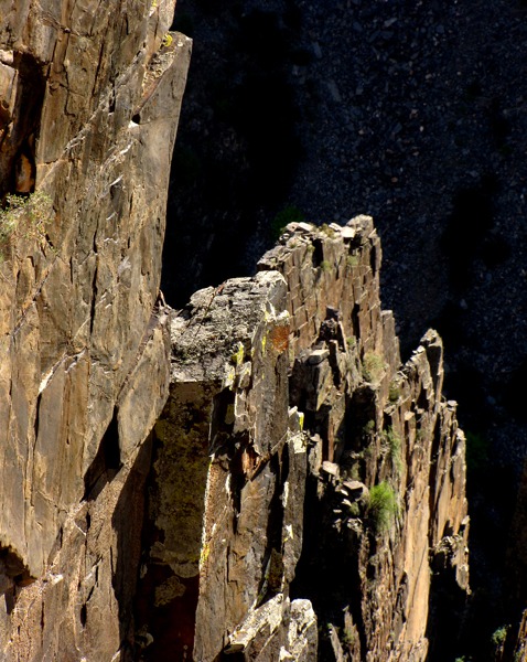
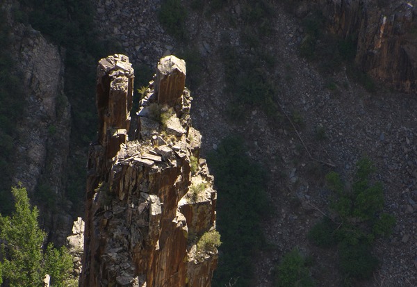
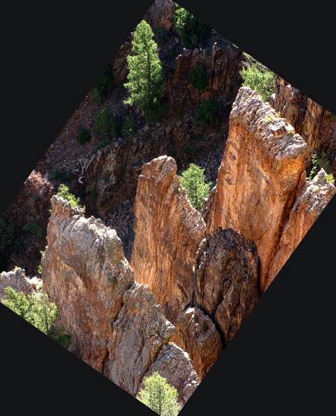
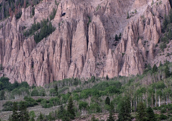
 All along the canyon spires and columns jumped up out of the depths and stuck their heads in the setting sun.
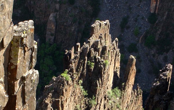 Periodically along the canyon rim, huge stone ramparts thrust to the sky.
 At certain points there were overlooks where you could go right to the edge of the canyon. However, by this time you were more or less peering into dark shadows -- except where the sun reflected off the far walls giving a little more daylight to the canyon bottom.
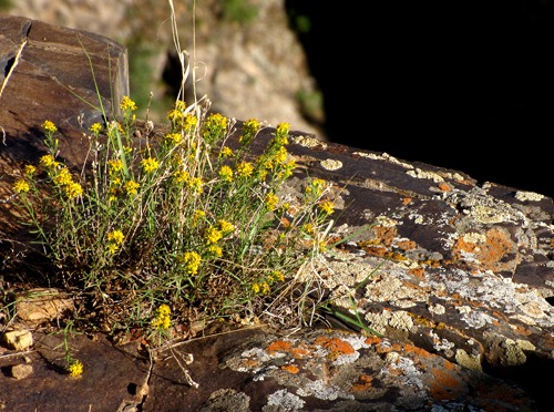
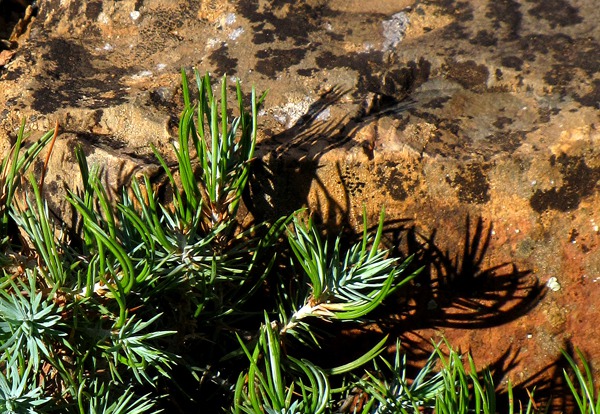
 Plants made a living wherever they could along the rim.
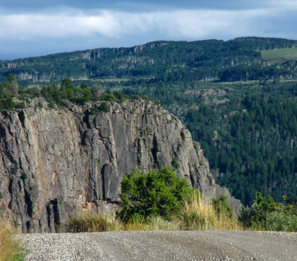
 You could occasionally glimpse one of the West Elk Mountains through the notches in the foothills north of Crawford and the rim of the canyon.
 We finally decided that if we were going to take advantage of the long light that was still holding on to finish out our drive, we'd better pull ourselves away from the canyon. On the way back to the highway, we did, however, stop to look at a few flowers that were growing just back from the rim.
 Again, following up on some scouting by our buddy Dave, we headed out to what proved to be the long (and amazing) way to Montrose. We left gravel and turned onto CO HWY 92 headed south toward Morrow Point Dam and Reservoir and, eventually, the junction of CO HWY 92 and US HWY 50, our highway into Montrose. CO HWY 92 follows the old Black Mesa Indian Trail along the rims of Black Mesa and Blue Mesa.

Huge Rock Balances Precariously Over Canyon in Black Canyon of the Gunnison National Park CO

Rim Top Instability in Black Canyon of the Gunnison National Park CO

Sheet Spires at Sundown in Black Canyon of the Gunnison National Park CO

Cliff Edge at Sundown in Black Canyon of the Gunnison National Park CO

Cliff Edge At Sundown in Black Canyon of the Gunnison National Park CO

Drive Along North Rim in Black Canyon of the Gunnison National Park CO

The Camel Formation in Black Canyon of the Gunnison National Park CO

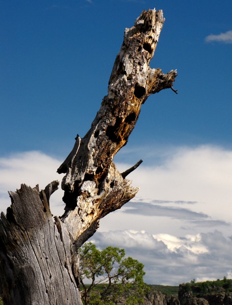
Woodpecker Condo on Canyon Rim in Black Canyon of the Gunnison National Park CO

Trees Find Shelf Foothold in Black Canyon of the Gunnison National Park CO

Vegetated Side Canyon in Black Canyon of the Gunnison National Park CO

Column in the Canyon in Black Canyon of the Gunnison National Park CO

Columns in the Canyon in Black Canyon of the Gunnison National Park CO

Canyon Pillars in Black Canyon of the Gunnison National Park CO

Overlook Near Road's End on the North Rim in Black Canyon of the Gunnison National Park CO

Spires Above the River in Black Canyon of the Gunnison National Park CO

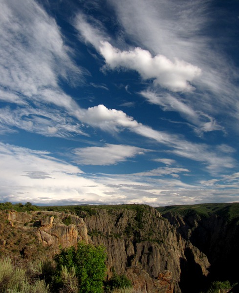
Cloud Blowout Over the Canyon in Black Canyon of the Gunnison National Park CO

Columns in the Canyon in Black Canyon of the Gunnison National Park CO
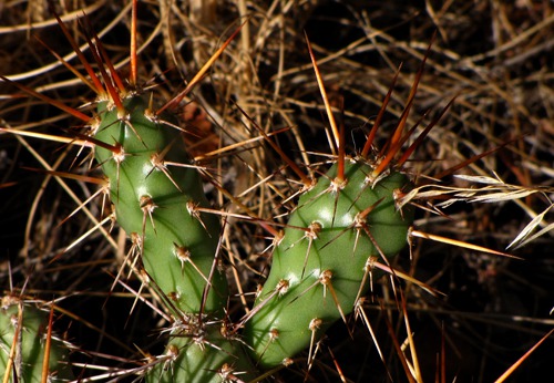
 on the Rim in Black Canyon of the Gunnison National Park CO&)
Prickly Pear Cactus (Opuntia phaeacantha) on the Rim in Black Canyon of the Gunnison National Park CO

Evergreen Out of Stone in Black Canyon of the Gunnison National Park CO

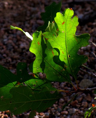
Low Light Through Oak Leaf

Clouds over Canyon Rim at Evening in Black Canyon of the Gunnison National Park CO

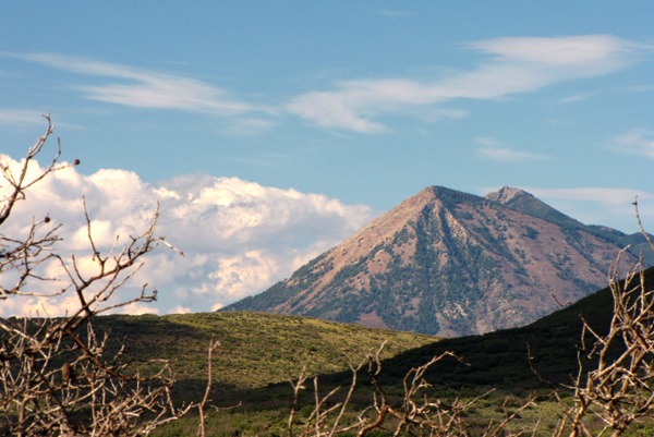
San Juan Peak North East of Canyon Rim

White Flower on Green Stalk

Paintbrush On Canyon Rim

White Stalk Flower
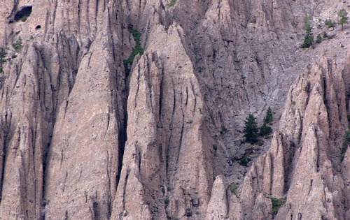
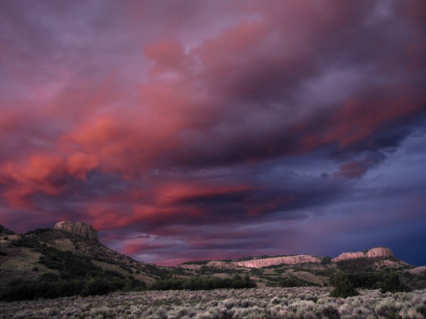
More Geology: The geologic scenery was just spectacular as we drove toward the Curecanti Needle and other needle formations a few miles ahead.
According to Roadside Geology of Colorado, "Rain and river water carved the strikingly castellated chocolate-colored Palisades we were seeing in relatively soft breccia of fine volcanic pumice and ash enclosing fragments of harder volcanic rocks. The breccia originated between 34 and 29 million years ago, during Early Phase volcanism in the West Elk Mountains" to the north. What a time to run out of daylight!
 The road makes a long sweep down off the plateau through a series of long switchbacks. As you descend, you can see series after series of buttes and rimrock walls -- in our case lit brilliantly in the low sun coming over the horizon.
 "Tuff and welded tuff form light-colored hills....Welded tuff forms during explosive eruptions when white-hot clouds of volcanic ash swoop down the slopes of volcanoes, often with terrifying rapidity, and weld together when they settle." The microscopic crystals are rhyolite, about the same chemical makeup as granite. The volcanic fragments in the West Elk breccia protect the underlying softer tuff, helping form the spires and cones evident along the road. Looks like Lord of the Rings country!
 The highway skirted the canyon edge and zigzagged up each creek to the best crossing. At Hermit's Rest Overlook, we piled out of the car to catch a glimpse of Curecanti Needle, an 800-foot high spire on the opposite side of the canyon, at the confluence of Big Blue Creek and the Gunnison River. (Too dark to photograph, unfortunately.) It was quite the attraction when the railroad carried passengers through here in the 1880's.

Sun On Canyon Cliffs Above x Reservoir

Aspen Grove Below Road Cut on HW 92

CO 92 Runs under the Rim

Evening Light On Butte from HW 92

Butte and Rock Wall

Cows and Far Mesas

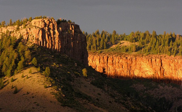
Black Mesa At Sundown

Cliff Wall at Sundown

Curecanti Needle Formations

Curecanti Needle Formations Close Up
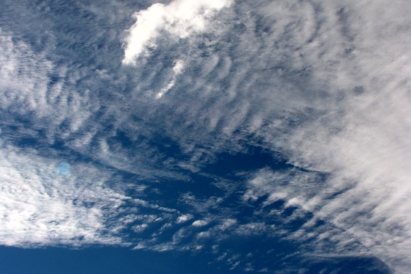
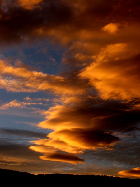
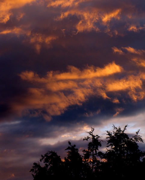
The sun was setting and an amazing sunset started to take form. Furry Purry loved the cooler weather and took off on a hike through the sage. The evening cool-down corresponded with what we call" the cat hour" -- the time when she starts to get all "sharp" and alert for the evening. Mesa Creek tumbled out of the mesas to our north, cutting a spectacular little canyon in its own right as it headed to the Gunnison.
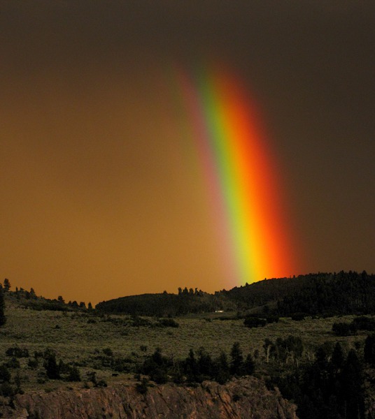
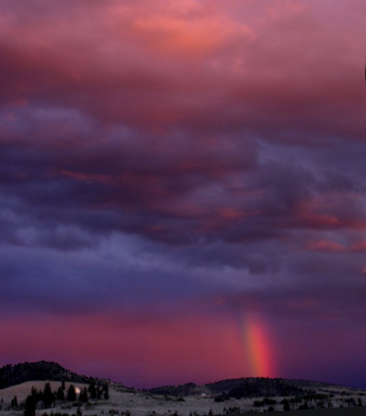
 While we were watching the sunset, we saw a bright glow forming across the canyon from the rest stop. Then one of the most brilliant rainbows we've ever seen shot up from the rim into the distant rain clouds. It was so brilliant, it actually didn't look real -- we gawked in disbelief.
 On our side of the canyon, the clouds were still picking up the last rays of the rainbow-painting sun.
 Then on the other side, the rainbow turned to a bright pink and the entire sky turned pink as the rainbow began to fade away.
 The last of the sun that had stuck faithfully with us for a very, very long day finally set, and then, just to add a little frosting to the day, sun torched the clouds over the top of Blue Mesa and the surrounding buttes that were still visible in the fading light.
 With the light gone and miles to go before we slept, we pulled up stakes at Hermit's Rest and headed for Montrose. We arrived around 10:30 and backed right up to the door of the motel. Furry Purry jumped out and sat in front of the door waiting for Louise to insert the key card. As soon as the door was open, she marched straight in and started looking for wet kitty food, which arrived post haste straight from the cooler -- before it even got into the refrigerator.
Then we all settled in for the night. We didn't have to crank out early the next day because we were going to spend the following night in Montrose as well so that we could take a more leisurely day trip to the South Rim of the Black Canyon the next day.
With the light gone and miles to go before we slept, we pulled up stakes at Hermit's Rest and headed for Montrose. We arrived around 10:30 and backed right up to the door of the motel. Furry Purry jumped out and sat in front of the door waiting for Louise to insert the key card. As soon as the door was open, she marched straight in and started looking for wet kitty food, which arrived post haste straight from the cooler -- before it even got into the refrigerator.
Then we all settled in for the night. We didn't have to crank out early the next day because we were going to spend the following night in Montrose as well so that we could take a more leisurely day trip to the South Rim of the Black Canyon the next day.

Cloud Stream at Sunset

Sunset with Tree Tops

Rainbow At Hermit's Rest

Cloud Stream at Sunset

Rainbow Second Stage

Sunset Over Buttes

Butte and Sunset
What an overwhelming day of sun, scenery, and magnificent geology!! We'll have to go back someday and drive from Blue Mesa Dam to Montrose on US HWY 50 in the daylight. Our constant companion, Roadside Geology of Colorado, extolled the glories along that road. Who knew Colorado was all volcanoes and hot gases and lava and the oldest gneiss on the planet? Wow!
Brian and Louise with Photos by Brian. Text and Photos Copyright Goin Mobyle, LLC. 2010