Day Six -- Last Leg To Taos, 10 August 2010: We rolled out of Pagosa Springs headed for Taos at the crack of 10:00 am -- about our usual on-the-road schedule by the time we walked next door to breakfast, dragged the bags, and packed the pet cat Furry Purry. We thought we'd be on pavement most of the day, but of course, also as usual, ended up on a fair bit of gravel before we rolled into Taos (technically, into Arroyo Seco) to meet our friend Dave.
We started out heading south on US HWY 84. About fifteen miles down the road, we found gravel in the form of Coyote Park Road (County Road 359). The landscape slowly morphed from timbered hills into high, dry mesa country. The mesas had names like del Medio, Cortado, Archuleta, Diamante, and, prosaically enough, Briggs.
Into New Mexico -- We crossed into New Mexico at Edith on the Navajo River where the road became County Road 357 and ended at US HWY 64 in Lumberton NM.
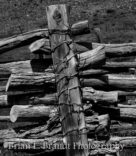
 When you get into "scrub" country, things like old corrals tend to be made from "found objects" more than from nice uniform materials like you see in Westerns.
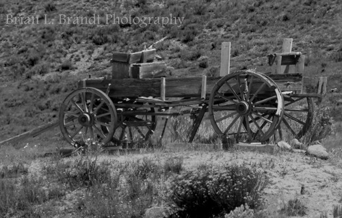
 And out in the road-less-traveled spots there were a number of old wagons and implements that in the dry heat were reasonably well preserved.
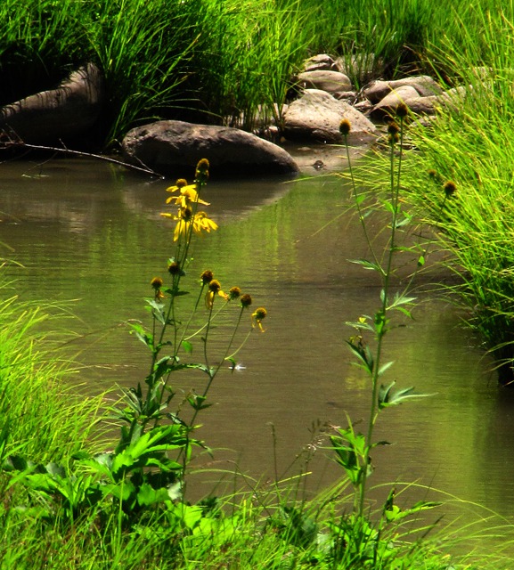
 While there certainly wasn't much water in this country, the occasional small river wandered through, creating a wet strip oasis in the dry country.
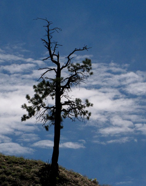
 Now and again, a more substantial tree had found a foothold and made a sculpture against the deep blue New Mexico sky.
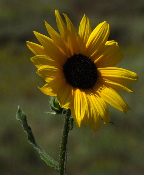
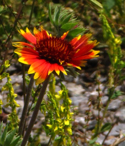
 Here and there flowers made a showing along the gravel road, even though it was early August and quite hot.
 US HWY 64 joined US HWY 84 as we headed east to Chama. Confronted by the Tusas Mountains, the highway turned abruptly south.

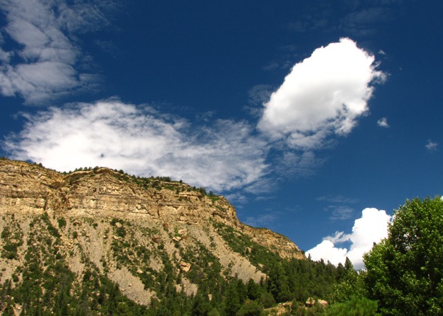
First New Mexican Butte

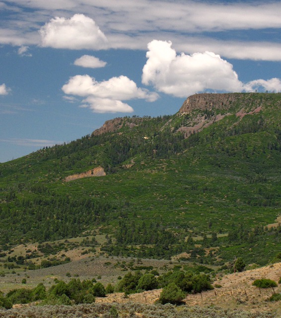
Mesa Two with Cumulus Clouds

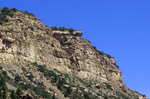
Mesa Edge Detail

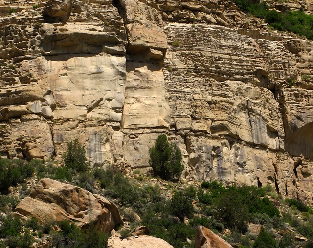
Mesa Bottom Detail

Barbed Wire Corral Post

Old Wagon with Small Foreground Gopher
&)
Cutleaf Coneflower (Rudbeckia lacinata)

Lone Tree on Hillside
&)
Common Sunflower (Helianthus annuus)
&)
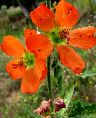
Indian Blanket (Gaillardia aristata)
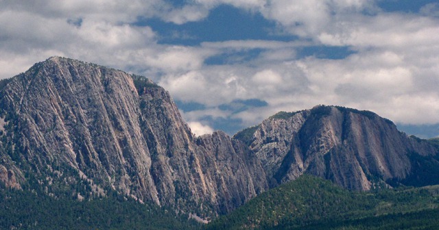
The Brazos -- At Brazo NM, we could see a massive cliff face off to our left ahead of us -- the Brazos Cliffs of the Brazos Box -- a canyon carved 2,000 feet deep by the Rio Brazos River -- walls that are higher than those of the Rio Grande Gorge outside Taos. Aren't they massive and impressive? Volcanoes to the northeast produced the massive lava flows that filled the canyon 250,000 years ago. The river carved through the Precambrian quartzite.
We couldn't find quickly a route over to The Box so we contented ourselves with a roadside stop to admire the cliffs.
 The summit still featured a wealth of wildflowers -- even in August. It was a stunning array of alpine flora.
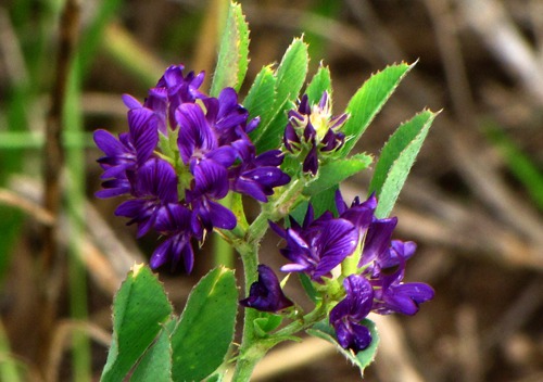
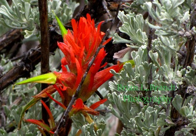
 One thing I found the most interesting visually from among these many blooms, all within about a 100-yard radius, was the interspersing of a beautiful Orange Paintbrush with the cool green of the sage. Paintbrush is something of a parasite, growing right in with the sage and using its roots to obtain water.
 At Tierra Amarilla, US HWY 64 turned east, leaving US HWY 84 to continue on south.

Brazos Cliffs with Connecting Ridge
&)
Hooked Spur Violet (Viola adunca)
&)
Death Camas (Zigadenus)
&)
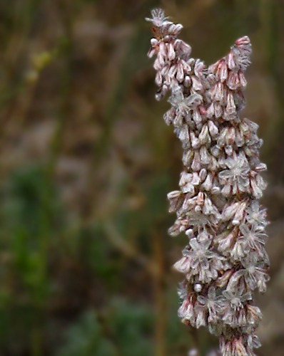
Redroot Buckwheat (Eriogonum racemosum)
&)
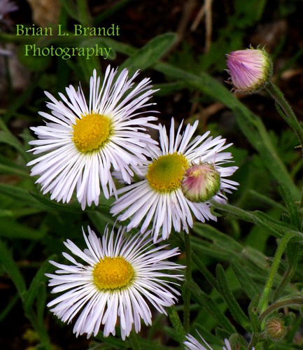
Showy Fleabane (Erigeron speciosus)
&)
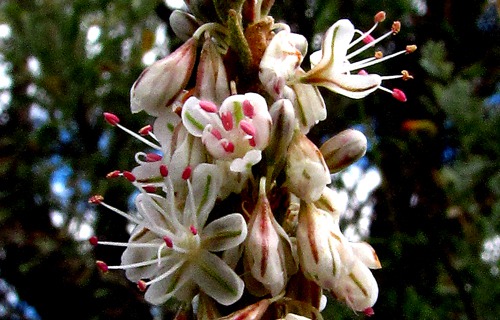
Globemallow (Sphaeralcea coccinea)
 and Sage&)
Orange Paintbrush (Castilleja integra) and Sage
- Up Over the Tusas -- We started to climb up to the 10,505 foot summit of the Tusas mountains, the last major heights before descending to the Taos flats and the Rio Grande Gorge. The pass was covered with aspens and what we discovered was California False Hellebore. It made a lovely contrast to the grass and aspens, although it is poisonous to humans, livestock, and insects.
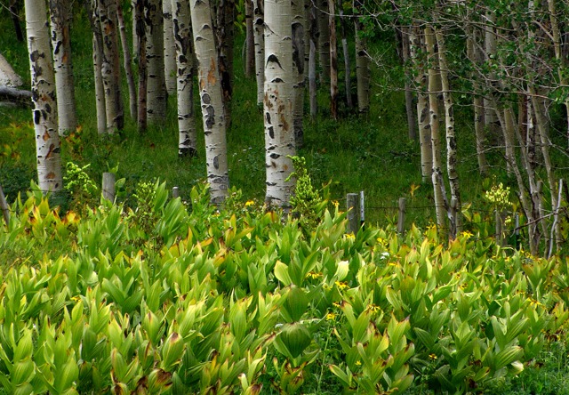 Calfornia False Hellebore (Veratrum californicum) and AspensThere were also a number of cutleaf coneflowers amid the aspens contributing their color to the green, black and white. Look closely and you will also see a small black and white butterfly in the bottom right corner of the following photo. There were quite a few of them, but they showed no propensity for posing.
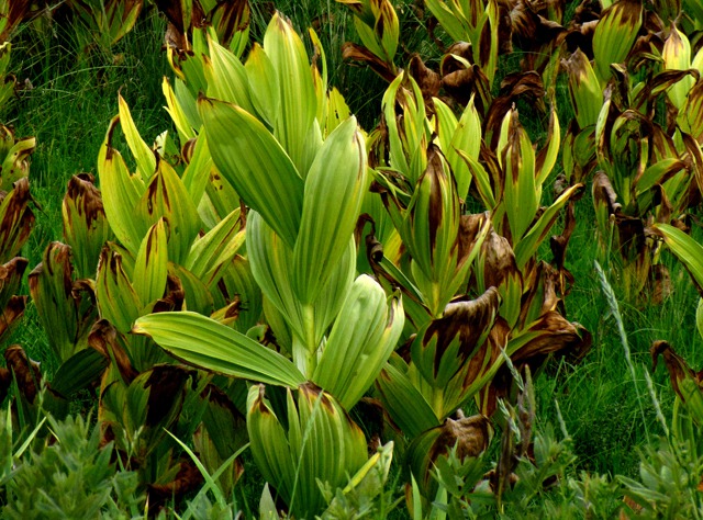 California False Hellebore (Veratrum californicum)Near the top of the pass, you could look back down on the Brazos Box cliffs.
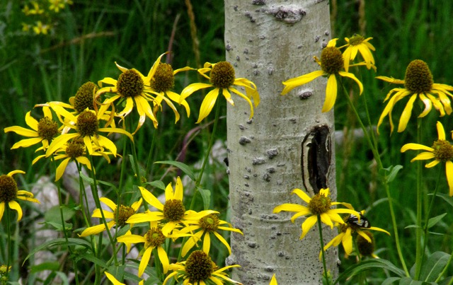 Cutleaf Coneflower (Rudbeckia lacinata) and Weidemeyer's Admiral Butterfly (Limenitis weidemeyerii)The summit also had a number of lovely wildflowers even though it was fairly late in the season.
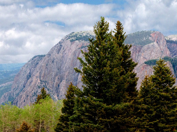 Brazos Cliff Face Looking Back from Tusas Mountains Summit
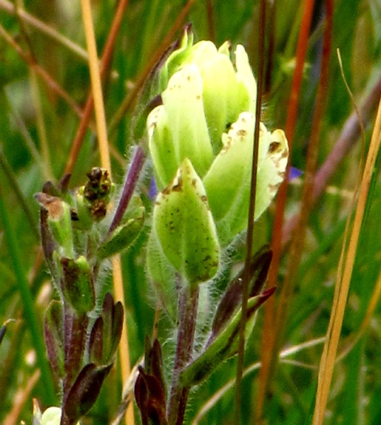 Sulphur Paintbrush (Castelleja sulphurea)
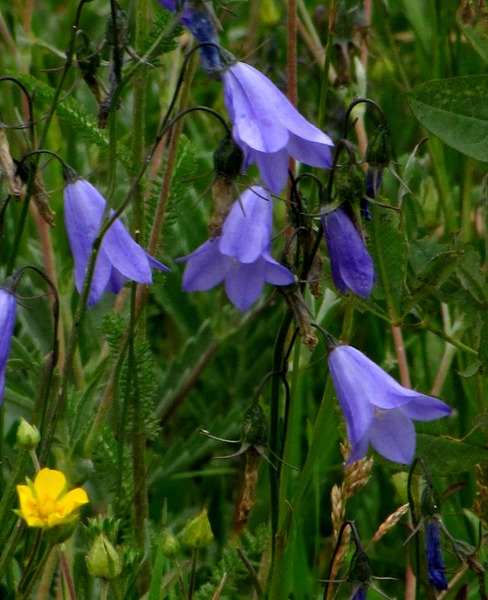 Harebell (Campanula rotundifolia)
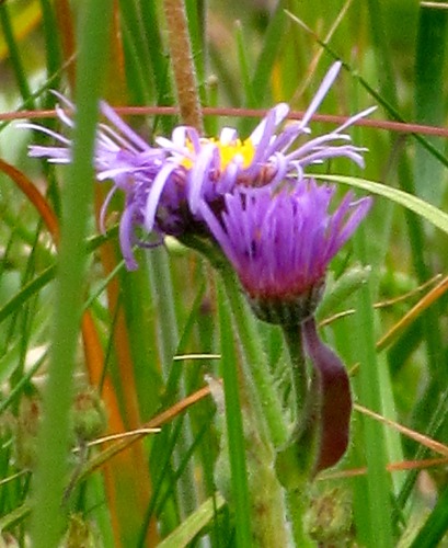 Purple TownsendiaWe came down off the Tusas Mountains summit at a diagonal across the face, and then started across the flats leading to Taos.
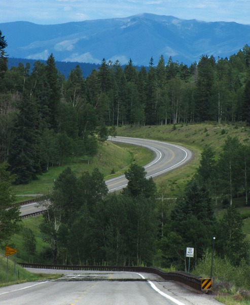 US HWY 64 Across Tusas MountainsFrom the view above, it looks like you could more or less just prance the fifteen miles into Taos.
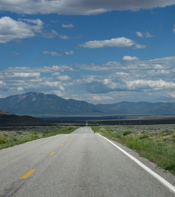 Distant Taos Mountains Looking Across Flood Plain of Rio Pueblo de Taos
 - Rio Grande Gorge -- Then you get about halfway to the distant mountains and there's a big gash in your path -- courtesy of the Rio Grande. That must have confounded more than a few early travelers.
It's about 650 feet from the rim to the river. The Rio Grande Gorge Bridge is the seventh highest bridge in the US. Louise had a great hike across its 1,284 foot length and back, but it was too hot for Furry Purry to want to leave her little purple house in the shade of our rig. She and Brian stayed in the air-conditioned car!
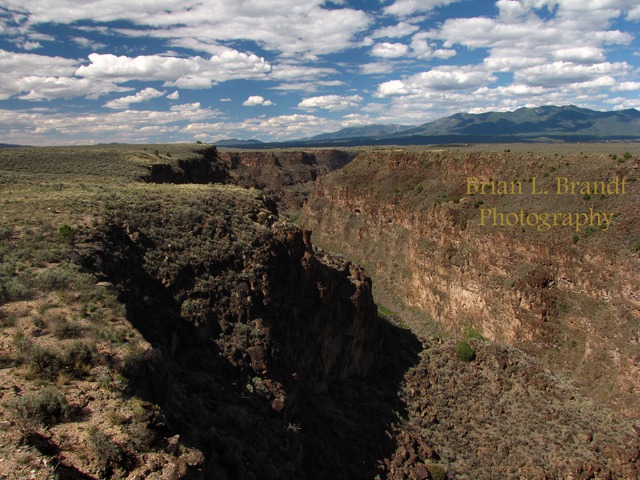 Rio Grande Gorge Wide Angle
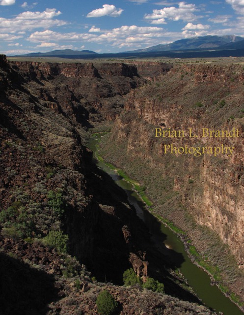 Rio Grande Gorge -- 650 Feet to the WaterAfter we left the Rio Grande Gorge, we headed toward Arroyo Seco and the Sabroso Restaurant -- our rendezvous point to meet Dave.
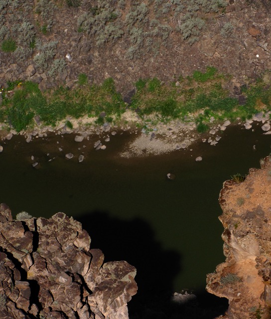 View over Cliff Edge to the Rio Grande
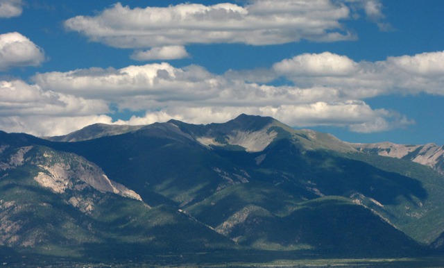 Taos Mountains Drawing NearArriving in Arroyo Seco -- At Arroyo Seco we finally pulled off the road -- and into the very charming Sabroso Restaurant with a wood-fired grill and a big covered outdoor patio -- where they were happy to let Leesha get out and have a big stretch after the long ride. Louise got a welcome glass of white wine -- Leesha got water.
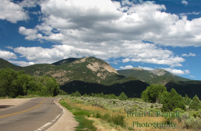 Road Approaching Arroyo SecoWe loved the fence around the restaurant patio -- very "southwesty".
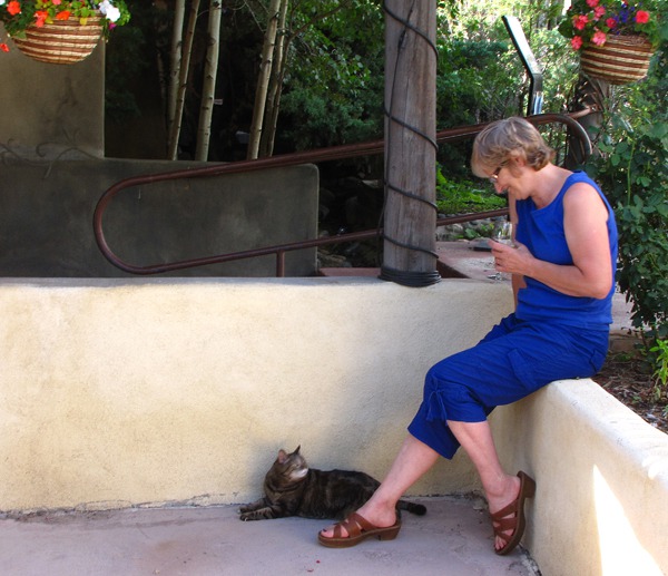 Louise and Leesha Stretch on the Sabroso Restaurant Patio
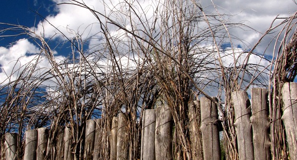 Stick and Pole Fence around Sabroso RestaurantText by Brian and Louise, photos by Brian. Text and Photos copyright 2010 Goin Mobyle LLC.
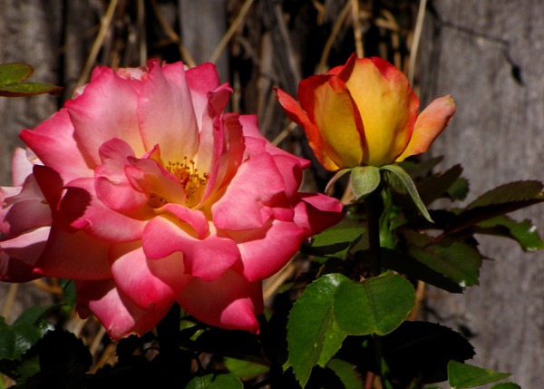 The Roses of Sabroso
 and Aspens&)
&)
 and Weidemeyer's Admiral Butterfly (Limenitis weidemeyerii)&)

&)
&)


