Day One -- We Head Off to Laramie: 5 August 2010: Way back before the Sturgis Motorcycle Rally hit South Dakota for the 75th time or so, we were looking for a way to vacate. Now, we're not against motorcycles and certainly not against the windfall of money they bring into the state, but after you've seen 300,000 of them, you've seen (and more importantly, heard) them all.
Luckily our buddy, Dave, in Taos said, "Hey, come on down here for the rally." We didn't take much persuading. First, we really like Dave. And second, in a "dang near anywhere but here" scenario, Taos was a big bonus. So we packed the rig, loaded up Leesha, a.k.a., The Furry Purry, and took off.
Our first day destination was Laramie WY some 350 miles hence.
Our plan was to go down "the spine" of Colorado over the course of four or five days, land in Taos, spend a few days, and then work our way back up "the spine" and home after the rally subsided.
We headed south out of Rapid City and turned off onto US HWY 20 headed for Wyoming.
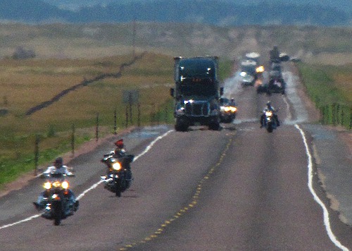 We hadn't gone far on that Thursday before the rally before we hit the rally head on. The photo above doesn't do justice to the non-stop avalanche of "Winnebago pulling motorcycle trailer" stream, coupled with zillions of "single practitioner" bikers headed north while we headed south.
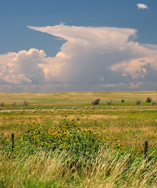
 We paused at Mule Creek junction where US HWY 20 joins US HWY 85 and watched the first huge thunderheads build over the prairie and over a swatch of fence-line sunflowers.
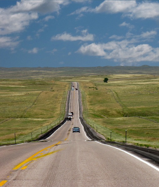
 We drove US HWY 85/18/20 until we simply couldn't stand both the pace (over 50 mph) and the traffic any longer, so we dodged west onto WY HWY 270 which yielded up sweeping vistas and a whole bunch less traffic. Just our style.
 We topped a crest and looked back toward Edgemont SD way off east in the far distance. From the top of that crest you could see almost the curvature of the earth as the prairie swept across the horizon. One of the first dinosaur discoveries in North America was made in this Lance Creek area. Triceratops remains were found in the sandstone and shale.
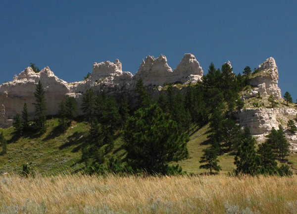
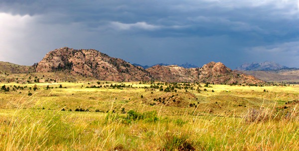
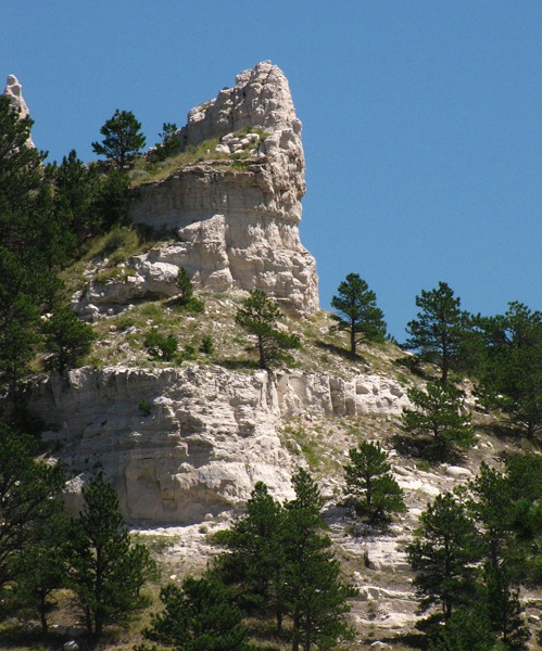 Seventy-Seven Hills Range: In Lance Creek, WY HWY 270 turned south toward Manville and the Seventy-Seven Hills. The pass went along a ridge of limestone that had been shaped into castles and castle-wall formations by the relentless prairie wind that perpetually howled through the road cut.
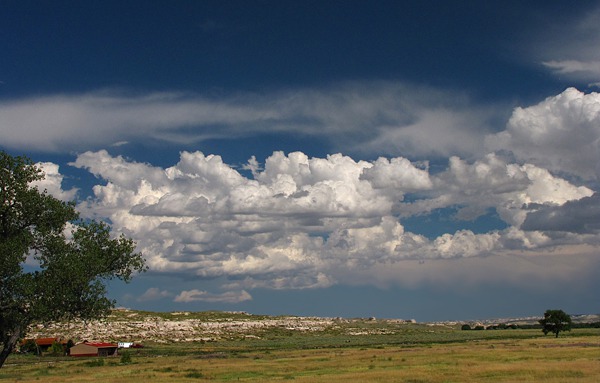
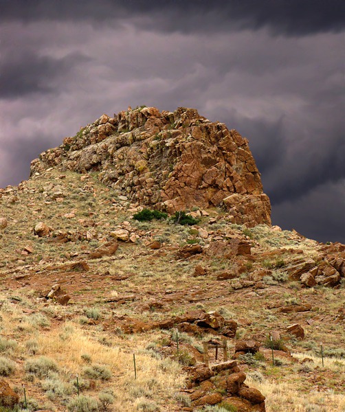
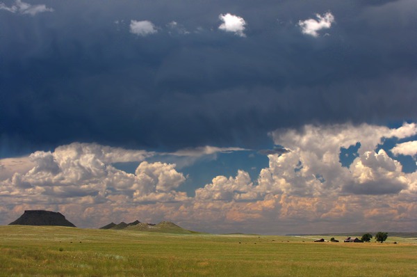 After clearing the pass, we emptied down onto another wide plain near Manville, characterized by a series of buttes (permanent) and huge thunderheads, (transitory.)
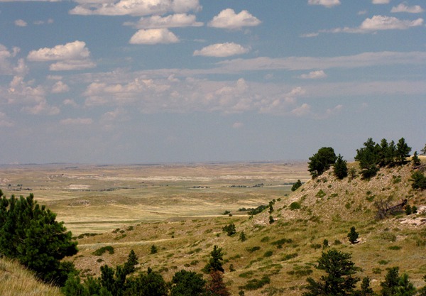
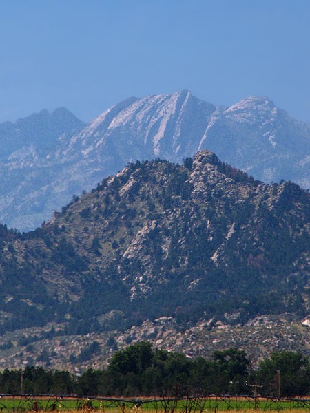
 South of Manville, the road followed a long valley between the Wildcat Hills to the East and the Hogback to the west. The lush grass was still green after the wet summer. The Laramie Range was visible in the western distance.

Why We Left Rapid City

Road Less Traveled Toward Wyoming

Cumulus and Sunflowers Near Mule Creek Junction

First Turn Off Onto WY HWY 270

Looking Back Toward Edgemont

Limestone Ridge

Limestone Castle at Ridge End
&)
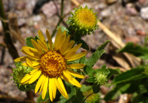
Curlycup Gumweed (Grindelia squarrosa)

Butte and Farm with Dark Sky

Prairie Cumulus Uplift
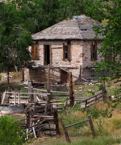
Hartville-Sunrise Mining District: Just east of Guernsey State Park, we drove into the old mining town of Hartville, most of which was long abandoned in that Wyoming boom-and-bust fashion. The town sits in an area of canyons and breaks east of the North Platte River -- the Hartville-Sunrise Mining District.
The Precambrian metamorphosed sedimentary and volcanic rocks contain hematite -- iron oxide. Open pit iron mining began in 1898 and went underground in the 1930s. Ore from the Sunrise Mine was shipped to blast furnaces in Pueblo, CO.
 The country after Hartville is a series of river bottoms broken by limestone ridges and outcroppings.
 We turned west on US HWY 26 to Wheatland and continued west on WY HWY 34 into the Laramie Mountains.

House in Gold Town Hartville WY

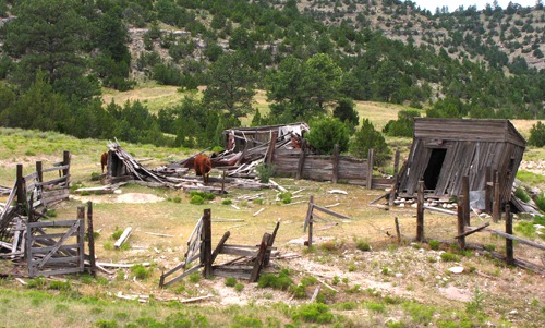
Town of Hartville WY -- Corral Needs Work

Ranch Tree and Clouds Outside Wheatland WY

Cumulus over Harvested Field
Laramie Names: As we drove, Louise found the derivation of "Laramie" -- a typical corruption of the name of French fur trapper Jacques La Ramee (1784-1821)? From that point on, we called our destination La Ramie in honor of old Jacques, whom history pretty much forgot, and subsequently even twisted around his name sake.
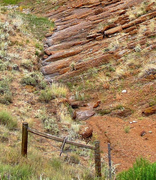
 Not far outside Wheatland, the road started up into higher canyon-laced country with a wide range of rock formations and types.

Peak and Ridge Outside Town Wheatland WY

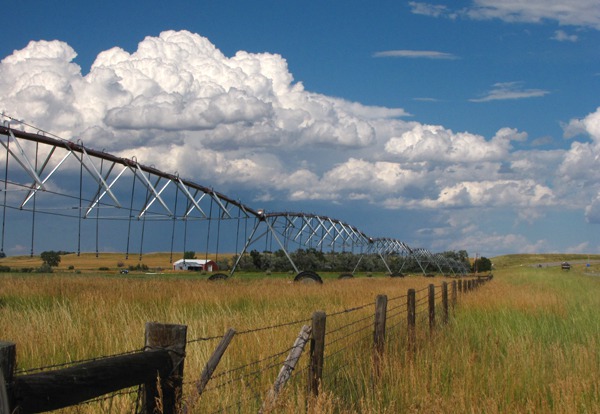
Cumulus, Irrigation and Fence

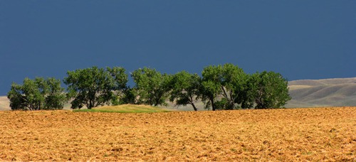
Line of Trees at Field's Edge

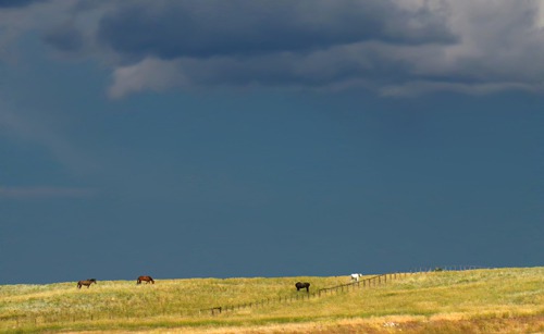
Horses Graze in Gathering Storm
Sybille and Ferrets: Storms were gathering, blowing, and dissipating all around us, as is so typical of this country in summer. The road follows Sybille Creek to Morton Pass.
We passed Sybille Wildlife Research Center. Black-footed ferrets, thought to be extinct, were found in the Shirley Basin. The Center used these wild ferrets to raise a population that was released in Badlands National Park SD among other locations.
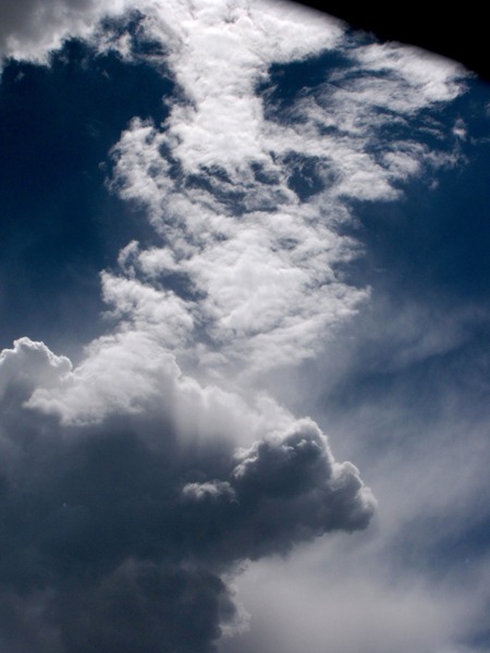
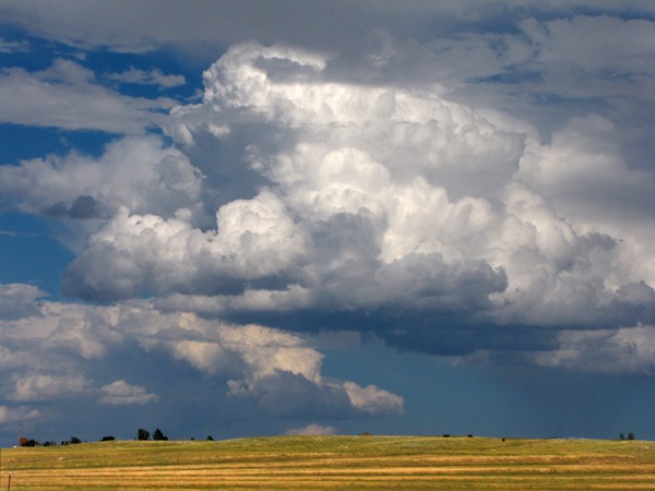
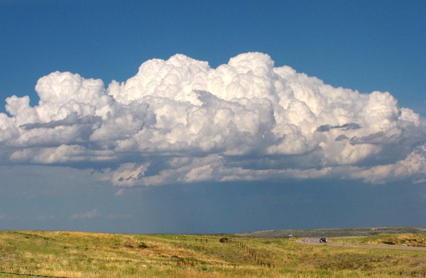
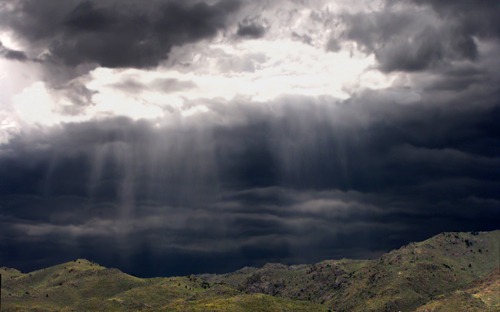
 As we looked back east, a huge cumulus formation was hanging in the sky over the road, dwarfing the few cars that whizzed by.
 Not long after we pulled out of a pull-off near Red Mountain, a small squall rolled across in front of us, with a dazzling light show over the rolling hills.
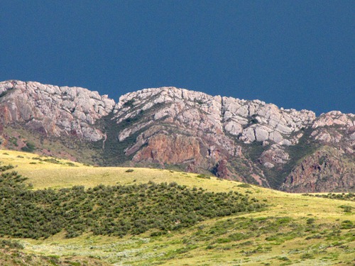
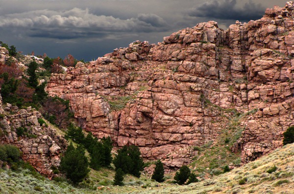
 Laramie Mountains Geology: Soon after the canyon narrowed, where one side of the road had billion-year-old rock and the other side had "zillion" year-old rock. It was amazing to see such a disparity in geology separated only by a creek bottom that ran down an old fault line.

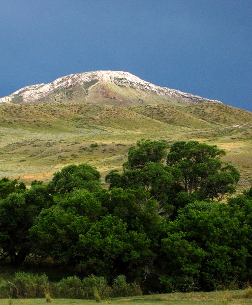
Mountain Across from Red Mountain

Ridge Across from Red Mountain

Red Mountain and Evening Storm
 Near Red Mountain&)
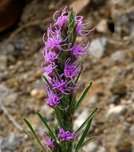
Gayfeather (Liatris lancifolia) Near Red Mountain

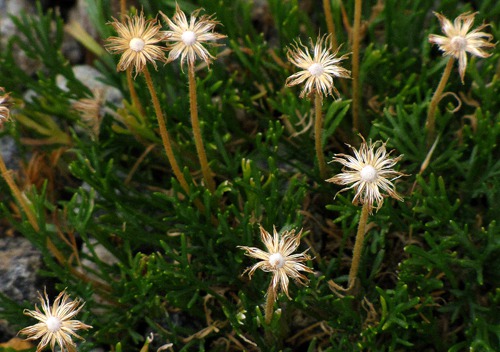
Spent White Flowers Near Red Mountain

Big Thunderhead and Tiny Car

Streaming Light over Rolling Hills
From Roadside Geology of Wyoming, by David R. Lageson and Darwin R. Spearing, pp. 25-26: "The northern half of the [Laramie] range, from Casper to Wyoming HWY 34 south of Wheatland, is composed of extremely ancient granitic rocks of Precambrian age. These rocks were intruded as hot magma into the primitive crust of Wyoming around 2.6 billion years ago. South of Wyoming HWY 34, the Laramie Range is composed of much younger Precambrian granitic rocks, called the Sherman granite, that crystallized around 1.4 billion years ago. The Sherman granite in turn contains a unique body of igneous rock anorthosite, composed almost entirely of the mineral plagioclase feldspar." 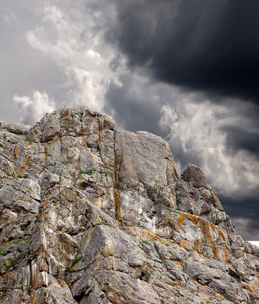
 At Morton Pass, we drove past the box canyon from whence issued the architect of this canyon -- Sybille Springs.
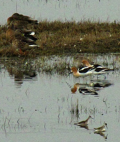
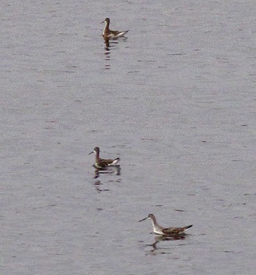
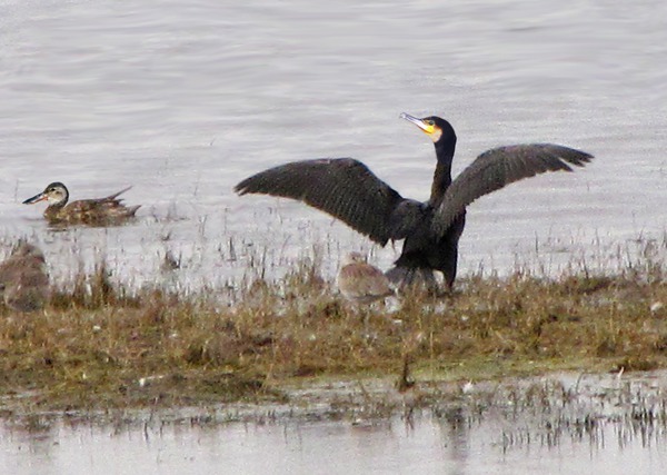
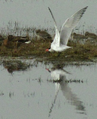
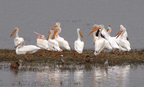
 A Bird Fest: Just at the junction of US HWY 287/30, the highway into Laramie, we saw a huge pond -- unusual this time of year when the pond would normally be a huge bowl of yellow dust. When a drought breaks around here, it really breaks. The pond was alive with all manner of birds, doing their birdie business as night descended on us.
 We arrived in La Ra Mie, and slung ourselves on the beds in the Best Western with Furry Purry on the end of the bed after her wet kitty food supper. It had been a quiet day for Leesha -- too hot to get out much.
For once we had arrived early enough to take advantage of the motel amenities. So off Louise went to the exercise room, and I headed to the hot tub. She then hit the pool for a few laps and water stretches; sitting in the car all day is very hard on a person! Text by Brian and Louise. Pictures by Brian. Text and photos copyright Goin Mobyle, LLC, 2010.
We arrived in La Ra Mie, and slung ourselves on the beds in the Best Western with Furry Purry on the end of the bed after her wet kitty food supper. It had been a quiet day for Leesha -- too hot to get out much.
For once we had arrived early enough to take advantage of the motel amenities. So off Louise went to the exercise room, and I headed to the hot tub. She then hit the pool for a few laps and water stretches; sitting in the car all day is very hard on a person! Text by Brian and Louise. Pictures by Brian. Text and photos copyright Goin Mobyle, LLC, 2010.

Ancient Roadside Granite

Boulder Pile Across from Ancient Granite

Rock Incline Gully and Fence

Sybille Spring Head Canyon

Cinnamon Teal, Anas cyanoptera, American Avocet, Recurvirostra americana, and Wilson's Phalarope, Phalaropus tricolor

Wilson's Phalarope, Phalaropus tricolor

Double-crested Cormorant, Phalacrocorax auritus, Northern Shoveler, Anas clypeata

Common Tern Wings Up, Sterna hirundo

Pelican Group, American White Pelican, Pelecanus erythrorhynchos