Day Eleven -- Driving From Taos NM to Salida, CO, 15 August 2010. We left Taos and drove north toward Colorado on NM HWY 522.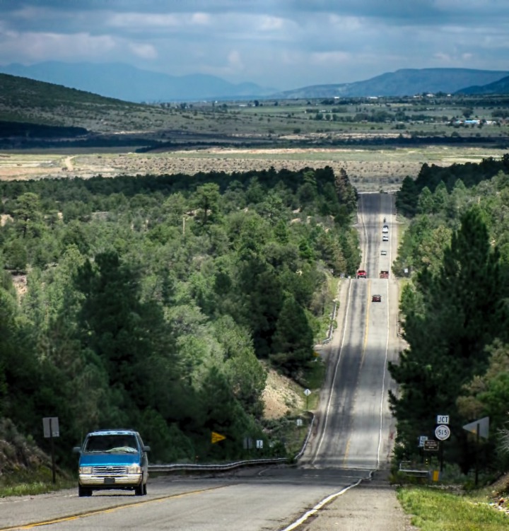 It became CO HWY 159 at the border. Not far along on that route, we encountered a heavy, localized thunderstorm that is typical of New Mexico and Colorado summers.
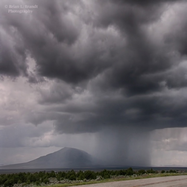 As we drove north, the
Culebra Range of the Sangre de Cristo Mountains
to the east was busy gathering and trapping storm clouds.
As we drove north, the
Culebra Range of the Sangre de Cristo Mountains
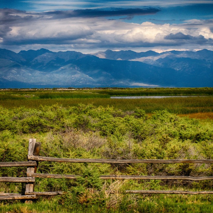
to the east was busy gathering and trapping storm clouds. 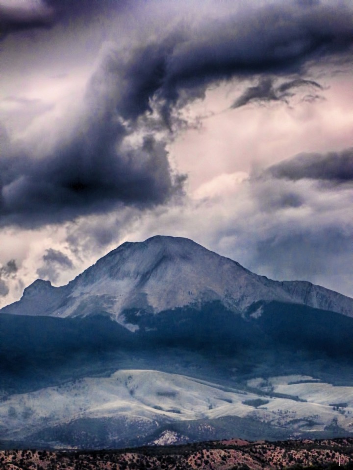 Once a Ute Sanctuary -- The valley we were driving through, around Alamosa CO, was an important hunting and trading ground for the Utes. For hundreds of years, this valley was a key hunting and gathering ground to them. Legend has it that this is where they first encountered "Magic Dogs" -- horses escaped from Spanish Expeditions of the late 1600s. In the distance, a lone, straight dirt road crossed the remaining valley floor and disappeared into the timber at the base of the ridge.
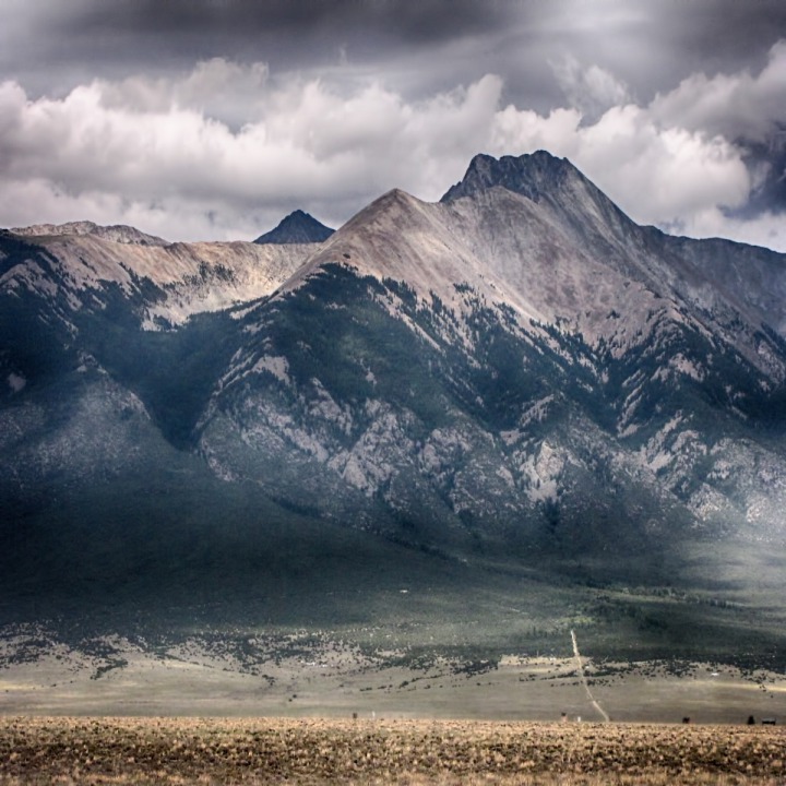 We cut west on CO HWY 160 and then picked up CO HWY 17 north at Alamosa. From there, it was about thirty miles to our next stop.

NM HWY 522 north out of Taos

A Localized New Mexico Thunderstorm

Storm Swirl Over a Peak in the Culebra Range

Lone Dirt Road Trails Toward the Culebra Range
Arriving at the Great Sand Dunes National Park and Preserve -- Just past Alamosa, we made it to our first targeted stop of the day -- The Great Sand Dunes National Park and Preserve.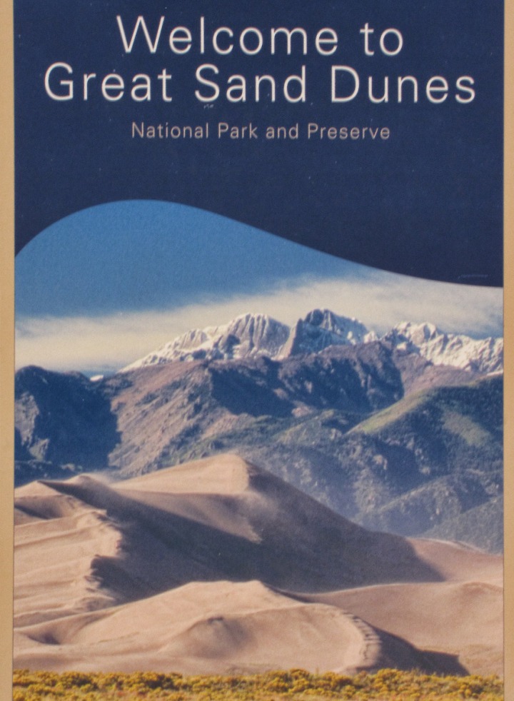
 Well Known to Indigenous Tribes -- The traditional Ute phrase for the Great Sand Dunes is Saa waap maa nache, "sand that moves." Jicarilla Apaches who settled in northern New Mexico called the dunes Sei-anyedi, "it goes up and down." Blanca Peak, just southeast of the dunes, is one of the four sacred mountains of the Navajo, who call it Sisnaajini. These various tribes collected the inner layers of bark from ponderosa pines for use as food and medicine. The people from the Tewa/Tiwa-speaking pueblos along the Rio Grande remember a traditional site of great importance located in the valley near the dunes: the lake through which their people emerged into the present world. They call the lake Sip'ophe, meaning "Sandy Place Lake", which is thought to be the springs and/or lakes immediately west of the dune-field.

At Great Sand Dunes National Park and Preserve CO

Sweep of Sand Dunes
The Park -- The Park was created in 1932 as a monument, then changed to a National Park in 2004.
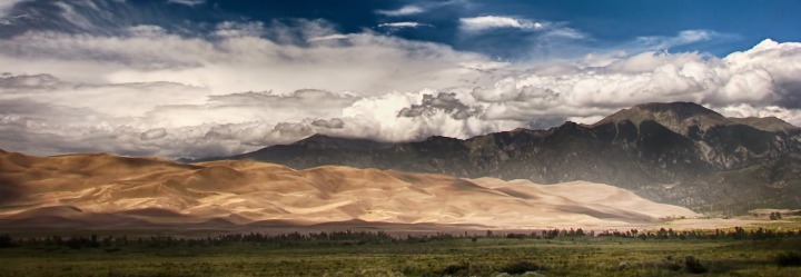
The dunes cover an area of about 30 sq mi (78 km2) and are estimated to contain over five billion cubic meters of sand.
The nearly unceasing wind whips the dunes into peaks like whipped cream 750 feet (229 m) tall, backed by the rise of the Sangre di Cristo mountains, topped out at the summit of 13,604 ft (4,146 m) Tijeras Peak in the northern part of the Park.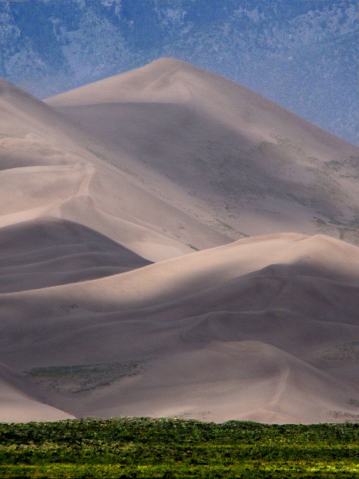 The dunes flow toward the mountains, driven by the wind off the plains, and create sweeps of blowing sand.
 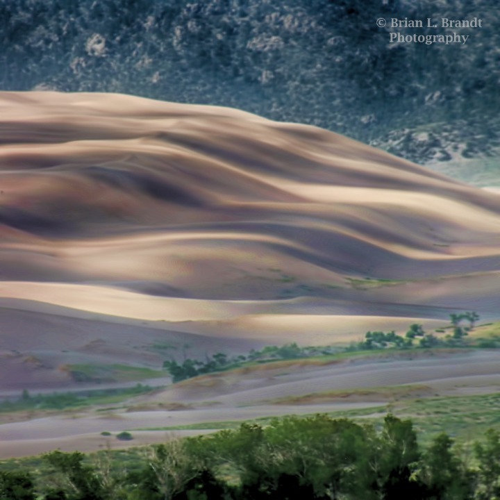 While we were there, wind and rain kept cropping up and blasting through, created a "cloud cap" on over the dune tops.
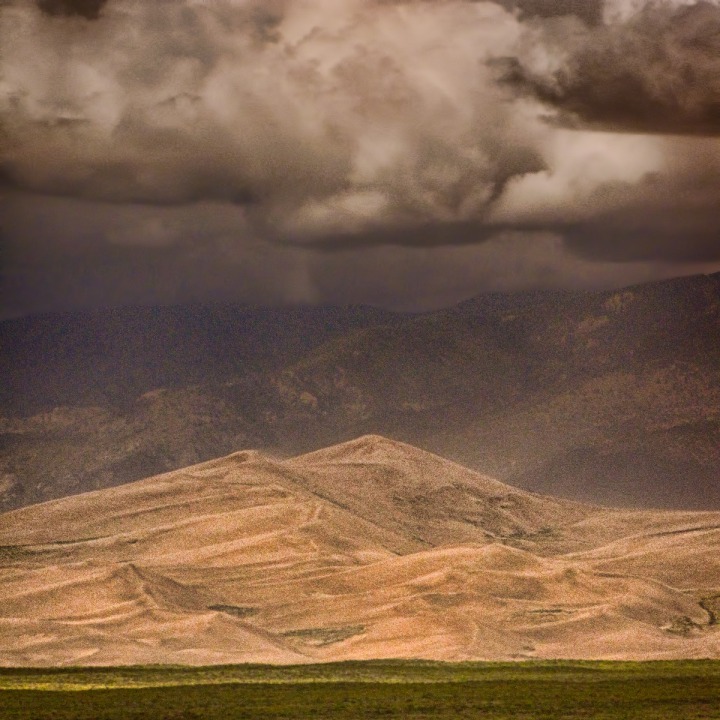 Massive Scale -- In abstract, the size of the dunes is hard to grasp, as it is when you are there in person. In the photo below, the small dark blots at the bottom right are full-sized cottonwood trees, probably fifty to sixty feet tall.
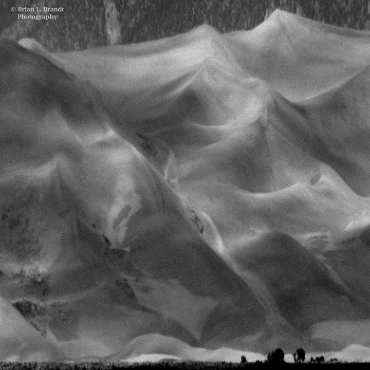 You also get a sense of the scale when you see hikers on the dunes -- in this case, walking across the lower edge of what is probably 20 percent of the total height of the dune in front of them.
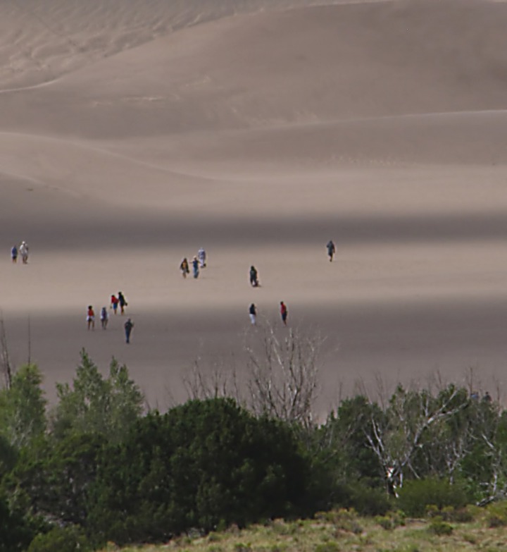 As we were leaving, the sun poked through the gathering cloud layer, and a shaft of light illuminated a small section of a dune for us. As if to say, "Wait, I have more to show." We'll be back for certain -- with more time, a better camera, and sand-proofing.
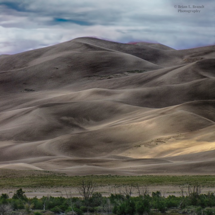 The San Luis Valley -- After we left the sand dunes, we drove further up into the San Luis Valley on CO HWY 17, cut across on CO HWY 112 between Hooper CO and Center CO and then followed US HWY 285 into a rich agricultural area stretching for eighty or more miles west of the Sangre de Cristo mountain range and east of the Rio Grande and Gunnison National Forests.
 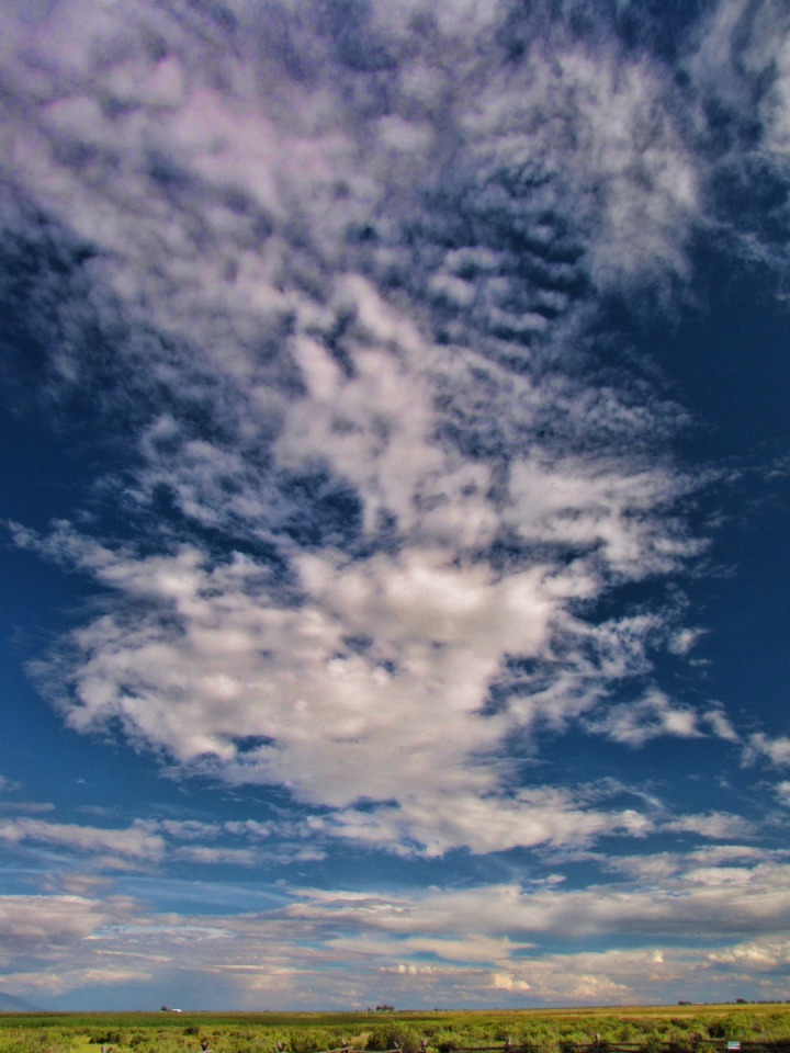 Getting double duty out of water, irrigation was in full swing even in the rain.
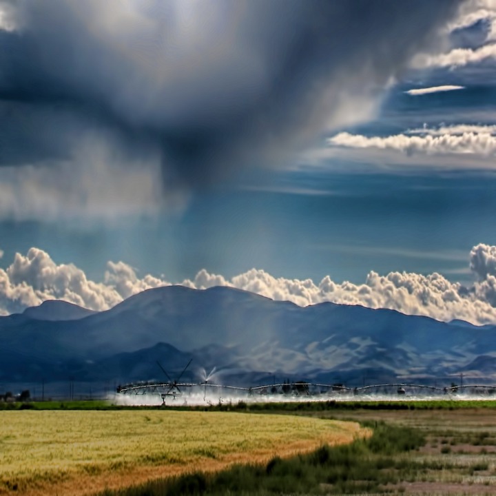 All the "Ag", with the accompanying fertilizer, had turned all the valley creeks and canals into sludge-like algae flows.
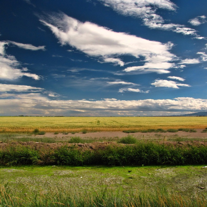
 "Winning" The Valley -- like most of the West, the economy was built on chopping down, digging up, and shooting, done mostly, contrary to Western myth, by unsavory characters
  A Respite -- In the midst of the hay and algae-chocked canals, we found a pocket of shade and a few tenacious native plants at the Russell Lakes State Wildlife Area, nine miles south of Saguache CO
 A spring creek flows through this area, feeding a maze of wetlands, dikes, canals, and shallow lakes designed and built to restore habitat for nesting waterfowl. Much of the site is closed February to July for nesting, Since this was August, Louise took Furry Purry for an "I'll carry you" stretch break on one of the paths.
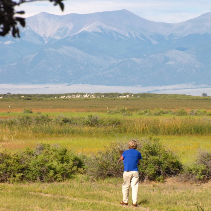 There were a few wild flower blooms left, even this late, including
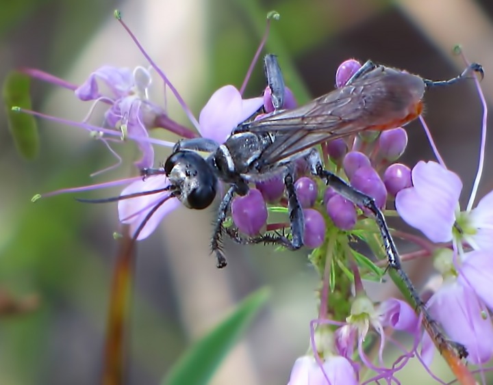
Rocky Mountain Bee Plant (Cleome serrulata).
There were a few wild flower blooms left, even this late, including
Rocky Mountain Bee Plant (Cleome serrulata).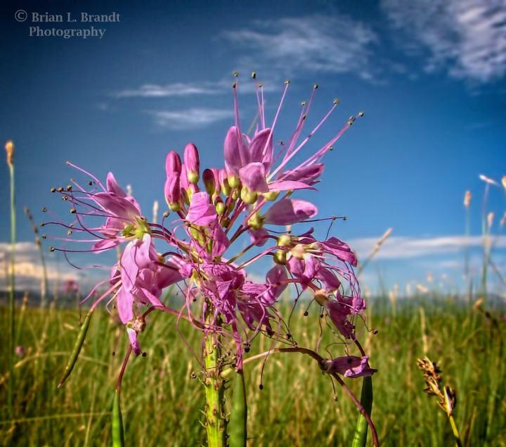
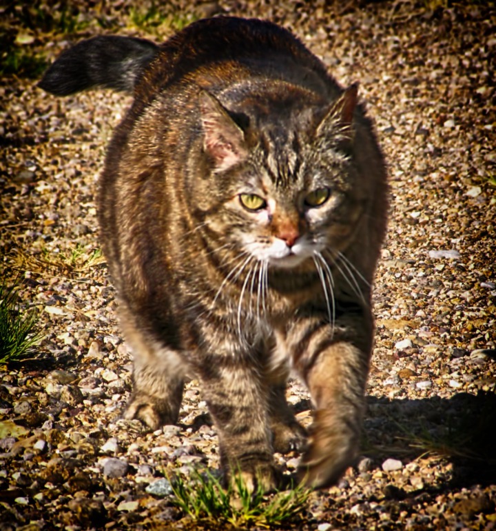
 Furry Purry started to "squirm down" because she wanted to walk a little of the way back, so she got down and headed back, quickly, for the shade and the coolness of the 4-Runner.
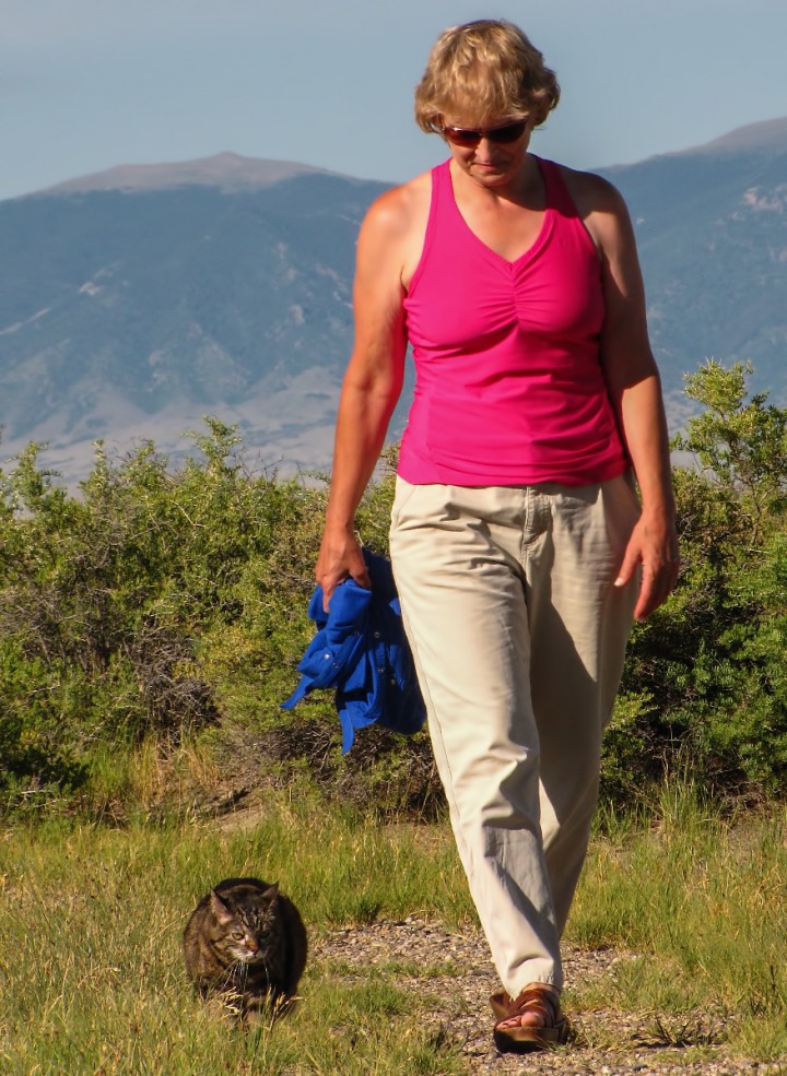
 We found a side road out further into the wildlife area, and followed it east toward the Sangre de Cristo Range across the valley floor.
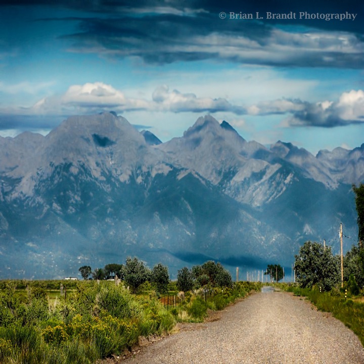 The area, when not flooded in spring, is scrub land covered with brush and what appeared to be lava sand.
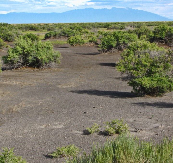 We saw a few jackrabbits, but the refuge was quiet without the nesting waterfowl -- and especially in the heat of the day. There were a few hawkweed and other late-blooming flowers still in evidence.
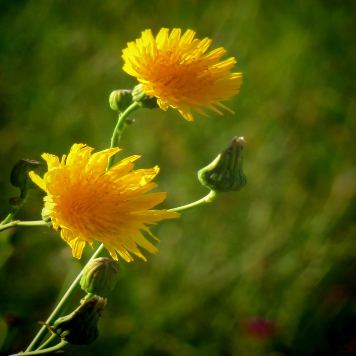 On to Salida -- We drove back out to the main road (US HWY 285) and turned north toward Saguache. Afternoon cumulus were building once again over the north end of the San Luis Valley
 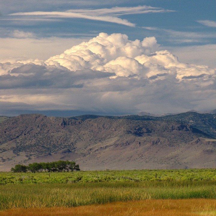 As drove along, we saw more sculpted mounds, reminiscent of the sand dunes, but on a relatively tiny scale.
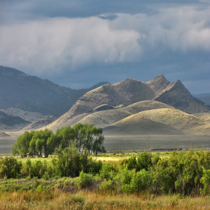 There were a few road cuts through what appeared to be massive basalt flows.
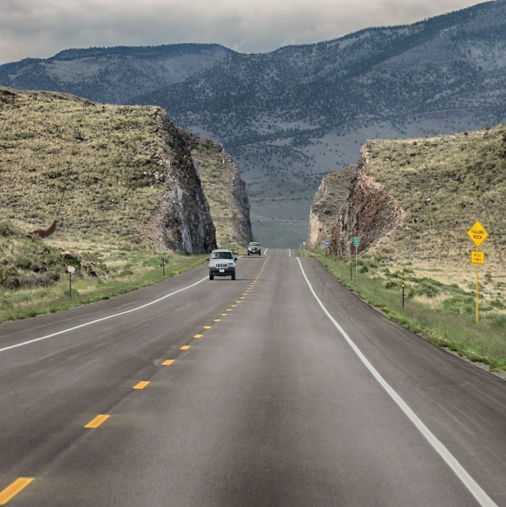 We could see evidence of the area's violent past in the huge rock and boulder piles that dotted the north end of the San Luis Valley.
 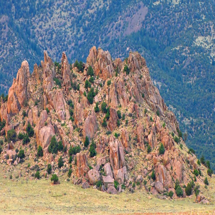 We were starting up a long hill-- just before the valley squeezed tight between Alder and Mears Junction -- when the sun blasted the Sangre de Cristo range one last time before it was overtaken by an approaching cloud layer -- one that dumped buckets on us by the time we reached Salida in the near dark.
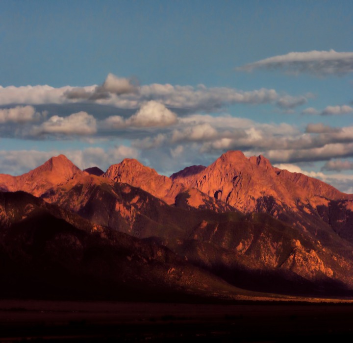 Text by Brian and Louise, Photos by Brian. Text and photos copyright Goin Mobyle LLC 2010.

A Sand Dune "Peak" Backed By the Sangre de Cristo Mountain Range

The Sculpted Flow of a Dune End

A Cloud Cap Floats Over the Dunes in an Afternoon Storm

Wind-Sculpted Dunes with Cottonwood Trees at Lower Right

Hikers Dwarfed By the Massive Dunes

The Sun Pierces a Cloud and Lights a Dune

Tall Sky over the San Luis Valley

Irrigating in the Rain

Broad San Luis Valley with Algae Ditch

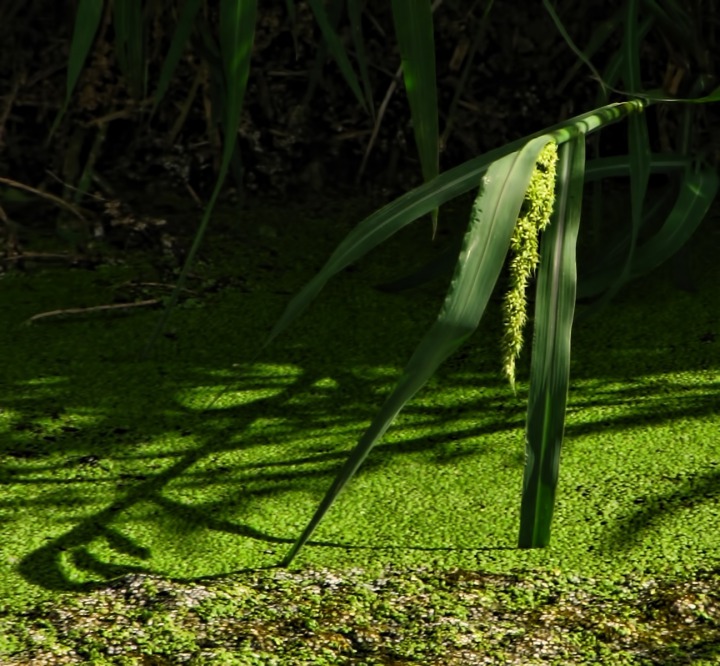
Bent Sprig over an Algae Canal

The Making of the San Luis Valley

Looking Out Over the Russell Lakes State Wildlife Area

Louise Takes Furry Purry for a Short Hot Cat Walk
 at the Russell Lakes State Wildlife Refuge&)
Rocky Mountain Bee Plant (Cleome serrulataon) at the Russell Lakes State Wildlife Refuge
&)
Bug on the Rocky Mountain Bee Plant (Cleome serrulata)

Louise Returns with Furry Purry From a Short Stroll

Fiercely Determined Furry Purry Heads for the Shade

Side Road to Russell Lakes State Wildlife Area Outback

Scrub Land of the San Luis Valley Floor at Russell Lakes State Wildlife Area CO
 On the Russell Lakes State Wildlife Refuge CO&)
Hawkweed (Hieracium) On the Russell Lakes State Wildlife Refuge CO

Afternoon Cumulus Rising over the North End of the San Luis Valley CO

Sculpted Mound at the North End of the San Luis Valley CO

Road Cut Through Basalt on CO HWY 285 South of Salida CO

Jagged Rock Pile Near the Base of Rio Grande National Forest Mountains West of CO HWY 285

Sundown on the Sangre de Cristo Range South of Salida CO